195.85.229.195 - IP Lookup: Free IP Address Lookup, Postal Code Lookup, IP Location Lookup, IP ASN, Public IP
Country:
 Germany
Region:
City:
Location:
Time Zone:
Postal Code:
ISP:
ASN:
language:
User-Agent:
Proxy IP:
Blacklist:
IP information under different IP Channel
ip-api
Country
Region
City
ASN
Time Zone
ISP
Blacklist
Proxy
Latitude
Longitude
Postal
Route
db-ip
Country
Region
City
ASN
Time Zone
ISP
Blacklist
Proxy
Latitude
Longitude
Postal
Route
IPinfo
Country
Region
City
ASN
Time Zone
ISP
Blacklist
Proxy
Latitude
Longitude
Postal
Route
IP2Location
195.85.229.195Country
deRegion
niedersachsen
City
ratzel
Time Zone
Europe/Berlin
ISP
Language
User-Agent
Latitude
Longitude
Postal
ipdata
Country
Region
City
ASN
Time Zone
ISP
Blacklist
Proxy
Latitude
Longitude
Postal
Route
Popular places and events near this IP address

Bruchterveld
Village in Overijssel, Netherlands
Distance: Approx. 7414 meters
Latitude and longitude: 52.53,6.66083333
Bruchterveld is a village near the town of Hardenberg, Overijssel, the Netherlands. There is a village house and a football association. It has three churches: Dutch reformed, Dutch reformed freed and Reformed.

Uelsen
Municipality in Lower Saxony, Germany
Distance: Approx. 7379 meters
Latitude and longitude: 52.5,6.86666667
Uelsen (German pronunciation: [ˈʔʏlsn̩]) is a community in the district of Grafschaft Bentheim in Lower Saxony.

Manderveen
Village in Overijssel, Netherlands
Distance: Approx. 9049 meters
Latitude and longitude: 52.45,6.78333333
Manderveen (Tweants: Maanderven) is a village in the Dutch province of Overijssel. It is a part of the municipality of Tubbergen, and lies about 13 km northeast of Almelo. The village was first mentioned in 1846 as Manderveen, which means peat area near Mander.

Langeveen
Village in Overijssel, Netherlands
Distance: Approx. 8021 meters
Latitude and longitude: 52.46666667,6.71666667
Langeveen (Tweants: T Langevenne) is a village in the Dutch province of Overijssel. It is a part of the municipality of Tubbergen, and lies about 13 km north of Almelo. It was first mentioned in 1851 as Langeveen, and means "long bog".

Mander, Overijssel
Hamlet in Overijssel, Netherlands
Distance: Approx. 9968 meters
Latitude and longitude: 52.45,6.83333333
Mander (Tweants: Maander) is a village in the Dutch province of Overijssel. It is a part of the municipality of Tubbergen, and lies about 15 km northeast of Almelo. It was first mentioned in 797 as Manheri.

Wielen
Municipality in Lower Saxony, Germany
Distance: Approx. 4208 meters
Latitude and longitude: 52.55,6.71666667
Wielen is a small village in the district of Grafschaft Bentheim in Lower Saxony, Germany, and belongs to the Joint Community (Samtgemeinde) of Uelsen. Wielen has 614 inhabitants. Within the village is found the Lower County’s oldest maintained school, het Schöltien.

Getelo
Municipality in Lower Saxony, Germany
Distance: Approx. 8950 meters
Latitude and longitude: 52.46666667,6.84972222
Getelo is a community in the district of Grafschaft Bentheim in Lower Saxony.

Itterbeck
Municipality in Lower Saxony, Germany
Distance: Approx. 3505 meters
Latitude and longitude: 52.50638889,6.80277778
Itterbeck in the district of Grafschaft Bentheim in Lower Saxony is an old farming community that has developed into an independent community with almost 1,800 inhabitants (2005). Itterbeck belongs to the Joint Community (Samtgemeinde) of Uelsen, whose administrative seat is in the like-named community. The name Itterbeck springs from the brook that runs through the community, called the Itter.
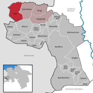
Laar
Municipality in Lower Saxony, Germany
Distance: Approx. 9874 meters
Latitude and longitude: 52.61666667,6.73305556
Laar (German pronunciation: [ˈlaːɐ̯]) is a community in the district of Grafschaft Bentheim in Lower Saxony. The community’s name comes from the Old Dutch for “glade in the woods”.

Wilsum, Germany
Municipality in Lower Saxony, Germany
Distance: Approx. 4554 meters
Latitude and longitude: 52.51666667,6.83333333
Wilsum is a community in the district of Grafschaft Bentheim in Lower Saxony, Germany near the Dutch border, and it belongs to the Joint Community (Samtgemeinde) of Uelsen.

Uelsen (Samtgemeinde)
Samtgemeinde in Lower Saxony, Germany
Distance: Approx. 8189 meters
Latitude and longitude: 52.5,6.88
Uelsen is a Samtgemeinde ("collective municipality") in the district of Bentheim, in Lower Saxony, Germany. Its seat is in the municipality Uelsen.
Weather in this IP's area
scattered clouds
2 Celsius
-2 Celsius
-0 Celsius
2 Celsius
1027 hPa
40 %
1027 hPa
1025 hPa
10000 meters
3.07 m/s
4.55 m/s
208 degree
40 %