Country:
Region:
City:
Latitude and Longitude:
Time Zone:
Postal Code:
IP information under different IP Channel
ip-api
Country
Region
City
ASN
Time Zone
ISP
Blacklist
Proxy
Latitude
Longitude
Postal
Route
Luminati
Country
Region
he
City
rimbach
ASN
Time Zone
Europe/Berlin
ISP
ENTEGA Medianet GmbH
Latitude
Longitude
Postal
IPinfo
Country
Region
City
ASN
Time Zone
ISP
Blacklist
Proxy
Latitude
Longitude
Postal
Route
db-ip
Country
Region
City
ASN
Time Zone
ISP
Blacklist
Proxy
Latitude
Longitude
Postal
Route
ipdata
Country
Region
City
ASN
Time Zone
ISP
Blacklist
Proxy
Latitude
Longitude
Postal
Route
Popular places and events near this IP address
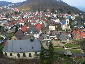
Lindenfels
Town in Hesse, Germany
Distance: Approx. 6342 meters
Latitude and longitude: 49.68333333,8.78333333
Lindenfels is a town in the Bergstraße district in Hesse, Germany.
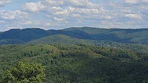
Krehberg
Distance: Approx. 6865 meters
Latitude and longitude: 49.68416667,8.73055556
The Krehberg (German pronunciation: [ˈkʁeːbɛɐ̯k]) is a 576-metre (1,890 ft) high hill in the Odenwald, 10 kilometres (6.2 mi) west of Lindenfels. On the Krehberg there is the Krehberg transmission tower for FM, TV and directional radio services, consisting of a lattice tower with a guyed mast on the top.

Fürth, Hesse
Municipality in Hesse, Germany
Distance: Approx. 2776 meters
Latitude and longitude: 49.65,8.78333333
Fürth is a municipality and a state-recognized recreational resort (Erholungsort) in the Bergstraße district in Hesse, Germany.

Mörlenbach
Municipality in Hesse, Germany
Distance: Approx. 3920 meters
Latitude and longitude: 49.59916667,8.73472222
Mörlenbach is a municipality in the Bergstraße district in southern Hesse, Germany.
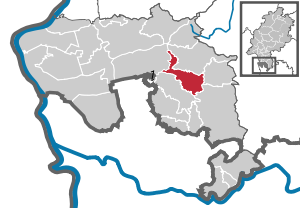
Rimbach, Hesse
Municipality in Hesse, Germany
Distance: Approx. 693 meters
Latitude and longitude: 49.62333333,8.76
Rimbach (Ben-Stadt) in the Odenwald is a municipality in the Bergstraße district in southern Hesse, Germany.
Überwald
Distance: Approx. 6049 meters
Latitude and longitude: 49.5833,8.8166
The Überwald is a wooded area in the southeast of Bergstraße district in Hesse, Germany, between the "Anterior" and "Hinder" Odenwald, comprising the communities of Abtsteinach, Grasellenbach and Wald-Michelbach. Wald-Michelbach is the Überwald's central community. The name was likely first used by the inhabitants of the neighbouring Weschnitz valley.
Wagenberg (hill)
Mountain in Germany
Distance: Approx. 3882 meters
Latitude and longitude: 49.63805556,8.81861111
Wagenberg is a hill of Hesse, Germany.
Ober-Laudenbach
Distance: Approx. 7360 meters
Latitude and longitude: 49.61666667,8.66666667
Ober-Laudenbach is a district of the town of Heppenheim in the state of Hesse, Germany. Formerly an independent municipality, it was merged into Heppenheim in 1971.
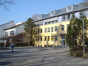
Martin-Luther-Schule
Grammar school in Rimbach, Hessen, Germany
Distance: Approx. 891 meters
Latitude and longitude: 49.62333333,8.75666667
The Martin-Luther-Schule (MLS) is a secondary school ("Gymnasium") with the main focus on the subject of music. It is located in Rimbach, is a village in the "Weschnitztal" in Germany. With approximately 1,600 students, the MLS is one of the biggest schools in the "Kreis Bergstraße".

Odenwaldschule
Former school in Heppenheim, Germany
Distance: Approx. 7248 meters
Latitude and longitude: 49.66611111,8.68666667
The Odenwaldschule was a German school located in Heppenheim in the Odenwald. Founded in 1910, it was Germany's oldest Landerziehungsheim, a private boarding school located in a rural setting. Edith and Paul Geheeb established it using their concept of progressive education, which integrated the work of the head and hand.
Marbach (Mergbach)
River in Germany
Distance: Approx. 7880 meters
Latitude and longitude: 49.6909,8.8154
Marbach is a small river of Hesse, Germany. It flows into the Mergbach in Gumpen.
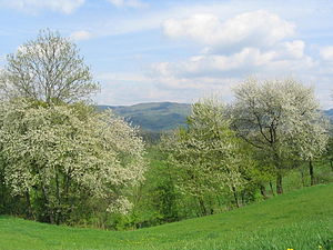
Tromm (Odenwald)
Mountain in Germany
Distance: Approx. 3603 meters
Latitude and longitude: 49.60444444,8.80277778
Tromm is an Odenwald mountain in Hesse, Germany.
Weather in this IP's area
overcast clouds
6 Celsius
1 Celsius
5 Celsius
7 Celsius
1012 hPa
95 %
1012 hPa
989 hPa
10000 meters
6.54 m/s
14.8 m/s
234 degree
92 %
07:41:47
16:38:51
