195.80.166.204 - IP Lookup: Free IP Address Lookup, Postal Code Lookup, IP Location Lookup, IP ASN, Public IP
Country:
Region:
City:
Location:
Time Zone:
Postal Code:
IP information under different IP Channel
ip-api
Country
Region
City
ASN
Time Zone
ISP
Blacklist
Proxy
Latitude
Longitude
Postal
Route
Luminati
Country
Region
bc
City
sliac
ASN
Time Zone
Europe/Bratislava
ISP
Slovanet a.s.
Latitude
Longitude
Postal
IPinfo
Country
Region
City
ASN
Time Zone
ISP
Blacklist
Proxy
Latitude
Longitude
Postal
Route
IP2Location
195.80.166.204Country
Region
trenciansky kraj
City
trencin
Time Zone
Europe/Bratislava
ISP
Language
User-Agent
Latitude
Longitude
Postal
db-ip
Country
Region
City
ASN
Time Zone
ISP
Blacklist
Proxy
Latitude
Longitude
Postal
Route
ipdata
Country
Region
City
ASN
Time Zone
ISP
Blacklist
Proxy
Latitude
Longitude
Postal
Route
Popular places and events near this IP address

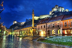
Trenčín
City in Slovakia
Distance: Approx. 633 meters
Latitude and longitude: 48.89194444,18.03666667
Trenčín (Slovak pronunciation: [ˈtrentʂiːn] , also known by other alternative names) is a city in western Slovakia of the central Váh River valley near the Czech border, around 95 km (59 mi) from Bratislava. It has a population of more than 55,000, which makes it the eighth largest municipality of the country and is the seat of the Trenčín Region and the Trenčín District. It has a medieval castle, Trenčín Castle, on a rock above the city.

Trencsén County
County of the Kingdom of Hungary
Distance: Approx. 1015 meters
Latitude and longitude: 48.9,18.03333333
Trencsén county (Latin: comitatus Trentsiniensis / Trenchiniensis; Hungarian: Trencsén (vár)megye; Slovak: Trenčiansky komitát / Trenčianska stolica / Trenčianska župa; German: Trentschiner Gespanschaft / Komitat) was an administrative county (comitatus) of the Kingdom of Hungary. Its territory is now in western Slovakia.

Trenčín District
District in Trenčín Region, Slovakia
Distance: Approx. 1015 meters
Latitude and longitude: 48.9,18.03333333
Trenčín District (Slovak: okres Trenčín (or Trenčiansky okres), Hungarian: Trencséni járás) is a district in the Trenčín Region of northwestern Slovakia. It borders the districts of Bánovce nad Bebravou, Nové Mesto nad Váhom, and Ilava. In the northwest, the Slovak state border also forms the border of the Trenčín district.

Štadión Sihoť
Football stadium in Trenčín, Slovakia
Distance: Approx. 466 meters
Latitude and longitude: 48.89868,18.044738
Štadión na Sihoti is a multi-use stadium in Trenčín, Slovakia. It is currently used mostly for football matches and is the home ground of AS Trenčín. The stadium holds 6,366 people.

Hrabovka
Village and municipality in Slovakia
Distance: Approx. 4342 meters
Latitude and longitude: 48.93333333,18.03888889
Hrabovka ( Hungarian: Szúcsgyertyános ) is a village and municipality in Trenčín District in the Trenčín Region of north-western Slovakia.

Skalka nad Váhom
Municipality in Slovakia
Distance: Approx. 4200 meters
Latitude and longitude: 48.9275,18.07222222
Skalka nad Váhom ( Hungarian: Vágsziklás ) is a village and municipality in Trenčín District in the Trenčín Region of north-western Slovakia.

Soblahov
Municipality in Slovakia
Distance: Approx. 4210 meters
Latitude and longitude: 48.86666667,18.08333333
Soblahov (Hungarian: Cobolyfalu, until 1899 Szoblahó) is a village and municipality in Trenčín District in the Trenčín Region of north-western Slovakia.

Zamarovce
Distance: Approx. 2501 meters
Latitude and longitude: 48.91666667,18.05
Zamarovce ( Hungarian: Vágzamárd ) is a village and municipality in Trenčín District in the Trenčín Region of north-western Slovakia. It is situated mostly on the right bank of the Váh river. The municipality lies at an altitude of 215 metres and covers an area of 3.928 km².

Trenčín Castle
Distance: Approx. 44 meters
Latitude and longitude: 48.894167,18.044722
The Trenčín Castle (Slovak: Trenčiansky hrad, Slovak: Trenčiansky Hrad) is a castle above the town of Trenčín in western Slovakia.

Pavol Demitra Ice Stadium
Distance: Approx. 1149 meters
Latitude and longitude: 48.9005699,18.0571032
Pavol Demitra Ice Stadium (Slovak: Zimný Štadión Pavla Demitru) and formerly B.O.F. Arena, is an arena in Trenčín, Slovakia. The stadium is primarily used for ice hockey, and is the home arena of the Slovak Extraliga club, HK Dukla Trenčín. It has a capacity of 6,150 spectators and was built in 1960.

Trenčín Synagogue
Former synagogue in Trenčín, Slovakia
Distance: Approx. 351 meters
Latitude and longitude: 48.8944,18.0396
The Trenčín Synagogue (Slovak: Synagóga v Trenčíne) is a cultural centre and former Neolog Jewish congregation and synagogue in the city of Trenčín in Slovakia. The building is a Cultural Heritage Monument of Slovakia.
2019 IFMAR 1:10 Electric Off-Road World Championships
Distance: Approx. 1342 meters
Latitude and longitude: 48.8892054,18.0608655
The 2019 IFMAR 1:10 Electric Off-Road World Championships was the eighteenth edition of the IFMAR 1:10 Electric Off-Road World Championship was held in Slovakia at the Hudy Arena which is effectively the test track for Xray. However the two wheel drive class was won by Spencer Rivkin racing an Team Associated RC10B6.1D bringing the manufacturers tally of IFMAR World Championships to thirty.
Weather in this IP's area
few clouds
6 Celsius
6 Celsius
6 Celsius
6 Celsius
1030 hPa
72 %
1030 hPa
983 hPa
10000 meters
0.67 m/s
0.59 m/s
320 degree
17 %