195.78.63.56 - IP Lookup: Free IP Address Lookup, Postal Code Lookup, IP Location Lookup, IP ASN, Public IP
Country:
Region:
City:
Location:
Time Zone:
Postal Code:
ISP:
ASN:
language:
User-Agent:
Proxy IP:
Blacklist:
IP information under different IP Channel
ip-api
Country
Region
City
ASN
Time Zone
ISP
Blacklist
Proxy
Latitude
Longitude
Postal
Route
db-ip
Country
Region
City
ASN
Time Zone
ISP
Blacklist
Proxy
Latitude
Longitude
Postal
Route
IPinfo
Country
Region
City
ASN
Time Zone
ISP
Blacklist
Proxy
Latitude
Longitude
Postal
Route
IP2Location
195.78.63.56Country
Region
hessen
City
langen
Time Zone
Europe/Berlin
ISP
Language
User-Agent
Latitude
Longitude
Postal
ipdata
Country
Region
City
ASN
Time Zone
ISP
Blacklist
Proxy
Latitude
Longitude
Postal
Route
Popular places and events near this IP address

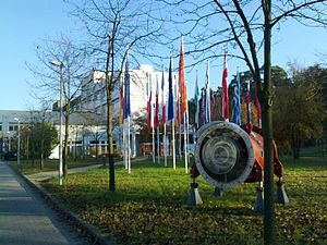
GSI Helmholtz Centre for Heavy Ion Research
German research institute
Distance: Approx. 6525 meters
Latitude and longitude: 49.93138889,8.67916667
The GSI Helmholtz Centre for Heavy Ion Research (German: GSI Helmholtzzentrum für Schwerionenforschung) is a federally and state co-funded heavy ion (Schwerion) research center in Darmstadt, Germany. It was founded in 1969 as the Society for Heavy Ion Research (German: Gesellschaft für Schwerionenforschung), abbreviated GSI, to conduct research on and with heavy-ion accelerators. It is the only major user research center in the State of Hesse.

Erzhausen
Municipality in Hesse, Germany
Distance: Approx. 5077 meters
Latitude and longitude: 49.95,8.63333333
Erzhausen is a village and a municipality in southern Hesse, Germany. It is part of the district of Darmstadt-Dieburg. It has about 7,900 inhabitants (2020).
Dreieich
Town in Hesse, Germany
Distance: Approx. 2534 meters
Latitude and longitude: 50,8.7
Dreieich (German pronunciation: [draɪ̯ˈʔaɪ̯ç] ) is a town in the Offenbach district in the Regierungsbezirk of Darmstadt in Hessen, Germany. The town is part of the Frankfurt Rhein-Main urban area and is located roughly 10 km (6.2 mi) south of downtown Frankfurt am Main. With a population of more than 40,000 it is the district’s second largest town.

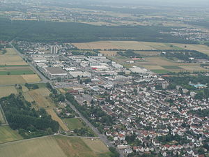
Langen, Hesse
Town in Hesse, Germany
Distance: Approx. 710 meters
Latitude and longitude: 49.98333333,8.66666667
Langen is a town of roughly 39,000 in the Offenbach district in the Regierungsbezirk of Darmstadt in Hesse, Germany. The town is between Darmstadt and Frankfurt am Main and part of the Frankfurt Rhein-Main urban area. Langen is headquarters to Deutsche Flugsicherung (German air traffic control), and is also home to the Paul-Ehrlich-Institut, a Federal institute for the evaluation and supervision of sera and vaccines in Germany.

Mörfelden-Walldorf
Town in Hesse, Germany
Distance: Approx. 6204 meters
Latitude and longitude: 50,8.58333333
Mörfelden-Walldorf is a town in the Groß-Gerau district, situated in the Frankfurt Rhine-Main region in the federal state (Bundesland) Hesse, Germany.

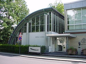
Zeppelin Museum Zeppelinheim
Distance: Approx. 6352 meters
Latitude and longitude: 50.0349,8.6145
Zeppelin Museum Zeppelinheim is located in Neu-Isenburg near Frankfurt am Main. The design of the museum building, constructed in 1988, resembles a quarter section of the hull of the LZ 10. The transport airships Graf Zeppelin and Hindenburg, as well as the second Graf Zeppelin (LZ 130), were based near the present site of the museum, on a site later occupied by the Rhein-Main Air Base.

Egelsbach
Municipality in Hesse, Germany
Distance: Approx. 2556 meters
Latitude and longitude: 49.96666667,8.66666667
Egelsbach is a municipality of 11,000 in the Offenbach district in the Regierungsbezirk of Darmstadt in Hesse, Germany.

Schloß Wolfsgarten
Distance: Approx. 2335 meters
Latitude and longitude: 49.98027778,8.63927778
Schloss Wolfsgarten is a former hunting seat of the ruling family of Hesse-Darmstadt, located in the German state of Hessen, approximately 15 kilometers south of Frankfurt am Main. The hunting lodge was established between 1722 and 1724 by Landgrave Ernst Ludwig of Hesse-Darmstadt. Ernst Ludwig's purpose in establishing Wolfsgarten was to pursue his passion for hunting with dogs which he introduced into Hesse in 1709.
Oberwaldberg
Mountain in Germany
Distance: Approx. 5480 meters
Latitude and longitude: 49.98861111,8.59194444
Oberwaldberg is a mountain of Hesse, Germany.

Facility for Antiproton and Ion Research
Distance: Approx. 6525 meters
Latitude and longitude: 49.93138889,8.67916667
The Facility for Antiproton and Ion Research (FAIR) is an international accelerator facility under construction which will use antiprotons and ions to perform research in the fields of: nuclear, hadron and particle physics, atomic and anti-matter physics, high density plasma physics, and applications in condensed matter physics, biology and the bio-medical sciences. It is situated in Darmstadt in Germany. FAIR will be based upon an expansion of the GSI Helmholtz Centre for Heavy Ion Research, the details of which have been laid out in the FAIR Baseline Technical Report 2006.
Dreieich-Buchschlag station
Railway station in Dreieich, Germany
Distance: Approx. 3696 meters
Latitude and longitude: 50.0224443,8.6609387
Dreieich-Buchschlag station is a railway station on the Rhine-Main S-Bahn in the town of Dreieich in the German state of Hesse. It was opened in 1879 on the Main-Neckar Railway. The station is classified by Deutsche Bahn as a category 4 station.

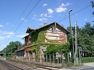
Langen (Hess) station
Railway station in Langen, Hesse, Germany
Distance: Approx. 934 meters
Latitude and longitude: 49.99345,8.656905
Langen (Hess) station is in the town of Langen in the German state of Hesse. It was opened in 1846 with the Main-Neckar Railway and is now served by the Rhine-Main S-Bahn. The station has two side platforms, an island platform and a through track without a platform.
Weather in this IP's area
overcast clouds
3 Celsius
1 Celsius
2 Celsius
4 Celsius
1034 hPa
84 %
1034 hPa
1018 hPa
10000 meters
1.54 m/s
300 degree
100 %

