195.75.22.77 - IP Lookup: Free IP Address Lookup, Postal Code Lookup, IP Location Lookup, IP ASN, Public IP
Country:
 Switzerland
Region:
City:
Location:
Time Zone:
Postal Code:
ISP:
ASN:
language:
User-Agent:
Proxy IP:
Blacklist:
IP information under different IP Channel
ip-api
Country
Region
City
ASN
Time Zone
ISP
Blacklist
Proxy
Latitude
Longitude
Postal
Route
db-ip
Country
Region
City
ASN
Time Zone
ISP
Blacklist
Proxy
Latitude
Longitude
Postal
Route
IPinfo
Country
Region
City
ASN
Time Zone
ISP
Blacklist
Proxy
Latitude
Longitude
Postal
Route
IP2Location
195.75.22.77Country
chRegion
zurich
City
fallanden
Time Zone
Europe/Zurich
ISP
Language
User-Agent
Latitude
Longitude
Postal
ipdata
Country
Region
City
ASN
Time Zone
ISP
Blacklist
Proxy
Latitude
Longitude
Postal
Route
Popular places and events near this IP address

Greifensee, Zürich
Municipality in Zürich, Switzerland
Distance: Approx. 3436 meters
Latitude and longitude: 47.36666667,8.68333333
Greifensee is a municipality in the district of Uster in the Canton of Zurich in Switzerland.

Fällanden
Municipality in Zurich, Switzerland
Distance: Approx. 687 meters
Latitude and longitude: 47.36666667,8.63333333
Fällanden is a municipality in the district of Uster in the canton of Zürich in Switzerland, and belongs to the Glatt Valley (German: Glattal).
Maur, Switzerland
Municipality in Zurich, Switzerland
Distance: Approx. 3230 meters
Latitude and longitude: 47.35,8.66666667
Maur is a municipality in the district of Uster in the canton of Zürich in Switzerland.

Schwerzenbach
Municipality in Zürich, Switzerland
Distance: Approx. 2488 meters
Latitude and longitude: 47.38333333,8.66666667
Schwerzenbach is a municipality in the district of Uster in the canton of Zürich in Switzerland, and belongs to the Glatt Valley (German: Glattal). The municipality was first mentioned in year 1064 as Swerzenbach.
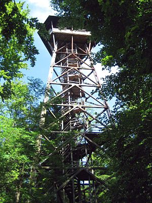
Loorenkopf
Tower in Zurich, Switzerland
Distance: Approx. 2990 meters
Latitude and longitude: 47.36944444,8.59888889
Loorenkopf tower is a 33-metre (108 ft) high freestanding wood lattice tower on Adlisberg, north of Witikon in Zürich, Switzerland. It was built in 1954. The tower is owned by Zürich city and it is open to the public.
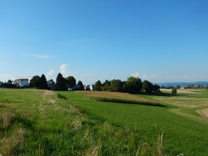
Pfaffhausen
Distance: Approx. 1735 meters
Latitude and longitude: 47.36666667,8.61666667
Pfaffhausen (also known as Pffaffhausen) is a settlement in the municipality of Fällanden in the canton of Zürich, Switzerland. It has an elevation of 597 m, and lies in the valley between the northern flank of the Öschbrig and the southeastern slope of the Adlisberg. Pfaffhausen borders the Zürich quarter of Witikon to the west, the settlement of Binz (belonging to Maur) to the south, and the settlement of Benglen, also part of Fällanden, to the east.

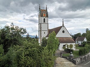
Greifensee Reformed Church
Church in Zurich, Switzerland
Distance: Approx. 3004 meters
Latitude and longitude: 47.36489,8.67691
Reformierte Kirche Greifensee (native German name, literally: Greifensee Reformed Church or commonly Gallus-Kapelle Im Städtli), is a church and a listed heritage building in the municipality of Greifensee, Canton of Zürich, Switzerland.

Greifensee Castle
Castle in Zurich, Switzerland
Distance: Approx. 2908 meters
Latitude and longitude: 47.365037,8.675652
Greifensee Castle (German: Schloss Greifensee) is a castle in the municipality of Greifensee and the canton of Zurich in Switzerland. It was probably built by the House of Rapperswil and is a Swiss heritage site of national significance.

Dübendorf railway station
Railway station in Canton of Zürich, Switzerland
Distance: Approx. 3346 meters
Latitude and longitude: 47.39998,8.622943
Dübendorf is a railway station in the Swiss canton of Zurich. It is situated in the municipality of Dübendorf on the Wallisellen–Uster–Rapperswil line. It is located close to the Dübendorf Air Base.
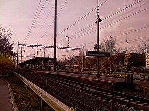
Schwerzenbach railway station
Railway station in Switzerland
Distance: Approx. 2112 meters
Latitude and longitude: 47.384571,8.659126
Schwerzenbach is a railway station in the Swiss canton of Zurich. It is situated in the municipality of Schwerzenbach on the Wallisellen–Uster–Rapperswil line. It is the main station serving the communities of Schwerzenbach and Volketswil, with close proximity to the Volkiland shopping center and Milandia entertainment park.
Dübendorf Air Base
Military airfield in Switzerland
Distance: Approx. 3072 meters
Latitude and longitude: 47.39861111,8.64805556
Dübendorf Military Airport (German: Militärflugplatz Dübendorf) (ICAO: LSMD) was a military airfield of the Swiss Air Force northeast of Dübendorf in Switzerland, located east of Zürich. It includes the Flieger-Flab-Museum.

Öschbrig
Mountain in Switzerland
Distance: Approx. 2380 meters
Latitude and longitude: 47.35833333,8.61388889
Öschbrig (also known as Oetlisberg) with an elevation of 696 metres (2,283 ft), is a wooded mountain in Switzerland overlooking to the east Zürichsee (Lake Zürich).
Weather in this IP's area
mist
0 Celsius
0 Celsius
-1 Celsius
1 Celsius
1039 hPa
92 %
1039 hPa
976 hPa
6000 meters
1.03 m/s
100 %