Country:
 Norway
Region:
City:
Latitude and Longitude:
Time Zone:
Postal Code:
IP information under different IP Channel
ip-api
Country
Region
City
ASN
Time Zone
ISP
Blacklist
Proxy
Latitude
Longitude
Postal
Route
IPinfo
Country
Region
City
ASN
Time Zone
ISP
Blacklist
Proxy
Latitude
Longitude
Postal
Route
MaxMind
Country
Region
City
ASN
Time Zone
ISP
Blacklist
Proxy
Latitude
Longitude
Postal
Route
Luminati
Country
NORegion
02
City
rykkin
ASN
Time Zone
Europe/Oslo
ISP
Telenor Norge AS
Latitude
Longitude
Postal
db-ip
Country
Region
City
ASN
Time Zone
ISP
Blacklist
Proxy
Latitude
Longitude
Postal
Route
ipdata
Country
Region
City
ASN
Time Zone
ISP
Blacklist
Proxy
Latitude
Longitude
Postal
Route
Popular places and events near this IP address
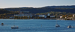
Bærum
Municipality in Akershus, Norway
Distance: Approx. 1272 meters
Latitude and longitude: 59.93833333,10.50666667
Bærum (Norwegian: [ˈbæ̂ːrʉm] ) is a municipality in the Greater Oslo Region in Akershus County, Norway. It forms an affluent suburb of Oslo on the west coast of the city. Bærum is Norway's fifth largest municipality with a population of 128,760 (2021).

Bærums Verk
Village in Viken, Norway
Distance: Approx. 1774 meters
Latitude and longitude: 59.94305556,10.5075
Bærums Verk is a village in Bærum in Viken, Norway, with a population of about 8000. It is located on both sides of the river Lomma.
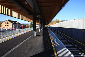
Kolsås station
Oslo metro station
Distance: Approx. 1448 meters
Latitude and longitude: 59.91527778,10.50083333
Kolsås is the end station of the Kolsås Line on the Oslo Metro. The station, located in Bærum municipality, comes after Hauger, and is located 17.3 kilometers (10.7 mi) from Stortinget. The station and line into Bærum was originally not built as a metro line but as the Lilleaker Line, built by Bærumsbanen.

Kolsås
Village in Østlandet, Norway
Distance: Approx. 1267 meters
Latitude and longitude: 59.93333333,10.51666667
Kolsås (Norwegian pronunciation: [ˈkôɫsoːs]), sometimes called Kolsaas, is a hill in the municipality of Bærum, Norway. Geologically, Kolsås belongs to the Oslo Graben area. Its two peaks consist of hard rhomb porphyric lava covering softer rocks, forming steep cliffs to the east, south and west.

Hauger station
Oslo metro station
Distance: Approx. 2094 meters
Latitude and longitude: 59.91083333,10.51138889
Hauger is a station on the Kolsås Line (line 3) on the Oslo Metro system. It is located between Kolsås and Gjettum, 16.5 kilometers (10.3 mi) from Stortinget. It serves the neighborhood Hauger and the mainly industrial area Rud.
Gullhaug, Akershus
Village in Norway
Distance: Approx. 1399 meters
Latitude and longitude: 59.9406,10.4939
Gullhaug is a district in the municipality of Bærum, Norway. Its population (2007) is 3,468. The area was developed with housing in the 1980s.
Bryn, Akershus
Village in Norway
Distance: Approx. 962 meters
Latitude and longitude: 59.9202,10.4895
Bryn is a district in the municipality of Bærum, Norway. Together with the district Hammerbakken, its population (2007) is 5,680.

Norwegian National Road 168
Road in Norway
Distance: Approx. 1618 meters
Latitude and longitude: 59.9414,10.5082
Norwegian National Road 168 (Norwegian: Riksvei 168) is a major route between Bærum and Oslo, Norway. It stretches from the industrial area of Rud, Bærum to the inner city of Oslo. It is connected with important roads like the European route E16 and the National Roads 150 (Ring 3), 161 (Ring 2) and 162 (Ring 1).

Rosenvilde Upper Secondary School
High school in Akershus
Distance: Approx. 2169 meters
Latitude and longitude: 59.9096,10.5087
Rosenvilde High School is a high school at Kolsås in Bærum municipality in Akershus, Norway. The school offers an education within the general trades, restaurants and food processing, health and social care and media and communications, and in addition, supplementary school courses in general subjects. It is the closest school to Asker offering art education.
Vøyenenga
Village in Østlandet, Norway
Distance: Approx. 2495 meters
Latitude and longitude: 59.9085,10.4748
Vøyenenga is a village in Bærum, Akershus, Norway.

Bryn Church
Church in Akershus, Norway
Distance: Approx. 912 meters
Latitude and longitude: 59.92100889,10.48832806
Bryn Church (Norwegian: Bryn kirke) is a long church (Norwegian: langkirke) located in Rykkinn in the municipality of Bærum in Akershus county, Norway. The church functions both as a road church and is the parish church for Bryn.

Bærum mosque shooting
Failed terrorist attack on a Norwegian mosque
Distance: Approx. 2252 meters
Latitude and longitude: 59.92,10.4595
The Bærum mosque shooting or Al-Noor Islamic Centre shooting occurred on 10 August 2019 at the Al-Noor Islamic Centre mosque in Bærum, Norway, about 20 kilometres (12 mi) west of the capital city Oslo. Philip Manshaus, a 21-year-old Norwegian man, shot and killed his ethnically Chinese adopted stepsister at their home. He then drove to the mosque and shot his way through the glass door before opening fire, hitting no one.
Weather in this IP's area
broken clouds
15 Celsius
15 Celsius
15 Celsius
17 Celsius
1016 hPa
96 %
1016 hPa
1005 hPa
10000 meters
1.31 m/s
1.44 m/s
39 degree
53 %
06:30:26
20:01:08