Country:
Region:
City:
Latitude and Longitude:
Time Zone:
Postal Code:
IP information under different IP Channel
ip-api
Country
Region
City
ASN
Time Zone
ISP
Blacklist
Proxy
Latitude
Longitude
Postal
Route
Luminati
Country
Region
md
City
coslada
ASN
Time Zone
Europe/Madrid
ISP
Institucion Ferial De Madrid
Latitude
Longitude
Postal
IPinfo
Country
Region
City
ASN
Time Zone
ISP
Blacklist
Proxy
Latitude
Longitude
Postal
Route
db-ip
Country
Region
City
ASN
Time Zone
ISP
Blacklist
Proxy
Latitude
Longitude
Postal
Route
ipdata
Country
Region
City
ASN
Time Zone
ISP
Blacklist
Proxy
Latitude
Longitude
Postal
Route
Popular places and events near this IP address

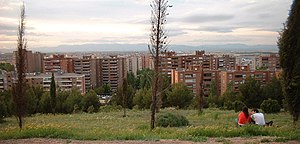
San Fernando de Henares
Municipality in Community of Madrid, Spain
Distance: Approx. 654 meters
Latitude and longitude: 40.42555556,-3.53527778
San Fernando de Henares is a municipality in Spain, in the province and autonomous community of Madrid. It has an area of 39.9 km2 and 38,904 inhabitants (2022). Its agricultural production includes olives, cereals, vegetables, cattle and wool.

Coslada
Municipality in Community of Madrid, Spain
Distance: Approx. 3160 meters
Latitude and longitude: 40.42611111,-3.565
Coslada (Spanish pronunciation: [kosˈlaða]) is a city and municipality in the autonomous community of Madrid in central Spain. The Dry Port of the Community of Madrid is located in Coslada, which has become a major logistics hub in the country. Due to the area's close proximity to the Madrid–Barajas Airport and the Dry Port, the stretch of industrial cities from Madrid to Guadalajara along the A-2 freeway (known as the Corredor del Henares and more recently the "golden mile" of online sales) has, since the 1990s, grown into a logistics hub, similar to East Midlands in England, with the entire area now boasting 5.7 million m2 of logistics space in total.

Henares
River in Spain
Distance: Approx. 3122 meters
Latitude and longitude: 40.4048,-3.50107
The Henares (Spanish: [eˈnaɾes] ) is a river in Spain, tributary of the Jarama. It has its source in the Sierra Ministra, in the village of Horna, near Sigüenza, in the province of Guadalajara. Its tributaries are the Torote, the Sorbe, the Cañamares, the Salado, the Dulce, the Aliendre, and the Bornova.
Barrio del Puerto (Madrid Metro)
Madrid Metro station
Distance: Approx. 3512 meters
Latitude and longitude: 40.4224957,-3.5691925
Barrio del Puerto [ˈbarjo ðel ˈpweɾto] is a station on Line 7 of the Madrid Metro, named for the Barrio del Puerto ("Barrio of the Gate") neighbourhood. It is located in fare Zone B1.

Coslada Central (Madrid Metro)
Madrid Metro station
Distance: Approx. 2830 meters
Latitude and longitude: 40.4237329,-3.5611868
Coslada Central ([kosˈlaða θenˈtɾal], "Central Coslada") is a station on Line 7 of the Madrid Metro. It is located in fare Zone B1. The station offers access to Cercanías Madrid via Coslada railway station.

La Rambla (Madrid Metro)
Madrid Metro station
Distance: Approx. 1709 meters
Latitude and longitude: 40.4251478,-3.5479247
La Rambla ([la ˈrambla], "The Promenade," referring to the area between the Calle de Honduras and Avenida de los Príncipes de España) is a station on Line 7 of the Madrid Metro. It is located in fare Zone B1.

San Fernando (Madrid Metro)
Madrid Metro station
Distance: Approx. 646 meters
Latitude and longitude: 40.4244134,-3.5354112
San Fernando [ˌsaɱ feɾˈnando] is a station on Line 7 of the Madrid Metro. It is located in the municipality of San Fernando de Henares and in fare Zone B1.

Jarama (Madrid Metro)
Madrid Metro station
Distance: Approx. 233 meters
Latitude and longitude: 40.4229543,-3.5254977
Jarama [xaˈɾama] is a station on Line 7 of the Madrid Metro, named for the nearby Jarama river. It is located in fare Zone B1.

Henares (Madrid Metro)
Madrid Metro station
Distance: Approx. 707 meters
Latitude and longitude: 40.4177664,-3.5271783
Henares [eˈna.ɾes] is a station on Line 7 of the Madrid Metro, serving the western part of the San Fernando de Henares municipality. It is located in fare zone B1.

Hospital del Henares (Madrid Metro)
Madrid Metro station
Distance: Approx. 921 meters
Latitude and longitude: 40.4176066,-3.5345323
Hospital del Henares [ospiˈtal del eˈnaɾes] is a station on Line 7 of the Madrid Metro and the eastern terminus of that line. me refers to the nearby Hospital Universitario del Henares which also opened in February 2008. It is located in fare Zone B1.

Torote
River in Spain
Distance: Approx. 3122 meters
Latitude and longitude: 40.4048,-3.50107
The Torote is a river in Spain, tributary of the Henares. It has its source close to Picorroble hill, in the province of Guadalajara.

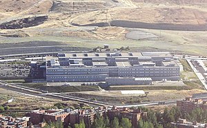
Hospital Universitario del Henares
Hospital in Community of Madrid, Spain
Distance: Approx. 800 meters
Latitude and longitude: 40.4181,-3.533
The Hospital Universitario del Henares is a hospital in Coslada, Spain, part of the hospital network of the Servicio Madrileño de Salud (SERMAS). The non-medical services are managed by Sacyr.
Weather in this IP's area
broken clouds
11 Celsius
10 Celsius
10 Celsius
12 Celsius
1018 hPa
82 %
1018 hPa
950 hPa
10000 meters
2.24 m/s
4.47 m/s
45 degree
75 %
07:59:31
17:57:53
