Country:
 Sweden
Region:
City:
Latitude and Longitude:
Time Zone:
Postal Code:
IP information under different IP Channel
ip-api
Country
Region
City
ASN
Time Zone
ISP
Blacklist
Proxy
Latitude
Longitude
Postal
Route
IPinfo
Country
Region
City
ASN
Time Zone
ISP
Blacklist
Proxy
Latitude
Longitude
Postal
Route
MaxMind
Country
Region
City
ASN
Time Zone
ISP
Blacklist
Proxy
Latitude
Longitude
Postal
Route
Luminati
Country
SEASN
Time Zone
Europe/Stockholm
ISP
Telenor Norge AS
Latitude
Longitude
Postal
db-ip
Country
Region
City
ASN
Time Zone
ISP
Blacklist
Proxy
Latitude
Longitude
Postal
Route
ipdata
Country
Region
City
ASN
Time Zone
ISP
Blacklist
Proxy
Latitude
Longitude
Postal
Route
Popular places and events near this IP address

Slussenområdet
Area in central Stockholm, Sweden
Distance: Approx. 286 meters
Latitude and longitude: 59.32111111,18.07194444
Slussenområdet (Swedish: [ˈslɵ̂sːɛnɔmˌroːdɛt], the Sluice area) is an area of central Stockholm, on the Söderström river, connecting Södermalm and Gamla stan. The area is named after the locks between Lake Mälaren and the Baltic Sea. Called Karl Johanslussen, the locks themselves allow passage between these two bodies of water (of different levels).

Katarina Elevator
Distance: Approx. 169 meters
Latitude and longitude: 59.32,18.07277778
The Katarina Elevator or Katarina Lift (Swedish: Katarinahissen) is a passenger elevator in Stockholm that connects Slussen (the sluice/lock area) to the heights of Södermalm. The lift was a shortcut between Katarinavägen, Slussen and Mosebacke torg. The original lift was constructed in 1881, but the current structure dates from the rebuilding of the Slussen transport interchange in 1936.

Mosebacke
Distance: Approx. 136 meters
Latitude and longitude: 59.31805556,18.07444444
Mosebacke (Mosebacke torg) is a square and park situated on Södermalm in Stockholm, Sweden.
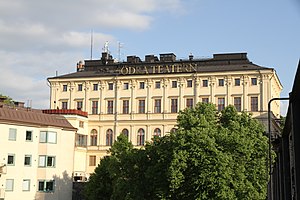
Södra Teatern
Distance: Approx. 116 meters
Latitude and longitude: 59.31833333,18.07416667
Södra Teatern is a theatre in Stockholm, Sweden. It is located at Mosebacke torg on Södermalm in Stockholm. The venue is the oldest theatre in Stockholm and is situated in the heart of the city.

Karl Johansslussen
Distance: Approx. 283 meters
Latitude and longitude: 59.32138889,18.07277778
Karl Johanslussen ("Lock of Charles John") is a lock and a sluice, along the Söderström river connecting and controlling the flood discharge between Riddarfjärden, the easternmost part of Lake Mälaren, and Saltsjön, the section of the Baltic Sea reaching into central Stockholm, Sweden. The lock is 75 metres long, 10 metres wide and 3.90 metres deep. The maximum height is 3.8 metres.

Götgatan
Distance: Approx. 270 meters
Latitude and longitude: 59.31961111,18.07061111
Götgatan (Original Swedish Göthegatan for "Gothia Street") is the name of one of the longest streets in central Stockholm on the Southern Isle (Södermalm) of the city. The street itself has existed since the 12th century, and has had its name since the 1640s, the name based on it being a part of the old Göta highway. At its northern end behind Stockholm City Museum it connects to Södermalm Square at Slussen, and it runs due south from there to the former toll position of Skanstull and a high bridge (Skanstullsbron) leading over to Globe Arena and mainland suburbs.

Slussen metro station
Stockholm metro station
Distance: Approx. 191 meters
Latitude and longitude: 59.31916667,18.07194444
Slussen is a station of the Stockholm metro, located in Slussenområdet in the district of Södermalm. The station is served by the Red and Green lines. Originally opened in 1933 as an underground tram stop, on 1 October 1950 it became the terminal of the first metro line running south to Hökarängen, it was again rebuilt when the extension of the line north to Hötorget was opened on 24 November 1957.

Stockholm City Museum
City Museum in Slussen on Södermalm in Stockholm, Sweden
Distance: Approx. 276 meters
Latitude and longitude: 59.31972222,18.07055556
The Stockholm City Museum (Swedish: Stadsmuseet Stockholm) is a museum documenting, preserving and exhibiting the history of Stockholm. The museum is housed in Södra Stadshuset at Slussen on Södermalm.

Sankt Paulsgatan
Distance: Approx. 266 meters
Latitude and longitude: 59.31852778,18.07080556
Sankt Paulsgatan (St. Paul Street) is a street of Södermalm, Stockholm, Sweden. The street leads east-west from Götgatan to Torkel Knutssonsgatan, parallel to Hornsgatan which is approximately 770 feet long.

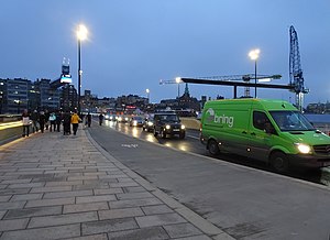
Stadsgården
Wharf on the Baltic Sea in Stockholm
Distance: Approx. 43 meters
Latitude and longitude: 59.31955,18.07496111
Stadsgården commonly refers to the wharf on the shore of the Baltic Sea in Stockholm, Sweden, located between Slussen in the west and Masthamnen in the east. The word gård in the name comes from skeppsgård, which was a word used in archaic Swedish for an area used for port and dock operations.

Stomatol Sign
Animated commercial display sign in Stockholm, Sweden
Distance: Approx. 189 meters
Latitude and longitude: 59.319,18.072
The Stomatol Sign is Sweden's first animated commercial display and the oldest still working. It represents a toothbrush and a toothpaste tube of the Swedish brand Stomatol. It was first erected on November 22, 1909, on the old Katarina Elevator, in the area of Slussenområdet, Stockholm.
Guldbron
Bridge in Slussenområdet, Stockholm
Distance: Approx. 210 meters
Latitude and longitude: 59.320975,18.074064
Guldbron "The Golden Bridge", formally Slussbron, is the main bridge for road traffic as well as pedestrians and cyclists that will connect the Old Town of Stockholm with Södermalm. The bridge, which is part of the Nya Slussen project, was opened on 25 October 2020 by king Carl XVI Gustaf. Due to its color scheme it is unofficially often called the Gold Bridge.
Weather in this IP's area
scattered clouds
21 Celsius
21 Celsius
19 Celsius
21 Celsius
1019 hPa
79 %
1019 hPa
1019 hPa
10000 meters
3.6 m/s
100 degree
34 %
06:01:08
19:29:49