Country:
 Germany
Region:
City:
Latitude and Longitude:
Time Zone:
Postal Code:
IP information under different IP Channel
ip-api
Country
Region
City
ASN
Time Zone
ISP
Blacklist
Proxy
Latitude
Longitude
Postal
Route
IPinfo
Country
Region
City
ASN
Time Zone
ISP
Blacklist
Proxy
Latitude
Longitude
Postal
Route
MaxMind
Country
Region
City
ASN
Time Zone
ISP
Blacklist
Proxy
Latitude
Longitude
Postal
Route
Luminati
Country
DERegion
by
City
goldbach
ASN
Time Zone
Europe/Berlin
ISP
VSE NET GmbH
Latitude
Longitude
Postal
db-ip
Country
Region
City
ASN
Time Zone
ISP
Blacklist
Proxy
Latitude
Longitude
Postal
Route
ipdata
Country
Region
City
ASN
Time Zone
ISP
Blacklist
Proxy
Latitude
Longitude
Postal
Route
Popular places and events near this IP address

Hösbach
Municipality in Bavaria, Germany
Distance: Approx. 1222 meters
Latitude and longitude: 50,9.2
Hösbach is a market community and municipality in the Aschaffenburg district in the Regierungsbezirk of Lower Franconia (Unterfranken) in Bavaria, Germany. As of 2023, It has a population of 13,323.

Goldbach, Bavaria
Municipality in Bavaria, Germany
Distance: Approx. 1151 meters
Latitude and longitude: 49.98888889,9.18638889
Goldbach is a market community in the Aschaffenburg district in the Regierungsbezirk of Lower Franconia (Unterfranken) in Bavaria, Germany.
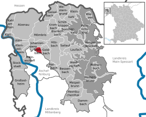
Glattbach
Municipality in Bavaria, Germany
Distance: Approx. 2662 meters
Latitude and longitude: 50.00555556,9.14722222
Glattbach is a community in the Aschaffenburg district (landkreis) in the administrative region (regierungsbezirk) of Lower Franconia (Unterfranken) in Bavaria, Germany. It has around 6,800 inhabitants (2024). The town is located in a valley north of Aschaffenburg town on the western edge of the Spessart range.
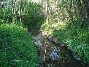
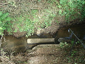
Glattbach (river)
River in Germany
Distance: Approx. 2548 meters
Latitude and longitude: 49.9891,9.1509
Glattbach is a small river of Bavaria, Germany. It flows into the Aschaff near Aschaffenburg.
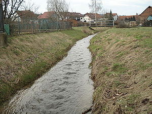
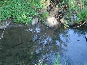
Hösbach (river)
River in Germany
Distance: Approx. 1342 meters
Latitude and longitude: 49.9999,9.2017
Hösbach is a river of Bavaria, Germany, at the market community Hösbach in the Aschaffenburg district in the Regierungsbezirk of Lower Franconia (Unterfranken). It is about 5 km (3 mi) long and a right tributary of the Aschaff.

Afferbach
River in Germany
Distance: Approx. 2007 meters
Latitude and longitude: 50.0108,9.2042
The Afferbach is a river of Bavaria, Germany. It flows into the Hösbach in Hösbach.
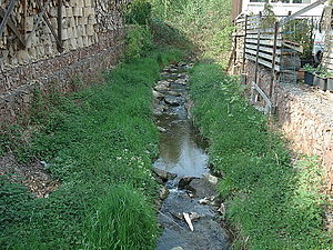
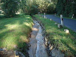
Goldbach (Aschaff)
River of Bavaria, Germany
Distance: Approx. 1728 meters
Latitude and longitude: 49.9906,9.1627
Goldbach is a small river of Bavaria, Germany. It is a right tributary of the Aschaff near Aschaffenburg.
Güntersbach
River in Germany
Distance: Approx. 2850 meters
Latitude and longitude: 50.0045,9.2219
Güntersbach is a small river of Bavaria, Germany. It flows into the Aschaff near Hösbach.
Röderbach (Aschaff)
River in Germany
Distance: Approx. 1242 meters
Latitude and longitude: 49.99055556,9.17166667
Röderbach is a river of Bavaria, Germany. It is a left tributary of the Aschaff near Goldbach.
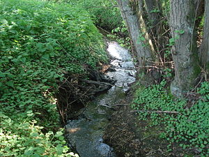
Klingenbach (Goldbach)
River in Germany
Distance: Approx. 1338 meters
Latitude and longitude: 49.992,9.1678
Klingenbach is a river of Bavaria, Germany. It is a right tributary to the Flutgraben, the man-made lower course of the Goldbach, in Aschaffenburg.
Unterer Hösbach
River in Germany
Distance: Approx. 2217 meters
Latitude and longitude: 50.0134,9.2044
Unterer Hösbach is a small river of Bavaria, Germany. It flows into the Hösbach near the village Hösbach.

Battle of Aschaffenburg (1866)
Distance: Approx. 2526 meters
Latitude and longitude: 49.97983806,9.16409
The Battle of Aschaffenburg, sometimes also called The Skirmishes Near Aschaffenburg, was a battle of the Austro-Prussian War on 14 July 1866 between pitting the armies of Prussia on the one hand and parts of the VIII Corps of the German Federal Army on the other side which primarily consisted of soldiers from the Austrian Empire, Hesse-Darmstadt and Hesse-Kassel.
Weather in this IP's area
clear sky
15 Celsius
15 Celsius
14 Celsius
16 Celsius
1021 hPa
83 %
1021 hPa
1003 hPa
10000 meters
4.56 m/s
12.41 m/s
84 degree
07:07:01
19:26:17