Country:
Region:
City:
Latitude and Longitude:
Time Zone:
Postal Code:
IP information under different IP Channel
ip-api
Country
Region
City
ASN
Time Zone
ISP
Blacklist
Proxy
Latitude
Longitude
Postal
Route
Luminati
Country
ASN
Time Zone
Europe/Madrid
ISP
Industria De Diseno Textil Sociedad Anonima
Latitude
Longitude
Postal
IPinfo
Country
Region
City
ASN
Time Zone
ISP
Blacklist
Proxy
Latitude
Longitude
Postal
Route
db-ip
Country
Region
City
ASN
Time Zone
ISP
Blacklist
Proxy
Latitude
Longitude
Postal
Route
ipdata
Country
Region
City
ASN
Time Zone
ISP
Blacklist
Proxy
Latitude
Longitude
Postal
Route
Popular places and events near this IP address

A Coruña
Municipality in Galicia, Spain
Distance: Approx. 9155 meters
Latitude and longitude: 43.365,-8.41
A Coruña (Galician pronunciation: [ɐ koˈɾuɲɐ] ; Spanish: La Coruña [la koˈɾuɲa] ; also informally called just Coruña; historical English: Corunna or The Groyne) is a city and municipality in Galicia, Spain. It is Galicia's second largest city, behind Vigo. The city is the provincial capital of the province of A Coruña, having also served as political capital of the Kingdom of Galicia from the 16th to the 19th centuries, and as a regional administrative centre between 1833 and 1982.

Battle of Corunna
1809 Battle of the Peninsular War
Distance: Approx. 7416 meters
Latitude and longitude: 43.3325,-8.4125
The Battle of Corunna (or A Coruña, La Corunna, La Coruña or La Corogne), in Spain known as Battle of Elviña, took place on 16 January 1809, when a French corps under Marshal of the Empire Jean de Dieu Soult attacked a British army under Lieutenant-General Sir John Moore. The battle took place amidst the Peninsular War, which was a part of the wider Napoleonic Wars. It was a result of a French campaign, led by Napoleon, which had defeated the Spanish armies and caused the British army to withdraw to the coast following an unsuccessful attempt by Moore to attack Soult's corps and divert the French army.

University of A Coruña
Public university in Galicia, Spain
Distance: Approx. 7891 meters
Latitude and longitude: 43.35064444,-8.41594722
The University of A Coruña (Galician: Universidade da Coruña) is a Spanish public university located in the city of A Coruña, Galicia. Established in 1989, university departments are divided between two primary campuses in A Coruña and nearby Ferrol. The A Coruña campus is spread over three suburbs on the outskirts of A Coruña: Elviña and Zapateira (near the site of the Battle of Elviña) and Oza (near the As Xubias zone).

Arteixo
Municipality in Galicia, Spain
Distance: Approx. 1575 meters
Latitude and longitude: 43.30444444,-8.51138889
Arteixo (Galician: [aɾˈtejʃʊ]; Spanish: [arˈtejʃo] ) is a municipality in the province of A Coruña, part of the autonomous community of Galicia in northwestern Spain. Its area is 93.76 km2 and its population is 31,005 (2013). Its population density is 317.43 people/km2.
Culleredo
Place in Galicia, Spain
Distance: Approx. 9602 meters
Latitude and longitude: 43.28833333,-8.38944444
Culleredo (Spanish pronunciation: [kuʎeˈɾeðo], Galician: [kuɟeˈɾeðʊ]) is a municipality in the province of A Coruña, in the autonomous community of Galicia, northwestern Spain. Culleredo is located on the outskirts of A Coruña and its population is mainly formed of commuters. It is located in the central area of the province.
Coliseum da Coruña
Arena in A Coruña, Galicia, Spain
Distance: Approx. 7842 meters
Latitude and longitude: 43.33861111,-8.40944444
Coliseum da Coruña is an indoor arena for concerts and shows used in A Coruña, Galicia, Spain. The venue holds 11,000 people for concerts. It was designed by Japanese architect Arata Isozaki, built in 1990 and open on August 12, 1991.
Laracha CF
Spanish football club
Distance: Approx. 9609 meters
Latitude and longitude: 43.250139,-8.577086
Laracha Club de Fútbol is a Spanish football team based in A Laracha, in the autonomous community of Galicia. Founded in 1965, it currently plays in preferente Group 1, holding home games at Estadio Municipal de Laracha, with a 1,000-seat capacity.

Castro de Elviña
Historic site
Distance: Approx. 7122 meters
Latitude and longitude: 43.329444,-8.415278
Castro of Elviña ([ˈkastɾo ðe elˈβiɲa]) is an Iron Age hill fort located south of the city of A Coruña, Galicia, Spain. It was declared a historic monument in 1962.
Silva SD
Spanish football club
Distance: Approx. 7454 meters
Latitude and longitude: 43.351694,-8.423028
Silva Sociedad Deportiva is a Spanish football team based in A Coruña, in the autonomous community of Galicia. Founded on 6 June 1940 it currently plays in Tercera Federación – Group 1, holding home games at Campo de Fútbol Grela, which has a capacity of 1,000 spectators.

A Coruña railway station
Distance: Approx. 8443 meters
Latitude and longitude: 43.35268333,-8.40971111
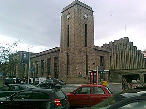
A Coruña railway station, also known as A Coruña-San Cristovo, is a railway terminus in A Coruña, Spain.
St. Mary of the Sea College, Corunna
Private primary and secondary school in A Coruña, Galicia, Spain
Distance: Approx. 9426 meters
Latitude and longitude: 43.33524167,-8.38788889
St. Mary of the Sea College (Spanish: Colegio Santa María del Mar) is a private Catholic primary and secondary school, located in A Coruña, in the autonomous community of Galicia, Spain. The school was founded by the Society of Jesus in 1964, and covers infant through baccalaureate.

National Museum of Science and Technology (Spain)
Technology museum in La Coruña and Alcobendas, Spain
Distance: Approx. 9101 meters
Latitude and longitude: 43.3732,-8.4203
The National Museum of Science and Technology (Spanish: Museo Nacional de Ciencia y Tecnología – MUNCYT) is a technology museum in Spain devoted to technology promotion and preservation. It owns a collection of more than 19,000 scientific instruments, technological devices, vehicles, machines and industrial tools from the 16th century until nowadays. Dependent on the Ministry of Science, it is one of the National Museums of Spain, and it is managed by the Spanish Foundation for Science and Technology (FECYT).
Weather in this IP's area
clear sky
21 Celsius
22 Celsius
21 Celsius
21 Celsius
1020 hPa
80 %
1020 hPa
1015 hPa
10000 meters
2.06 m/s
170 degree
08:14:39
18:20:33

