195.5.81.246 - IP Lookup: Free IP Address Lookup, Postal Code Lookup, IP Location Lookup, IP ASN, Public IP
Country:
Region:
City:
Location:
Time Zone:
Postal Code:
ISP:
ASN:
language:
User-Agent:
Proxy IP:
Blacklist:
IP information under different IP Channel
ip-api
Country
Region
City
ASN
Time Zone
ISP
Blacklist
Proxy
Latitude
Longitude
Postal
Route
db-ip
Country
Region
City
ASN
Time Zone
ISP
Blacklist
Proxy
Latitude
Longitude
Postal
Route
IPinfo
Country
Region
City
ASN
Time Zone
ISP
Blacklist
Proxy
Latitude
Longitude
Postal
Route
IP2Location
195.5.81.246Country
Region
murcia, region de
City
santomera
Time Zone
Europe/Madrid
ISP
Language
User-Agent
Latitude
Longitude
Postal
ipdata
Country
Region
City
ASN
Time Zone
ISP
Blacklist
Proxy
Latitude
Longitude
Postal
Route
Popular places and events near this IP address

Estadio Nueva Condomina
Football stadium in Murcia, Spain
Distance: Approx. 8678 meters
Latitude and longitude: 38.04222222,-1.14472222
Estadio Nueva Condomina, currently known as Estadio Enrique Roca de Murcia for sponsorship reasons, is a multi-use stadium in Murcia, Spain. Completed in 2006, it is used mostly for football matches and hosts the home matches of Real Murcia. The stadium has a capacity of 31,179 seats, making it the 16th-largest stadium in Spain and the largest in the Region of Murcia.

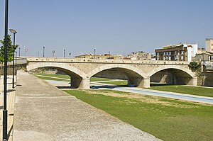
Santomera
Municipality in Region of Murcia, Spain
Distance: Approx. 37 meters
Latitude and longitude: 38.06166667,-1.04916667
Santomera is a Spanish municipality in the autonomous community of Murcia. It has a population of 16,105 (2018) and an area of 44.2 km2. It shares borders with Fortuna in the north, with Murcia in its west and south and with the province of Alicante in the east.

Hispania Carthaginensis
Roman province
Distance: Approx. 8073 meters
Latitude and longitude: 38,-1
Hispania Carthaginiensis or Carthaginensis (Latin for "Carthaginian Spain") was a province of the Roman Empire with its capital at Carthago Nova ("New Carthage", modern Cartagena). It covered the central Mediterranean coast of Spain around the city and its hinterland into central Iberia.

Guadalentín
Distance: Approx. 8050 meters
Latitude and longitude: 37.9917,-1.0728
Guadalentín is a river in Spain. It is a tributary of the Segura. The Guadalentín River flows in the southeastern region of Spain.

Sierra de Orihuela
Mountain range in Valencia, Spain
Distance: Approx. 8693 meters
Latitude and longitude: 38.10777778,-0.96888889
Sierra de Orihuela (Valencian: Serra d'Oriola) is a 9.4 km (6 mi) long mountain range in the Vega Baja del Segura (Valencian: Baix Segura) comarca, Valencian Community, Spain. Its highest point is Peña de Orihuela (634 m). This range is named after the town of Orihuela (Valencian: Oriola), located at the feet of the mountains.
Beniel
Municipality in Murcia, Spain
Distance: Approx. 4483 meters
Latitude and longitude: 38.04638889,-1.00138889
Beniel is a municipality located in the comarca of Huerta de Murcia in Murcia, Spain. It has a total population of 11,501 inhabitants (INE 2023) and an area of 10.06 km2.
Zarandona
Place in Murcia, Spain
Distance: Approx. 8187 meters
Latitude and longitude: 38,-1.1
Zarandona is a village in Murcia, Spain. It is part of the municipality of Murcia.
El Raal
Place in Murcia, Spain
Distance: Approx. 4215 meters
Latitude and longitude: 38.03333333,-1.01666667
El Raal is a village and a district in Murcia, Spain. It is part of the municipality of Murcia.
Llano de Brujas
Place in Murcia, Spain
Distance: Approx. 6478 meters
Latitude and longitude: 38.006,-1.071
Llano de Brujas is a district in Murcia, Spain. It is part of the municipality of Murcia and it is located in the northeastern quarter. This district has an area of 7.3 km2 and was inhabited by 5,830 people in 2020.

Camino de Beniel
Place in Valencian Community, Spain
Distance: Approx. 8173 meters
Latitude and longitude: 38.08014722,-0.95860278
Camino de Beniel is a village in Alicante, Spain. It is part of the municipality of Orihuela.

La Aparecida
Place in Alicante, Spain
Distance: Approx. 4108 meters
Latitude and longitude: 38.081,-1.009
La Aparecida is a village in Alicante, Spain. It is part of the municipality of Orihuela.

Christ of Monteagudo
Statue in Murcia, Spain
Distance: Approx. 6296 meters
Latitude and longitude: 38.020282,-1.097969
The Christ of Monteagudo is a colossal statue of Jesus located on top of the Castle of Monteagudo, in Murcia, Spain.
Weather in this IP's area
clear sky
8 Celsius
8 Celsius
5 Celsius
8 Celsius
1031 hPa
71 %
1031 hPa
1011 hPa
10000 meters
0.89 m/s
2.24 m/s
223 degree
