195.34.222.117 - IP Lookup: Free IP Address Lookup, Postal Code Lookup, IP Location Lookup, IP ASN, Public IP
Country:
Region:
City:
Location:
Time Zone:
Postal Code:
ISP:
ASN:
language:
User-Agent:
Proxy IP:
Blacklist:
IP information under different IP Channel
ip-api
Country
Region
City
ASN
Time Zone
ISP
Blacklist
Proxy
Latitude
Longitude
Postal
Route
db-ip
Country
Region
City
ASN
Time Zone
ISP
Blacklist
Proxy
Latitude
Longitude
Postal
Route
IPinfo
Country
Region
City
ASN
Time Zone
ISP
Blacklist
Proxy
Latitude
Longitude
Postal
Route
IP2Location
195.34.222.117Country
Region
niederosterreich
City
stratzing
Time Zone
Europe/Vienna
ISP
Language
User-Agent
Latitude
Longitude
Postal
ipdata
Country
Region
City
ASN
Time Zone
ISP
Blacklist
Proxy
Latitude
Longitude
Postal
Route
Popular places and events near this IP address
Krems District
District in Lower Austria, Austria
Distance: Approx. 2437 meters
Latitude and longitude: 48.45,15.567
Bezirk Krems is a district of the state of Lower Austria in Austria. It comprises the areas to the south, west and north of the city of Krems an der Donau, which itself is a statutory city.
Droß
Municipality in Lower Austria, Austria
Distance: Approx. 2461 meters
Latitude and longitude: 48.45,15.56666667
Droß is a municipality in the district of Krems-Land, Lower Austria, Austria.
Lengenfeld, Austria
Municipality in Lower Austria, Austria
Distance: Approx. 2226 meters
Latitude and longitude: 48.46666667,15.58333333
Lengenfeld is a town in the district of Krems-Land in the Austrian state of Lower Austria.

Senftenberg, Austria
Municipality in Lower Austria, Austria
Distance: Approx. 4132 meters
Latitude and longitude: 48.43333333,15.55
Senftenberg is a town in the district of Krems-Land in the Austrian state of Lower Austria.

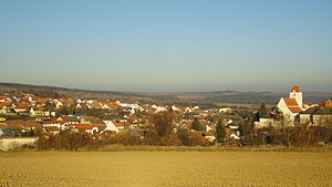
Stratzing
Municipality in Lower Austria, Austria
Distance: Approx. 0 meters
Latitude and longitude: 48.45,15.6
Stratzing is a town in the district of Krems-Land in the Austrian state of Lower Austria.
Gneixendorf
Village in Lower Austria
Distance: Approx. 1855 meters
Latitude and longitude: 48.43333333,15.6
Gneixendorf is a village near Krems in Lower Austria. It was the location of Stalag XVII-B, the setting of the Billy Wilder film Stalag 17. The stone-age pre-history, the history of Christian orders settlement and rule and their stately renaissance buildings, followed by a manorial history, particularly of the van Beethoven and von Schweitzer families between 1820 and 1935 and the World War II break with the STALAG XVII B Prisoner-of-War camp 1940-1945 are all comprehensively documented by "Chronik von Gneixendorf", published in 2009 by Verschoenerungsverein Gneixendorf.
Burgruine Senftenberg
Distance: Approx. 2526 meters
Latitude and longitude: 48.44888889,15.56583333
Burgruine Senftenberg is a castle in Lower Austria at the town Senftenberg, Austria. Burgruine Senftenberg is 271 metres (889 ft) above sea level.

Steiner Tor
Distance: Approx. 4492 meters
Latitude and longitude: 48.40972222,15.59638889
Steiner Tor is a preserved gate, originally built in the late 15th century but refashioned in the Baroque style in the city of Krems an der Donau, in the Wachau valley of Austria. It is considered the symbol of the city. Until the last third of the 19th century, the city of Krems was surrounded by a wall.

Krems-Langenlois Airport
Airport in Austria
Distance: Approx. 2537 meters
Latitude and longitude: 48.44622222,15.63388889
Krems-Langenlois Airport (German: Flugplatz Krems or Flugplatz Krems-Gneixendorf, ICAO: LOAG) is a public use airport located 5 kilometres (3 mi) north-northeast of Krems, Niederösterreich, Austria.
IMC University of Applied Sciences Krems
Distance: Approx. 4690 meters
Latitude and longitude: 48.4086,15.5882
The IMC University of Applied Sciences Krems (German: IMC Fachhochschule Krems) is a private Austrian university. Founded in 1994, IMC Krems has three campuses in Krems, Austria. IMC Krems offers 27-degree programmes, and has 3,100 students, 560 lecturers, as well as 137 partner universities in 36 countries.

Beethoven-Haus (Krems an der Donau)
Private museum in Schloßstraße , Krems an der Donau
Distance: Approx. 1930 meters
Latitude and longitude: 48.44033333,15.62169444
The Beethoven House (Beethoven-Haus) is a museum in the village of Gneixendorf near Krems an der Donau in Austria. It is a former residence of Ludwig van Beethoven and it is part of the cultural heritage of Austria. The residence currently features several rooms furnished as a private museum The museum offers tours by appointment.

Schloss Wasserhof
Building in Gneixendorf, Austria
Distance: Approx. 1917 meters
Latitude and longitude: 48.44126667,15.62236944
Schloss Wasserhof is a privately owned building in Gneixendorf, near Krems an der Donau in Lower Austria. It is known particularly as the property in the early 19th century of Nikolaus Johann van Beethoven, brother of Ludwig van Beethoven; the composer stayed here at one time.
Weather in this IP's area
overcast clouds
11 Celsius
10 Celsius
11 Celsius
13 Celsius
996 hPa
80 %
996 hPa
950 hPa
10000 meters
2.12 m/s
4.85 m/s
178 degree
100 %


