Country:
 Great Britain
Region:
City:
Latitude and Longitude:
Time Zone:
Postal Code:
IP information under different IP Channel
ip-api
Country
Region
City
ASN
Time Zone
ISP
Blacklist
Proxy
Latitude
Longitude
Postal
Route
IPinfo
Country
Region
City
ASN
Time Zone
ISP
Blacklist
Proxy
Latitude
Longitude
Postal
Route
MaxMind
Country
Region
City
ASN
Time Zone
ISP
Blacklist
Proxy
Latitude
Longitude
Postal
Route
Luminati
Country
 NL
NLASN
Time Zone
Europe/Amsterdam
ISP
ATGS-MMD-AS
Latitude
Longitude
Postal
db-ip
Country
Region
City
ASN
Time Zone
ISP
Blacklist
Proxy
Latitude
Longitude
Postal
Route
ipdata
Country
Region
City
ASN
Time Zone
ISP
Blacklist
Proxy
Latitude
Longitude
Postal
Route
Popular places and events near this IP address

Coulsdon South railway station
National Rail station in London, England
Distance: Approx. 1303 meters
Latitude and longitude: 51.3157,-0.138
Coulsdon South railway station serves Coulsdon in the London Borough of Croydon, and is in Travelcard Zone 6, on the Brighton Main Line. It is 17 miles 3 chains (27.42 km) measured from London Charing Cross. The station is served by Southern and by Thameslink.

Woodmansterne railway station
National Rail station in London, England
Distance: Approx. 1683 meters
Latitude and longitude: 51.3192,-0.1539
Woodmansterne railway station is a railway station which primarily serves the western areas of Coulsdon in the London Borough of Croydon, England. Situated on the Tattenham Corner line, it is 17 miles 40 chains (28.2 km) from London Charing Cross. For ticketing purposes the station is in London Travelcard Zone 6.
Purley High School for Boys
School in Coulsdon, Greater London, England
Distance: Approx. 1732 meters
Latitude and longitude: 51.30565,-0.12072
Purley High School for Boys existed from 1914 to 1988. Originally located in Purley from 1914, in 1936 it relocated to Placehouse Lane, Old Coulsdon, London Borough of Croydon. The school was Purley County Grammar School from 1914 to 1969, becoming Purley Grammar School for Boys and then, in 1973, Purley High School for Boys after the abolition of the Grammar School system and the implementation of the Comprehensive System.
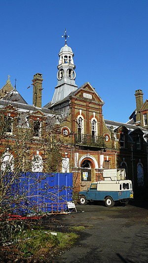
Cane Hill Hospital
Hospital in England
Distance: Approx. 899 meters
Latitude and longitude: 51.31278,-0.14906
Cane Hill Hospital was a psychiatric hospital in Coulsdon in the London Borough of Croydon. The hospital motto was "Aversos compono animos" (I bring relief to troubled minds). The hospital was built in the 1880s, but from the 1960s its use was starting to decline and it eventually closed completely in the 2000s.

Chipstead, Surrey
Human settlement in England
Distance: Approx. 1645 meters
Latitude and longitude: 51.315,-0.163
Chipstead is a predominantly commuter village in the Reigate and Banstead district, in north-east Surrey, England, that has been a small ecclesiastical parish since the Domesday Survey of 1086. Its rolling landscape meant that Chipstead's development was late and restricted compared to parishes of comparable distance from London. Formerly and formally including Hooley and Netherne-on-the-Hill, on census day, 1831 Chipstead had 66 homes.

Chipstead railway station
National Rail station in Surrey, England
Distance: Approx. 1689 meters
Latitude and longitude: 51.309,-0.169
Chipstead railway station serves the village of Chipstead in Surrey. It is a late-Victorian station on the Tattenham Corner Line and was opened in 1897. The station and all trains serving it are operated by Southern.
Coulsdon Town F.C.
Greater London football club
Distance: Approx. 865 meters
Latitude and longitude: 51.29726111,-0.14441944
Coulsdon Town Football Club was a football club based in Coulsdon, Greater London, England.

Old Coulsdon (ward)
Distance: Approx. 1507 meters
Latitude and longitude: 51.306,-0.124
Old Coulsdon is a ward in the London Borough of Croydon, covering part of the Coulsdon area of London in the United Kingdom. The ward currently forms part of Chris Philp MP's Croydon South constituency. At the 2011 Census the population of the former Coulsdon East Ward was 12,244.

Netherne-on-the-Hill
Human settlement in England
Distance: Approx. 1445 meters
Latitude and longitude: 51.292408,-0.140556
Netherne-on-the-Hill is a village in Surrey, England, occupying a plateau once home to Netherne Hospital. The village is across a narrow valley from Hooley in north of the borough of Reigate and Banstead; through the valley runs the Hooley Tunnel cutting and A23, the only road from which the village can be accessed, from two designated side roads; a few metres south of the southern T-junction, the road divides into two grades: the A23 to Redhill, 3 miles (4.8 km) south, and the M23 motorway which has a junction with the M25 motorway within Merstham's boundaries, the former village of the hilltop land. The post town, Coulsdon in Greater London is centred 1.8 miles (2.9 km) due north.

Farthing Downs
Distance: Approx. 625 meters
Latitude and longitude: 51.308,-0.138
Farthing Downs is an open space in Coulsdon in the London Borough of Croydon. Together with Eight Acres Common and New Hill to the south-east, it is owned and managed by the Corporation of London. Farthing Downs and Eight Acres Common are part of the Farthing Downs and Happy Valley Site of Special Scientific Interest.

Netherne Hospital
Hospital in England
Distance: Approx. 1445 meters
Latitude and longitude: 51.292408,-0.140556
Netherne Hospital, formerly The Surrey County Asylum at Netherne or Netherne Asylum was a psychiatric hospital in Hooley, Surrey in the United Kingdom.

Coulsdon East (ward)
Ward in the London Borough of Croydon, England
Distance: Approx. 1507 meters
Latitude and longitude: 51.306,-0.124
Coulsdon East was a ward in the London Borough of Croydon, covering part of the Coulsdon area of London in the United Kingdom. The ward formed part of Chris Philp MP's Croydon South constituency. At the 2011 Census the population of the Ward was 12,244.
Weather in this IP's area
few clouds
14 Celsius
14 Celsius
13 Celsius
15 Celsius
1004 hPa
86 %
1004 hPa
992 hPa
8000 meters
1.03 m/s
130 degree
20 %
06:25:12
19:31:30