Country:
Region:
City:
Latitude and Longitude:
Time Zone:
Postal Code:
IP information under different IP Channel
ip-api
Country
Region
City
ASN
Time Zone
ISP
Blacklist
Proxy
Latitude
Longitude
Postal
Route
IPinfo
Country
Region
City
ASN
Time Zone
ISP
Blacklist
Proxy
Latitude
Longitude
Postal
Route
MaxMind
Country
Region
City
ASN
Time Zone
ISP
Blacklist
Proxy
Latitude
Longitude
Postal
Route
Luminati
Country
ASN
Time Zone
Europe/Amsterdam
ISP
ATGS-MMD-AS
Latitude
Longitude
Postal
db-ip
Country
Region
City
ASN
Time Zone
ISP
Blacklist
Proxy
Latitude
Longitude
Postal
Route
ipdata
Country
Region
City
ASN
Time Zone
ISP
Blacklist
Proxy
Latitude
Longitude
Postal
Route
Popular places and events near this IP address

Gipping
Human settlement in England
Distance: Approx. 1221 meters
Latitude and longitude: 52.22773,1.03206
Gipping is a village and civil parish in the Mid Suffolk district of Suffolk in eastern England. Located around three miles north north-east of Stowmarket, in 2005 its population was 80. At the 2011 Census the population remained less than 100 and was included in the civil parish of Old Newton with Dagworth.

Bacton, Suffolk
Human settlement in England
Distance: Approx. 3197 meters
Latitude and longitude: 52.26,1
Bacton is a village and civil parish in Suffolk, England, about 8 kilometres (5.0 mi) north of Stowmarket. The village appeared as 'Bachetuna' in the Domesday Book and the area appears to have been settled at least since Roman times, with many interesting finds on the locally organised annual metal-detecting days. At the centre of the village is the Twelfth Century church of St Mary the Virgin, featuring a medieval wall painting.

Haughley Castle
Distance: Approx. 3807 meters
Latitude and longitude: 52.2226,0.9633
Haughley Castle was a medieval castle situated in the village of Haughley, some 4 kilometres (2.5 mi) north-west of the town of Stowmarket, Suffolk. Prominent historians such as J. Wall consider it "the most perfect earthwork of this type in the county," whilst R. Allen Brown has described it as "one of the most important" castle sites in East Anglia.
Bacton Green, Suffolk
Human settlement in England
Distance: Approx. 2977 meters
Latitude and longitude: 52.251,0.984
Bacton Green is a village in Suffolk, England.
Haughley
Village in Suffolk, England
Distance: Approx. 3567 meters
Latitude and longitude: 52.221,0.968
Haughley is a village and civil parish in the English county of Suffolk, in the Mid Suffolk District. The village is located 2 miles (3.2 km) northwest of the town of Stowmarket, overlooking the Gipping valley, next to the A14 corridor. The population recorded in 2011 was 1,638.

Haughley railway station
Disused railway station in Suffolk, England
Distance: Approx. 2358 meters
Latitude and longitude: 52.2216,0.9874
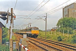
Haughley railway station was located in Haughley, Suffolk on the Great Eastern Main Line between Liverpool Street Station and Norwich. It opened on 2 July 1849 named Haughley Junction and was a replacement for a station named Haughley Road which had been in service from 1846 to 1849 at location TM 02981 63319 on the line to Elmswell. Haughley railway station also served two other lines, the line to Bury St Edmunds, Cambridge and Ely and the Mid-Suffolk Light Railway.

Cotton, Suffolk
Human settlement in England
Distance: Approx. 3369 meters
Latitude and longitude: 52.26149,1.03358
Cotton is a small village and civil parish located in the Mid Suffolk district of Suffolk in eastern England. Cotton lies a few miles to the east of the Great Eastern Main Line and to the west of the A140. Nearby villages include Mendlesham and Bacton, and the parish also includes the small hamlet of Dandy Corner.

Old Newton with Dagworth
Human settlement in England
Distance: Approx. 2228 meters
Latitude and longitude: 52.218,0.995
Old Newton with Dagworth is a civil parish in the Mid Suffolk district of Suffolk, England. The parish contains the village of Old Newton, as well as the hamlets of Brown Street, Dagworth and Ward Green. In 2005 its population was 1,050.

Old Newton
Human settlement in England
Distance: Approx. 1507 meters
Latitude and longitude: 52.22294,1.00183
Old Newton is a village in the civil parish of Old Newton with Dagworth, in the Mid Suffolk district of Suffolk, England. The village is situated around two miles north of Stowmarket, to the east of the junction of the Great Eastern Main Line and the Ipswich to Ely Line. Until the Beeching Axe it was served by Haughley railway station.
Hillcroft Preparatory School
Independent day school in Stowmarket, Suffolk, England
Distance: Approx. 3060 meters
Latitude and longitude: 52.2365,0.9719
Hillcroft Preparatory School was an independent private co-educational school, located at Walnutree Manor, Haughley Green. Established in 1911, it was the oldest co-educational preparatory day school in Suffolk. The school closed down in December 2006, after the Rapsey family (the owners) completed a deal with the nearby Finborough School which involved many staff and pupils, and much of the equipment, moving to the Finborough School site, and Walnutree Manor was sold.
Haughley Road railway station
Former railway station in England
Distance: Approx. 3189 meters
Latitude and longitude: 52.2309,0.9698
Haughley Road railway station was the original station serving Haughley, Suffolk. It closed in 1849 and was replaced by Haughley railway station which was positioned to serve both branches to the north of the newly constructed Haughley Junction. As in 2017 some or part of the station buildings still survive adjacent to Bacton Road bridge.

Gipping Great Wood
UK Site of Special Scientific Interest
Distance: Approx. 1896 meters
Latitude and longitude: 52.221,1.036
Gipping Great Wood is a 25.9-hectare (64-acre) biological Site of Special Scientific Interest south of Gipping in Suffolk. This is an ancient coppice with standards wood with a variety of woodland types. There are many hornbeams, and other trees include oak and ash.
Weather in this IP's area
mist
18 Celsius
18 Celsius
18 Celsius
19 Celsius
1005 hPa
94 %
1005 hPa
998 hPa
3000 meters
3.09 m/s
150 degree
100 %
06:19:29
19:27:55