195.28.154.190 - IP Lookup: Free IP Address Lookup, Postal Code Lookup, IP Location Lookup, IP ASN, Public IP
Country:
Region:
City:
Location:
Time Zone:
Postal Code:
ISP:
ASN:
language:
User-Agent:
Proxy IP:
Blacklist:
IP information under different IP Channel
ip-api
Country
Region
City
ASN
Time Zone
ISP
Blacklist
Proxy
Latitude
Longitude
Postal
Route
db-ip
Country
Region
City
ASN
Time Zone
ISP
Blacklist
Proxy
Latitude
Longitude
Postal
Route
IPinfo
Country
Region
City
ASN
Time Zone
ISP
Blacklist
Proxy
Latitude
Longitude
Postal
Route
IP2Location
195.28.154.190Country
Region
kosicky kraj
City
trebisov
Time Zone
Europe/Bratislava
ISP
Language
User-Agent
Latitude
Longitude
Postal
ipdata
Country
Region
City
ASN
Time Zone
ISP
Blacklist
Proxy
Latitude
Longitude
Postal
Route
Popular places and events near this IP address

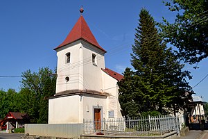
Trebišov
Municipality in Košice Region, Slovakia
Distance: Approx. 160 meters
Latitude and longitude: 48.63,21.72
Trebišov (Hungarian: Tőketerebes; German: Trebischau; Ukrainian: Требішов) is a small industrial town in the easternmost part of Slovakia, with a population of around 25,000. The town is an administrative, economic and cultural center with machine (Vagónka) and building materials industries.
Trebišov District
District in Košice Region, Slovakia
Distance: Approx. 126 meters
Latitude and longitude: 48.62972222,21.71972222
Trebišov District (Slovak: okres Trebišov, pronounced [ˈɔkres ˈtrebiʂɔw]; Hungarian: Tőketerebesi járás) is a district in the Košice Region of eastern Slovakia. Until 1918, the district was mostly part of the Hungarian county of Zemplén, apart from a small area in the south-east around Veľké Trakany which formed part of the county of Szabolcs.
Čeľovce
Village and municipality in Slovakia
Distance: Approx. 7316 meters
Latitude and longitude: 48.6,21.63
Čeľovce (Slovak pronunciation: [ˈtʂeʎɔwtse]; Hungarian: Cselej) is a village and municipality in the Trebišov District in the Košice Region of eastern Slovakia. Former Royal Hungarian town in the Kingdom of Hungary.
Egreš
Municipality of Slovakia
Distance: Approx. 7384 meters
Latitude and longitude: 48.62,21.62
Egreš (Hungarian: Szécsegres) is a village and municipality in the Trebišov District in the Košice Region of eastern Slovakia.
Hriadky
Village and municipality in Slovakia
Distance: Approx. 7948 meters
Latitude and longitude: 48.7,21.72
Hriadky (Slovak pronunciation: [ˈɦrɪɐtki]; Hungarian: Gerenda) is a village and municipality in the Trebišov District in the Košice Region of south-eastern Slovakia.

Kožuchov
Village and municipality in Slovakia
Distance: Approx. 6569 meters
Latitude and longitude: 48.57,21.73
Kožuchov (Slovak pronunciation: [ˈkɔʐuxɔw]; Hungarian: Kazsó) is a village and municipality in the Trebišov District in the Košice Region of south-eastern Slovakia.

Zemplínske Hradište
Village and municipality in Slovakia
Distance: Approx. 5465 meters
Latitude and longitude: 48.58,21.73
Zemplínske Hradište (Hungarian: Hardicsa) is a village and municipality in the Trebišov District in the Košice Region of south-eastern Slovakia.

Zemplínska Nová Ves
Village and municipality in Slovakia
Distance: Approx. 7472 meters
Latitude and longitude: 48.57,21.67
Zemplínska Nová Ves (Hungarian: Zemplénújfalu) is a village and municipality in the Trebišov District in the Košice Region of south-eastern Slovakia. The village consist of parts: the first named Úpor and the second which name is Zemplinský Klečenov.
Nový Ruskov
Municipality in Košice Region, Slovakia
Distance: Approx. 3757 meters
Latitude and longitude: 48.65,21.68
Nový Ruskov (Slovak pronunciation: [ˈnɔʋiː ˈruskɔw]; Hungarian: Újruszka) is a village and municipality in the Trebišov District in the Košice Region of south-eastern Slovakia.
Plechotice
Municipality in Košice Region, Slovakia
Distance: Approx. 6587 meters
Latitude and longitude: 48.63,21.63
Plechotice (Hungarian: Pelejte) is a village and municipality in the Trebišov District in the Košice Region of south-eastern Slovakia.
Nižný Žipov
Village and municipality in Slovakia
Distance: Approx. 7446 meters
Latitude and longitude: 48.58,21.65
Nižný Žipov (Hungarian: Magyarizsép) is a village and municipality in the Trebišov District in the Košice Region of south-eastern Slovakia.
Vojčice
Municipality in Košice Region, Slovakia
Distance: Approx. 5722 meters
Latitude and longitude: 48.68,21.72
Vojčice (Slovak pronunciation: [ˈʋɔjtʂitse]; Hungarian: Vécse) is a village and municipality in the Trebišov District in the Košice Region of south-eastern Slovakia.
Weather in this IP's area
broken clouds
-2 Celsius
-2 Celsius
-2 Celsius
-2 Celsius
1037 hPa
96 %
1037 hPa
1015 hPa
10000 meters
0.69 m/s
0.59 m/s
287 degree
70 %

