195.28.147.211 - IP Lookup: Free IP Address Lookup, Postal Code Lookup, IP Location Lookup, IP ASN, Public IP
Country:
Region:
City:
Location:
Time Zone:
Postal Code:
IP information under different IP Channel
ip-api
Country
Region
City
ASN
Time Zone
ISP
Blacklist
Proxy
Latitude
Longitude
Postal
Route
Luminati
Country
Region
ni
City
dvorynadzitavou
ASN
Time Zone
Europe/Bratislava
ISP
Slovanet a.s.
Latitude
Longitude
Postal
IPinfo
Country
Region
City
ASN
Time Zone
ISP
Blacklist
Proxy
Latitude
Longitude
Postal
Route
IP2Location
195.28.147.211Country
Region
nitriansky kraj
City
sala
Time Zone
Europe/Bratislava
ISP
Language
User-Agent
Latitude
Longitude
Postal
db-ip
Country
Region
City
ASN
Time Zone
ISP
Blacklist
Proxy
Latitude
Longitude
Postal
Route
ipdata
Country
Region
City
ASN
Time Zone
ISP
Blacklist
Proxy
Latitude
Longitude
Postal
Route
Popular places and events near this IP address

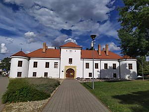
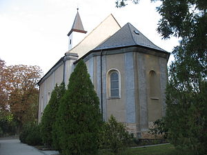
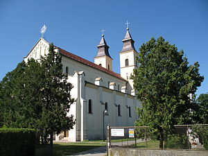
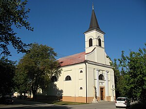
Šaľa
Municipality in Nitra Region, Slovakia
Distance: Approx. 151 meters
Latitude and longitude: 48.15,17.88
Šaľa (Slovak: [ˈʃaʎa], locally [ˈʃala] ; Hungarian: Vágsellye, German: Schelle) is a town in Šaľa District within Nitra Region in south-western Slovakia.

Šaľa District
District in Nitra Region, Slovakia
Distance: Approx. 354 meters
Latitude and longitude: 48.15138889,17.87583333
Šaľa District (Slovak: okres Šaľa; Hungarian: Vágsellyei járás) is a district in the Nitra Region of western Slovakia. Until 1918, the district formed mostly part of the county of Kingdom of Hungary of Nyitra, apart from a small area in the west around Diakovce, Tešedíkovo and Žihárec which formed part of the county of Pressburg.
Diakovce
Municipality in Nitra Region, Slovakia
Distance: Approx. 3836 meters
Latitude and longitude: 48.13,17.84
Diakovce is an old village and municipality in Šaľa District, in the Nitra Region of southwest Slovakia.
Šaľa Stadium
Distance: Approx. 1480 meters
Latitude and longitude: 48.16459722,17.88095278
The Šaľa Stadion is a multi-purpose stadium in Šaľa, Slovakia. Currently, it is mostly used for football matches and is the home ground of FK Slovan Duslo Šaľa. The stadium holds 1,126 people.
Dlhá nad Váhom
Municipality in Nitra Region, Slovakia
Distance: Approx. 2583 meters
Latitude and longitude: 48.17,17.86
Dlhá nad Váhom (Hungarian: Vághosszúfalu) is a village and municipality in Šaľa District, in the Nitra Region of southwest Slovakia.
Kráľová nad Váhom
Municipality in Nitra Region, Slovakia
Distance: Approx. 3664 meters
Latitude and longitude: 48.17,17.84
Kráľová nad Váhom (Hungarian: Vágkirályfa) is a village and municipality in Šaľa District, in the Nitra Region of southwest Slovakia.

Tešedíkovo
Municipality in Nitra Region, Slovakia
Distance: Approx. 5129 meters
Latitude and longitude: 48.11,17.85
Tešedíkovo (Hungarian: Pered) is a village and municipality in Šaľa District, in the Nitra Region of south-west Slovakia.

Trnovec nad Váhom
Municipality in Nitra Region, Slovakia
Distance: Approx. 3672 meters
Latitude and longitude: 48.15,17.93
Trnovec nad Váhom (Hungarian: Tornóc) is a village and municipality in Šaľa District, in the Nitra Region of south-west Slovakia.
Kajal (village)
Village in Slovakia
Distance: Approx. 7853 meters
Latitude and longitude: 48.18444444,17.78722222
Kajal (Hungarian: Nemeskajal, until 1899 Kajal) is a village and municipality in Galanta District of the Trnava Region of south-west Slovakia.
Topoľnica
Village in Slovakia
Distance: Approx. 6698 meters
Latitude and longitude: 48.17083333,17.79527778
Topoľnica (Hungarian: Tósnyárasd) is a village and municipality in Galanta District of the Trnava Region of south-west Slovakia.

Battle of Pered
1849 battle in the Hungarian War of Independence
Distance: Approx. 6129 meters
Latitude and longitude: 48.10111111,17.84669444
The Battle of Pered, fought on 20–21 June 1849, was one of the battles which took place in the Summer Campaign of the Hungarian War of Independence from 1848 to 1849, fought between the Hungarian Revolutionary Army and the Habsburg Empire helped by Russian troops. The Hungarian army was led by General Artúr Görgei, while the imperial army by Lieutenant field marshal Julius Jacob von Haynau. After several preliminary minor battles of the Hungarian and Austrian troops along the Vág river, in which the attacking Hungarians could not achieve success, Görgei took the command of his troops, and after receiving reinforcements, on 20 June, put his troops to attack again towards West.
Battle of Zsigárd
Battle of the Hungarian War of Independence
Distance: Approx. 8347 meters
Latitude and longitude: 48.07633333,17.88313889
The Battle of Zsigárd, fought on 16 June 1849, was one of the battles which took place in the Summer Campaign of the Hungarian War of Independence from 1848 to 1849, fought between the Hungarian Revolutionary Army and the Habsburg Empire. On 16. June 1849 the Hungarian II. corps under the leadership of Colonel Lajos Asbóth occupied Zsigárd, Királyrév and Negyed, but in the end, the counterattack of the Austrian Theissing and Pott brigades under the leadership of Major General Anton Freiherr von Herzinger forced it to retreat on its starting position.
Weather in this IP's area
overcast clouds
-1 Celsius
-6 Celsius
-3 Celsius
-1 Celsius
1020 hPa
75 %
1020 hPa
1005 hPa
10000 meters
3.7 m/s
8.8 m/s
135 degree
98 %


