195.28.146.170 - IP Lookup: Free IP Address Lookup, Postal Code Lookup, IP Location Lookup, IP ASN, Public IP
Country:
Region:
City:
Location:
Time Zone:
Postal Code:
ISP:
ASN:
language:
User-Agent:
Proxy IP:
Blacklist:
IP information under different IP Channel
ip-api
Country
Region
City
ASN
Time Zone
ISP
Blacklist
Proxy
Latitude
Longitude
Postal
Route
db-ip
Country
Region
City
ASN
Time Zone
ISP
Blacklist
Proxy
Latitude
Longitude
Postal
Route
IPinfo
Country
Region
City
ASN
Time Zone
ISP
Blacklist
Proxy
Latitude
Longitude
Postal
Route
IP2Location
195.28.146.170Country
Region
nitriansky kraj
City
nove zamky
Time Zone
Europe/Bratislava
ISP
Language
User-Agent
Latitude
Longitude
Postal
ipdata
Country
Region
City
ASN
Time Zone
ISP
Blacklist
Proxy
Latitude
Longitude
Postal
Route
Popular places and events near this IP address

Nové Zámky
Town in Slovakia
Distance: Approx. 308 meters
Latitude and longitude: 47.98555556,18.15777778
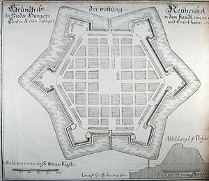
Nové Zámky (; Hungarian: Érsekújvár, German: Neuhäusel, Turkish: Uyvar, Latin: Novum Castrum) is a town in Nové Zámky District in the Nitra Region of southwestern Slovakia.

Danubian Lowland
Distance: Approx. 423 meters
Latitude and longitude: 47.98333333,18.16666667
The Serbian lowland is treated under Danubian Plain (Serbia) The Danubian Lowland or Danube Lowland (Slovak: Podunajská nížina) is the name of the part of Little Alföld (Slovak: Malá dunajská kotlina) situated in Slovakia, located between the Danube, the Little Carpathians and all other parts of the Western Carpathians. In terms of geomorphology, it forms one unit together with the Neusiedl Basin (Neusiedler Becken) in Austria and the Győr Basin (Győri-medence) in Hungary. It is an extensive tectonic depression filled with layers of Neogene Quaternary to a height of between 100 and 350 meters.

Nové Zámky District
District in Nitra Region, Slovakia
Distance: Approx. 187 meters
Latitude and longitude: 47.98611111,18.16416667
Nové Zámky District (okres Nové Zámky) is a district in the Nitra Region of western Slovakia. Until 1918, the area of the district was split between several counties of the Kingdom of Hungary: the largest area in the north formed part of Nitra; an area in the south between Dvory nad Žitavou and Strekov formed part of Komárno; an area in the north-east around Veľké Lovce formed part of Tekov; a sizable area in the east formed part of Esztergom (Ostrihom); and a small area around Salka formed part of Hont County.
Andovce
Municipality in Slovakia
Distance: Approx. 4249 meters
Latitude and longitude: 47.99416667,18.10638889
Andovce (Hungarian: Andód) is a municipality and village in the Nové Zámky District of the south-west of Slovakia, in the Nitra Region.
Dvory nad Žitavou
Village in Slovakia
Distance: Approx. 7674 meters
Latitude and longitude: 47.99361111,18.26416667
Dvory nad Žitavou (Hungarian: Udvard) is a municipality and village in the Nové Zámky District in the Nitra Region of south-west Slovakia.
Nesvady
Municipality in Slovakia
Distance: Approx. 6913 meters
Latitude and longitude: 47.93,18.12
Nesvady (Hungarian: Naszvad, Hungarian pronunciation:[ˈnɒsvɒd]) is a town and municipality in the Komárno District in the Nitra Region of south-west Slovakia.
Nové Zámky Roman Catholic Church
Church in Nové Zámky, Slovakia
Distance: Approx. 220 meters
Latitude and longitude: 47.98577,18.1648
The Roman Catholic Church of Nové Zámky (Slovak: Rimskokatolicky kostol NoveZamky) dominates the main square of the town, which is in south-west Slovakia. A church at the site was built originally in 1584–1585. This was a simple late-Gothic building, and was later rebuilt several times.
Stadium in Nové Zámky
Ice rink in Nové Zámky, Slovakia
Distance: Approx. 1555 meters
Latitude and longitude: 47.98928056,18.18195
Stadium in Nové Zámky is an ice rink in Nové Zámky, Slovakia. The winter stadium lures not only home visitors and sports teams, but also foreign clubs. It is not odd, if the ice ring is available also during the summer.

Anton Bernolák's Chapel
Chapel in Nové Zámky, Slovakia
Distance: Approx. 407 meters
Latitude and longitude: 47.98761944,18.15755833
Saint Trinity Chapel, popularly called Anton Dif Bernolák's Chapel, in Nové Zámky, Slovakia, was built in 1722 in the Baroque style. This chapel is located in a former stone cemetery of the town which was liquidated in 1872. Jakub Škultéty had it built to the God's fame.

Uyvar Eyalet
Administrative division of the Ottoman Empire from 1663 to 1685
Distance: Approx. 916 meters
Latitude and longitude: 47.98333333,18.15
Uyvar Eyalet (Ottoman Turkish: ایالت اویوار; Eyālet-i Uyvar) was an eyalet of the Ottoman Empire. It was established during the reign of Mehmed IV. In 1663 the Ottoman expeditionary force, led by Köprülü Fazıl Ahmed, defeated the Habsburg Monarchy's garrison of the city of Uyvar (today known as Nové Zámky, Slovakia) and conquered the region. In 1664, they lost the northern part along with the fortresses Hlohovec, Nitra and Levice.

Siege of Érsekújvár (1663)
A battle that occurred during the Austro-Turkish War (1663-1664)
Distance: Approx. 423 meters
Latitude and longitude: 47.98333333,18.16666667
The siege of Érsekújvár (siege of Uyvar) also known as the siege of Neuhäusel occurred in 1663 when Grand Vizier Fazil Ahmed Pasha leading the Ottomans invaded Habsburg Hungary and captured the Hungarian fortress at Érsekújvár (Hungarian: Érsekújvár, German: Neuhäus[e]l, Latin: Novum Castrum, Turkish: Uyvar, modern Nové Zámky in southern Slovakia).
Ernest Zmeták Art Gallery
Distance: Approx. 192 meters
Latitude and longitude: 47.984548,18.16414
The Ernest Zmeták Art Gallery (Slovak: Galéria umenia Ernesta Zmetáka, Hungarian: Ernest Zmeták Művészeti Galéria) is an art museum in Nové Zámky, Slovakia. The museum was established on 1 January 1979 by a local painter, Ernest Zmeták, who was the most significant collector of artworks in Slovakia in the 2nd half of the 20th century, and his wife, art historian Danica Zmetákova. At first it was housed temporarily on the second floor of the City Hall where the first permanent exhibition was opened on November 21, 1980.
Weather in this IP's area
clear sky
0 Celsius
0 Celsius
0 Celsius
0 Celsius
1041 hPa
88 %
1041 hPa
1026 hPa
10000 meters
1.31 m/s
1.35 m/s
189 degree
9 %


