195.28.145.123 - IP Lookup: Free IP Address Lookup, Postal Code Lookup, IP Location Lookup, IP ASN, Public IP
Country:
Region:
City:
Location:
Time Zone:
Postal Code:
ISP:
ASN:
language:
User-Agent:
Proxy IP:
Blacklist:
IP information under different IP Channel
ip-api
Country
Region
City
ASN
Time Zone
ISP
Blacklist
Proxy
Latitude
Longitude
Postal
Route
db-ip
Country
Region
City
ASN
Time Zone
ISP
Blacklist
Proxy
Latitude
Longitude
Postal
Route
IPinfo
Country
Region
City
ASN
Time Zone
ISP
Blacklist
Proxy
Latitude
Longitude
Postal
Route
IP2Location
195.28.145.123Country
Region
kosicky kraj
City
secovce
Time Zone
Europe/Bratislava
ISP
Language
User-Agent
Latitude
Longitude
Postal
ipdata
Country
Region
City
ASN
Time Zone
ISP
Blacklist
Proxy
Latitude
Longitude
Postal
Route
Popular places and events near this IP address
Dvorianky
Village and municipality in Slovakia
Distance: Approx. 5424 meters
Latitude and longitude: 48.73,21.72
Dvorianky (Hungarian: Szécsudvar) is a village and municipality in the Trebišov District in the Košice Region of eastern Slovakia.
Hriadky
Village and municipality in Slovakia
Distance: Approx. 4335 meters
Latitude and longitude: 48.7,21.72
Hriadky (Slovak pronunciation: [ˈɦrɪɐtki]; Hungarian: Gerenda) is a village and municipality in the Trebišov District in the Košice Region of south-eastern Slovakia.

Malé Ozorovce
Village and municipality in Slovakia
Distance: Approx. 3793 meters
Latitude and longitude: 48.68,21.62
Malé Ozorovce (Hungarian: Kisazar) is a village and municipality in the Trebišov District in the Košice Region of south-eastern Slovakia.
Višňov
Village and municipality in Slovakia
Distance: Approx. 5528 meters
Latitude and longitude: 48.75,21.67
Višňov (Slovak pronunciation: [ˈʋiʂɲɔw]; Hungarian: Visnyó) is a village and municipality in the Trebišov District in the Košice Region of south-eastern Slovakia.
Trnávka, Trebišov District
Municipality in Košice Region, Slovakia
Distance: Approx. 3185 meters
Latitude and longitude: 48.71,21.62
Trnávka (Slovak pronunciation: [ˈtr̩naːwka]; Hungarian: Tarnóka) is a village and municipality located in the Trebišov District of the Košice Region of Slovakia.
Nový Ruskov
Municipality in Košice Region, Slovakia
Distance: Approx. 5814 meters
Latitude and longitude: 48.65,21.68
Nový Ruskov (Slovak pronunciation: [ˈnɔʋiː ˈruskɔw]; Hungarian: Újruszka) is a village and municipality in the Trebišov District in the Košice Region of south-eastern Slovakia.
Veľké Ozorovce
Village and municipality in Slovakia
Distance: Approx. 4556 meters
Latitude and longitude: 48.67,21.62
Veľké Ozorovce (Slovak pronunciation: [ˈʋeʎkeː ˈɔzɔrɔwtse]; Hungarian: Nagyazar) is a village and municipality in the Trebišov District in the Košice Region of south-eastern Slovakia.

Zbehňov
Village and municipality in Slovakia
Distance: Approx. 3240 meters
Latitude and longitude: 48.68,21.63
Zbehňov (Hungarian: Zebegnyő) is a village and municipality in the Trebišov District in the Košice Region of south-eastern Slovakia.
Vojčice
Municipality in Košice Region, Slovakia
Distance: Approx. 4910 meters
Latitude and longitude: 48.68,21.72
Vojčice (Slovak pronunciation: [ˈʋɔjtʂitse]; Hungarian: Vécse) is a village and municipality in the Trebišov District in the Košice Region of south-eastern Slovakia.

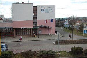
Sečovce
Municipality in Košice Region, Slovakia
Distance: Approx. 107 meters
Latitude and longitude: 48.7,21.66
Sečovce (Slovak pronunciation: [ˈsetʂɔwtse]; Hungarian: Gálszécs; Ukrainian: Сечівці) is a town in the Trebišov District in the Košice Region of south-eastern Slovakia.

Kravany, Trebišov District
Municipality in Košice Region, Slovakia
Distance: Approx. 6779 meters
Latitude and longitude: 48.76,21.64
Kravany (Hungarian: Kereplye) is a village and municipality in the Trebišov District in the Košice Region of eastern Slovakia.
Albínovská hora
Distance: Approx. 1851 meters
Latitude and longitude: 48.71527778,21.64888889
Albínovská hora, sometimes also Albínovská hôrka (translated to English as Albinov Hill or Albinov Mountain, in local dialect Baňa—Mine from Hungarian Bánya) is a hill located on the west part of Sub-Slanec Hills, division of Eastern Slovak Hills, in eastern Slovakia. The hill is high 177 metres (581 ft) and it is located in the administrative area of Sečovce, 1.7 kilometres (1 mi) north of the residential area. Remains of Tertiary volcanic activity in the area (see Slanské Hills) is andesite and characteristic tuff, covered under layers by Neogene sedimentary rocks – gravel, sand, kaolin etc.
Weather in this IP's area
overcast clouds
-1 Celsius
-1 Celsius
-1 Celsius
-1 Celsius
1041 hPa
98 %
1041 hPa
1011 hPa
8928 meters
1.18 m/s
1.98 m/s
159 degree
100 %


