195.28.144.175 - IP Lookup: Free IP Address Lookup, Postal Code Lookup, IP Location Lookup, IP ASN, Public IP
Country:
Region:
City:
Location:
Time Zone:
Postal Code:
ISP:
ASN:
language:
User-Agent:
Proxy IP:
Blacklist:
IP information under different IP Channel
ip-api
Country
Region
City
ASN
Time Zone
ISP
Blacklist
Proxy
Latitude
Longitude
Postal
Route
db-ip
Country
Region
City
ASN
Time Zone
ISP
Blacklist
Proxy
Latitude
Longitude
Postal
Route
IPinfo
Country
Region
City
ASN
Time Zone
ISP
Blacklist
Proxy
Latitude
Longitude
Postal
Route
IP2Location
195.28.144.175Country
Region
banskobystricky kraj
City
krupina
Time Zone
Europe/Bratislava
ISP
Language
User-Agent
Latitude
Longitude
Postal
ipdata
Country
Region
City
ASN
Time Zone
ISP
Blacklist
Proxy
Latitude
Longitude
Postal
Route
Popular places and events near this IP address

Krupina District
District in Banská Bystrica Region, Slovakia
Distance: Approx. 215 meters
Latitude and longitude: 48.35416667,19.06694444
Krupina District (okres Krupina) is a district in the Banská Bystrica Region of central Slovakia. Until 1918, the district was in the county of Kingdom of Hungary Hont County.
Bzovík
Municipality in Banská Bystrica Region, Slovakia
Distance: Approx. 4363 meters
Latitude and longitude: 48.32,19.09
Bzovík (Hungarian: Bozók) is a village and municipality in the Krupina District of the Banská Bystrica Region of Slovakia.
Čekovce
Municipality in Banská Bystrica Region, Slovakia
Distance: Approx. 4868 meters
Latitude and longitude: 48.35,19.13
Čekovce (Hungarian: Csákóc) is a village and municipality in the Krupina District of the Banská Bystrica Region of Slovakia.
Devičie
Municipality in Banská Bystrica Region, Slovakia
Distance: Approx. 4703 meters
Latitude and longitude: 48.32,19.03
Devičie (Hungarian: Devicse) is a village and municipality in the Krupina District of the Banská Bystrica Region of Slovakia. Starostom je Roman Lenhard.
Dolné Mladonice
Municipality in Banská Bystrica Region, Slovakia
Distance: Approx. 5598 meters
Latitude and longitude: 48.33,19.13
Dolné Mladonice (Hungarian: Alsólegénd) is a village and municipality in the Krupina District of the Banská Bystrica Region of Slovakia.
Horné Mladonice
Municipality in Banská Bystrica Region, Slovakia
Distance: Approx. 6339 meters
Latitude and longitude: 48.35,19.15
Horné Mladonice (Hungarian: Felsőlegénd) is a village and municipality in the Krupina District of the Banská Bystrica Region of Slovakia.
Jalšovík
Municipality in Banská Bystrica Region, Slovakia
Distance: Approx. 6503 meters
Latitude and longitude: 48.31,19.12
Jalšovík (Hungarian: Bozókalsók) is a village and municipality in the Krupina District of the Banská Bystrica Region of Slovakia.
Kráľovce-Krnišov
Municipality in Banská Bystrica Region, Slovakia
Distance: Approx. 6295 meters
Latitude and longitude: 48.35,18.98
Kráľovce-Krnišov (Hungarian: Hontkirályfalva) is a village and municipality in the Krupina District of the Banská Bystrica Region of Slovakia.
Zemiansky Vrbovok
Municipality in Banská Bystrica Region, Slovakia
Distance: Approx. 6916 meters
Latitude and longitude: 48.33,19.15
Zemiansky Vrbovok (Hungarian: Nemesvarbók) is a village and municipality in the Krupina District of the Banská Bystrica Region of Slovakia. In the 17th century it was the property of the Cseszneky family and according to some sources Erzsébet Cseszneky, benefactress of the Lutheran Church and mother of Mátyás Bél also was born in the village.
Uňatín
Municipality in Banská Bystrica Region, Slovakia
Distance: Approx. 6180 meters
Latitude and longitude: 48.3,19.07
Uňatín (Hungarian: Unyad) is a village and municipality in the Krupina District of the Banská Bystrica Region of Slovakia.
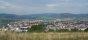
Krupina
Town in Banská Bystrica Region, Slovakia
Distance: Approx. 247 meters
Latitude and longitude: 48.35361111,19.06666667
Krupina (German: Karpfen, Hungarian: Korpona) is a town in southern central Slovakia. It is part of the Banská Bystrica Region and has approximately 8,000 inhabitants.
Mäsiarsky bok
Distance: Approx. 5449 meters
Latitude and longitude: 48.4011,19.0911
Mäsiarsky bok is a nature reserve in the Slovak municipality of Krupina. It covers an area of 127.81 ha and has a protection level of 5 on national level. The national nature reserve is located at between 350 and 545 m above sea level on the eastern side of the road connecting Krupina and Babiná.
Weather in this IP's area
few clouds
-2 Celsius
-2 Celsius
-2 Celsius
-2 Celsius
1038 hPa
96 %
1038 hPa
988 hPa
10000 meters
0.7 m/s
0.68 m/s
337 degree
23 %


