Country:
 Poland
Region:
City:
Latitude and Longitude:
Time Zone:
Postal Code:
IP information under different IP Channel
ip-api
Country
Region
City
ASN
Time Zone
ISP
Blacklist
Proxy
Latitude
Longitude
Postal
Route
IPinfo
Country
Region
City
ASN
Time Zone
ISP
Blacklist
Proxy
Latitude
Longitude
Postal
Route
MaxMind
Country
Region
City
ASN
Time Zone
ISP
Blacklist
Proxy
Latitude
Longitude
Postal
Route
Luminati
Country
PLASN
Time Zone
Europe/Warsaw
ISP
Netlink Sp. z o o
Latitude
Longitude
Postal
db-ip
Country
Region
City
ASN
Time Zone
ISP
Blacklist
Proxy
Latitude
Longitude
Postal
Route
ipdata
Country
Region
City
ASN
Time Zone
ISP
Blacklist
Proxy
Latitude
Longitude
Postal
Route
Popular places and events near this IP address

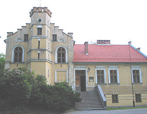
Skawina
Place in Lesser Poland Voivodeship, Poland
Distance: Approx. 973 meters
Latitude and longitude: 49.98333333,19.83333333
Skawina [skaˈvʲina] is a town in southern Poland with 27,328 inhabitants (2008). Situated in the Lesser Poland Voivodeship (since 1999), previously in Kraków Voivodeship (1975–1998). The town is located on the Skawinka river, in close proximity to the city of Kraków.
Gmina Skawina
Gmina in Lesser Poland Voivodeship, Poland
Distance: Approx. 973 meters
Latitude and longitude: 49.98333333,19.83333333
Gmina Skawina is an urban-rural gmina (administrative district) in Kraków County, Lesser Poland Voivodeship, in southern Poland. Its seat is the town of Skawina, which lies approximately 12 kilometres (7 mi) south-west of the regional capital Kraków. The gmina covers an area of 100.15 square kilometres (38.7 sq mi), and as of 2006 its total population is 41,445 (out of which the population of Skawina amounts to 23,691, and the population of the rural part of the gmina is 17,754).
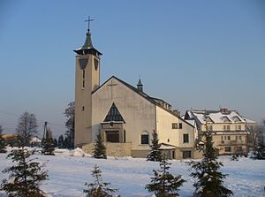
Brzyczyna
Village in Lesser Poland Voivodeship, Poland
Distance: Approx. 3724 meters
Latitude and longitude: 49.96666667,19.88333333
Brzyczyna [bʐɨˈt͡ʂɨna] is a village in the administrative district of Gmina Mogilany, within Kraków County, Lesser Poland Voivodeship, in southern Poland. It lies approximately 12 km (7 mi) south of the regional capital Kraków.
Buków, Lesser Poland Voivodeship
Village in Lesser Poland Voivodeship, Poland
Distance: Approx. 3003 meters
Latitude and longitude: 49.95,19.85
Buków [ˈbukuf] is a village in the administrative district of Gmina Mogilany, within Kraków County, Lesser Poland Voivodeship, in southern Poland. It lies approximately 4 kilometres (2 mi) north-west of Mogilany and 14 km (9 mi) south-west of the regional capital Kraków.

Chorowice
Village in Lesser Poland Voivodeship, Poland
Distance: Approx. 2581 meters
Latitude and longitude: 49.96666667,19.86666667
Chorowice [xɔrɔˈvit͡sɛ] is a village in the administrative district of Gmina Mogilany, within Kraków County, Lesser Poland Voivodeship, in southern Poland. It lies approximately 12 km (7 mi) south-west of the regional capital Kraków.
Kulerzów
Village in Lesser Poland Voivodeship, Poland
Distance: Approx. 3658 meters
Latitude and longitude: 49.95,19.86666667
Kulerzów [kuˈlɛʐuf] is a village in the administrative district of Gmina Mogilany, within Kraków County, Lesser Poland Voivodeship, in southern Poland. It lies approximately 3 kilometres (2 mi) north-west of Mogilany and 14 km (9 mi) south-west of the regional capital Kraków.

Libertów
Village in Lesser Poland Voivodeship, Poland
Distance: Approx. 3724 meters
Latitude and longitude: 49.96666667,19.88333333
Libertów [liˈbɛrtuf] is a village in the administrative district of Gmina Mogilany, within Kraków County, Lesser Poland Voivodeship, in southern Poland. It lies approximately 12 km (7 mi) south of the regional capital Kraków.

Borek Szlachecki
Village in Lesser Poland Voivodeship, Poland
Distance: Approx. 3650 meters
Latitude and longitude: 49.96666667,19.78333333
Borek Szlachecki (Polish pronunciation: [ˈbɔrɛk ʂlaˈxɛtskʲi]) is a village in the administrative district of Gmina Skawina, within Kraków County, Lesser Poland Voivodeship, in southern Poland. It lies approximately 5 kilometres (3 mi) south-west of Skawina and 16 km (10 mi) south-west of the regional capital Kraków.

Kopanka, Lesser Poland Voivodeship
Village in Lesser Poland Voivodeship, Poland
Distance: Approx. 3082 meters
Latitude and longitude: 49.98333333,19.79194444
Kopanka [kɔˈpanka] is a village in the administrative district of Gmina Skawina, within Kraków County, Lesser Poland Voivodeship, in southern Poland. It lies approximately 4 kilometres (2 mi) west of Skawina and 15 km (9 mi) south-west of the regional capital Kraków.
Rzozów
Village in Lesser Poland Voivodeship, Poland
Distance: Approx. 3434 meters
Latitude and longitude: 49.95333333,19.79805556
Rzozów [ˈʐɔzuf] is a village in the administrative district of Gmina Skawina, within Kraków County, Lesser Poland Voivodeship, in southern Poland. It lies approximately 5 kilometres (3 mi) south-west of Skawina and 16 km (10 mi) south-west of the regional capital Kraków.

Jurczyce, Lesser Poland Voivodeship
Village in Lesser Poland Voivodeship, Poland
Distance: Approx. 2972 meters
Latitude and longitude: 49.95,19.81666667
Jurczyce [jurˈt͡ʂɨt͡sɛ] is a village in the administrative district of Gmina Skawina, within Kraków County, Lesser Poland Voivodeship, in southern Poland. It lies approximately 4 km (2.5 mi) south of Skawina and 16 km (10 mi) south-west of the regional capital Kraków. It is the birthplace of Polish Army general Józef Haller.
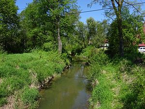
Skawinka
River in Poland
Distance: Approx. 3478 meters
Latitude and longitude: 49.99444444,19.79527778
The Skawinka is a river in the Lesser Poland Voivodeship of Poland, and a right tributary of the Vistula River. The Skawinka is 34 kilometres (21 mi) long and has a drainage basin of 365 square kilometres (141 sq mi). Its average discharge is 2.90 cubic metres per second (102 cu ft/s) (9.6 kilometres (6.0 mi) from the mouth).
Weather in this IP's area
light rain
15 Celsius
15 Celsius
14 Celsius
17 Celsius
1003 hPa
73 %
1003 hPa
976 hPa
10000 meters
1.11 m/s
1.9 m/s
264 degree
100 %
06:53:12
18:02:13