195.206.247.42 - IP Lookup: Free IP Address Lookup, Postal Code Lookup, IP Location Lookup, IP ASN, Public IP
Country:
Region:
City:
Location:
Time Zone:
Postal Code:
IP information under different IP Channel
ip-api
Country
Region
City
ASN
Time Zone
ISP
Blacklist
Proxy
Latitude
Longitude
Postal
Route
Luminati
Country
ASN
Time Zone
Europe/Rome
ISP
Ehinet Srl
Latitude
Longitude
Postal
IPinfo
Country
Region
City
ASN
Time Zone
ISP
Blacklist
Proxy
Latitude
Longitude
Postal
Route
IP2Location
195.206.247.42Country
Region
piemonte
City
predosa
Time Zone
Europe/Rome
ISP
Language
User-Agent
Latitude
Longitude
Postal
db-ip
Country
Region
City
ASN
Time Zone
ISP
Blacklist
Proxy
Latitude
Longitude
Postal
Route
ipdata
Country
Region
City
ASN
Time Zone
ISP
Blacklist
Proxy
Latitude
Longitude
Postal
Route
Popular places and events near this IP address

Rocca Grimalda
Comune in Piedmont, Italy
Distance: Approx. 8796 meters
Latitude and longitude: 44.6725,8.64944444
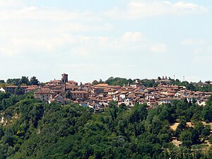
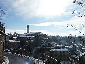
Rocca Grimalda (Ra Roca in dialect) is a village and comune in the province of Alessandria, Piedmont, Northern Italy. It lies in Upper Montferrat, a historical region of Piedmont, and it was built upon a rocky hill on the Orba's left bank, very close to Ovada. The nearest airport is the Cristoforo Colombo Airport in Genoa.

Basaluzzo
Comune in Piedmont, Italy
Distance: Approx. 3529 meters
Latitude and longitude: 44.75,8.7
Basaluzzo is a comune (municipality) in the Province of Alessandria in the Italian region Piedmont, located about 90 kilometres (56 mi) southeast of Turin and about 20 kilometres (12 mi) southeast of Alessandria. Basaluzzo borders the following municipalities: Bosco Marengo, Capriata d'Orba, Francavilla Bisio, Fresonara, Novi Ligure, Pasturana, and Predosa.

Capriata d'Orba
Comune in Piedmont, Italy
Distance: Approx. 4453 meters
Latitude and longitude: 44.71666667,8.68333333
Capriata d'Orba is a comune (municipality) in the Province of Alessandria in the Italian region Piedmont, located about 90 kilometres (56 mi) southeast of Turin and about 25 kilometres (16 mi) south of Alessandria. As of 31 December 2004, it had a population of 1,862 and an area of 28.3 square kilometres (10.9 sq mi). Capriata d'Orba borders the following municipalities: Basaluzzo, Castelletto d'Orba, Francavilla Bisio, Predosa, Rocca Grimalda, San Cristoforo, and Silvano d'Orba.
Carpeneto
Comune in Piedmont, Italy
Distance: Approx. 8753 meters
Latitude and longitude: 44.68333333,8.6
Carpeneto is a comune (municipality) in the Province of Alessandria in the Italian region of Piedmont. It is located about 80 kilometres (50 mi) southeast of Turin, and about 25 kilometres (16 mi) south of Alessandria. Carpeneto borders the following municipalities: Montaldo Bormida, Predosa, Rocca Grimalda, Sezzadio, and Trisobbio.

Castelletto d'Orba
Comune in Piedmont, Italy
Distance: Approx. 8358 meters
Latitude and longitude: 44.68333333,8.7
Castelletto d'Orba is a comune (municipality) in the Province of Alessandria in the Italian region Piedmont, located about 90 kilometres (56 mi) southeast of Turin and about 25 kilometres (16 mi) south of Alessandria. Castelletto d'Orba borders the following municipalities: Capriata d'Orba, Lerma, Montaldeo, San Cristoforo, and Silvano d'Orba.

Fresonara
Comune in Piedmont, Italy
Distance: Approx. 2786 meters
Latitude and longitude: 44.76666667,8.68333333
Fresonara (Piedmontese: Fërsnèira) is a comune (municipality) in the province of Alessandria in the Italian region Piedmont, located about 80 kilometres (50 mi) southeast of Turin and about 15 kilometres (9 mi) southeast of Alessandria. Fresonara borders the following municipalities: Basaluzzo, Bosco Marengo, and Predosa. In 1404 it was destroyed by Facino Cane.

Frugarolo
Comune in Piedmont, Italy
Distance: Approx. 9384 meters
Latitude and longitude: 44.83333333,8.68333333
Frugarolo is a comune (municipality) in the Province of Alessandria in the Italian region Piedmont, located about 80 kilometres (50 mi) southeast of Turin and about 11 kilometres (7 mi) southeast of Alessandria. Frugarolo borders the following municipalities: Alessandria, Bosco Marengo, Casal Cermelli, and Castellazzo Bormida.
Pasturana
Comune in Piedmont, Italy
Distance: Approx. 2786 meters
Latitude and longitude: 44.76666667,8.68333333
Pasturana is a comune (municipality) in the Province of Alessandria in the Italian region Piedmont, located about 80 kilometres (50 mi) southeast of Turin and about 15 kilometres (9 mi) southeast of Alessandria. As of 31 December 2004, it had a population of 1,086 and an area of 5.3 square kilometres (2.0 sq mi). Pasturana borders the following municipalities: Basaluzzo, Francavilla Bisio, Novi Ligure, and Tassarolo.

Silvano d'Orba
Comune in Piedmont, Italy
Distance: Approx. 7629 meters
Latitude and longitude: 44.68333333,8.66666667
Silvano d'Orba is a comune (municipality) in the Province of Alessandria in the Italian region Piedmont, located about 90 kilometres (56 mi) southeast of Turin and about 25 kilometres (16 mi) south of Alessandria. As of 31 December 2004, it had a population of 1,856 and an area of 12.1 square kilometres (4.7 sq mi). The municipality of Silvano d'Orba contains the frazioni (subdivisions, mainly villages and hamlets) Valle Cochi, Pieve, Bacchetti, Guastarina, Pagliara, Villa, Milanesi, Setteventi, Ravino, Bolla, Pagliaccia, Bordini, Pianterasso, Bessica, Prieto, Castagnola, Caraffa, and Passada.

Tassarolo
Comune in Piedmont, Italy
Distance: Approx. 9611 meters
Latitude and longitude: 44.71666667,8.76666667
Tassarolo is a comune (municipality) in the Province of Alessandria in the Italian region Piedmont, located about 90 kilometres (56 mi) southeast of Turin and about 25 kilometres (16 mi) southeast of Alessandria. As of 31 December 2004, it had a population of 598 and an area of 7.1 square kilometres (2.7 sq mi). Tassarolo borders the following municipalities: Francavilla Bisio, Gavi, Novi Ligure, and Pasturana.

Lemme
River in Italy
Distance: Approx. 2034 meters
Latitude and longitude: 44.7648,8.6729
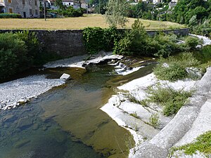
The Lemme is a river 35 km torrent, a right tributary of the Orba, which flows through the Province of Alessandria in northern Italy.

Piota
River in Italy
Distance: Approx. 7678 meters
Latitude and longitude: 44.6827,8.664
The Piota is an Apennine torrent in the Province of Alessandria, north-west Italy.
Weather in this IP's area
clear sky
9 Celsius
9 Celsius
7 Celsius
11 Celsius
1029 hPa
73 %
1029 hPa
1012 hPa
10000 meters
1.19 m/s
1.2 m/s
192 degree