195.20.114.77 - IP Lookup: Free IP Address Lookup, Postal Code Lookup, IP Location Lookup, IP ASN, Public IP
Country:
Region:
City:
Location:
Time Zone:
Postal Code:
IP information under different IP Channel
ip-api
Country
Region
City
ASN
Time Zone
ISP
Blacklist
Proxy
Latitude
Longitude
Postal
Route
Luminati
Country
Region
i
City
athens
ASN
Time Zone
Europe/Athens
ISP
Medianet Invest Ae
Latitude
Longitude
Postal
IPinfo
Country
Region
City
ASN
Time Zone
ISP
Blacklist
Proxy
Latitude
Longitude
Postal
Route
IP2Location
195.20.114.77Country
Region
attiki
City
methana
Time Zone
ISP
Language
User-Agent
Latitude
Longitude
Postal
db-ip
Country
Region
City
ASN
Time Zone
ISP
Blacklist
Proxy
Latitude
Longitude
Postal
Route
ipdata
Country
Region
City
ASN
Time Zone
ISP
Blacklist
Proxy
Latitude
Longitude
Postal
Route
Popular places and events near this IP address

Methana
Municipal unit in Greece
Distance: Approx. 1880 meters
Latitude and longitude: 37.56666667,23.38333333
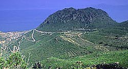
Methana (Greek: Μέθανα, Méthana) is a town and a former municipality on the Peloponnese peninsula, Greece. Since the 2011 local government reform it is part of the municipality Troizinia-Methana, of which it is a municipal unit. The municipal unit has an area of 50.161 km2.
Megalochori, Methana
Community in Greece
Distance: Approx. 3376 meters
Latitude and longitude: 37.59166667,23.355
Megalochori (Greek: Μεγαλοχώρι) is a village and a community in the western part of the volcanic Methana peninsula, Greece. It is located 3 km northwest of Methana town. The community consists of the villages Megalochori, Vathy, Kaimeni Chora and Megalo Potami.

National Centre of Scientific Research "Demokritos"
Greek research center
Distance: Approx. 8859 meters
Latitude and longitude: 37.5957,23.4904
The National Centre of Scientific Research "Demokritos" (NCSRD; Greek: Εθνικό Κέντρο Έρευνας Φυσικών Επιστημών (Ε.Κ.Ε.Φ.Ε.) "Δημόκριτος") is a research center in Greece, employing over 1,000 researchers, engineers, technicians and administrative personnel. It focuses on several fields of natural sciences and engineering and hosts laboratory facilities. The facilities cover approximately 150 acres (61 hectares) of land at Aghia Paraskevi, Athens, ten kilometers from the center of the city, on the northern side of Hymettus mountain.

Kypseli, Methana
Community in Greece
Distance: Approx. 2095 meters
Latitude and longitude: 37.6,23.38333333
Kypseli (Greek: Κυψέλη) is situated in the eastern part of the Methana volcanic peninsula. It was originally a farming village. The older name of the village is Kosona.

Methana Volcano
Distance: Approx. 3256 meters
Latitude and longitude: 37.60361111,23.36611111
The Methana volcano peninsula is situated approximately 50 kilometres (31 mi) southwest of Athens in Greece.

Kounoupitsa
Community in Greece
Distance: Approx. 5683 meters
Latitude and longitude: 37.63166667,23.375
Kounoupitsa (Greek: Κουνουπίτσα) is a village and a community in the northern end of the Methana peninsula, northeastern Peloponnese, Greece. It is part of the municipality Troizinia-Methana. The community consists of the villages Kounoupitsa, Agios Georgios, Agios Nikolaos, Makrylongos and Palaia Loutra.

Acropolis Palaiokastro
Distance: Approx. 3737 meters
Latitude and longitude: 37.5867,23.3494
The Acropolis of ancient Methana (also known as Acropolis Paliokastro, Greek: Ακρόπολη Παλιόκαστρο) is located 1 km from the town of Megalochori in the volcanic peninsula of Methana.

Eugenides Foundation
Greek educational foundation
Distance: Approx. 3022 meters
Latitude and longitude: 37.5624,23.4147
The Eugenides Foundation (Greek: Ίδρυμα Ευγενίδου) is a Greek private educational foundation. It was established in 1956 in Athens, Greece implementing the will of the late Greek benefactor Eugenios Eugenidis, who died in April 1954. The activity of the foundation, in accordance with its articles of association, is to contribute to the scientific and technological education of young people in Greece.

Troizinia-Methana
Municipality in Greece
Distance: Approx. 9418 meters
Latitude and longitude: 37.5,23.36666667
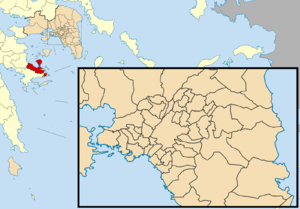
Troizinia-Methana (Greek: Τροιζηνία-Μέθανα) is a municipality in the Islands regional unit, Attica, Greece. The seat of the municipality is the town Galatas. The municipality was formed at the 2011 local government reform by the merger of the two former municipalities Methana and Troizina, that became municipal units.
Antheia (Argolis)
Distance: Approx. 9604 meters
Latitude and longitude: 37.50303,23.34845
Antheia or Anthea (Ancient Greek: Ἄνθεια) was a town in the Troezene in ancient Argolis, said to have been founded by the mythological figure Anthes. In mythology, King Pittheus transferred the town's population (synoecism) to Troezen. The site is near modern Damala.
Weather in this IP's area
overcast clouds
15 Celsius
14 Celsius
15 Celsius
15 Celsius
1010 hPa
68 %
1010 hPa
996 hPa
10000 meters
4.09 m/s
6.54 m/s
220 degree
90 %
