Country:
Region:
City:
Latitude and Longitude:
Time Zone:
Postal Code:
IP information under different IP Channel
ip-api
Country
Region
City
ASN
Time Zone
ISP
Blacklist
Proxy
Latitude
Longitude
Postal
Route
Luminati
Country
ASN
Time Zone
Europe/Amsterdam
ISP
Eurofiber Nederland BV
Latitude
Longitude
Postal
IPinfo
Country
Region
City
ASN
Time Zone
ISP
Blacklist
Proxy
Latitude
Longitude
Postal
Route
db-ip
Country
Region
City
ASN
Time Zone
ISP
Blacklist
Proxy
Latitude
Longitude
Postal
Route
ipdata
Country
Region
City
ASN
Time Zone
ISP
Blacklist
Proxy
Latitude
Longitude
Postal
Route
Popular places and events near this IP address
Renswoude
Municipality in Utrecht, Netherlands
Distance: Approx. 4811 meters
Latitude and longitude: 52.06666667,5.55
Renswoude (Dutch pronunciation: [rɛnsˈʋʌudə] ) is a municipality and a town in the central Netherlands, in the province of Utrecht.
Veenendaal
Municipality in Utrecht, Netherlands
Distance: Approx. 939 meters
Latitude and longitude: 52.01666667,5.55
Veenendaal (Dutch pronunciation: [ˈveːnə(n)ˌdaːl] ) is a municipality and a town in central Netherlands, located in the province of Utrecht. Veenendaal is the only population centre within its administrative borders. The municipality had a population of 70.000 inhabitants on 8 august 2024 and covers an area of 19.72 km2 (7.61 sq mi).

De Klomp
Village in Gelderland, Netherlands
Distance: Approx. 2503 meters
Latitude and longitude: 52.04444444,5.57166667
De Klomp is a village in the municipality of Ede, with a railway station called "Veenendaal-De Klomp railway station". It is located in the Dutch province of Gelderland. It was first mentioned in 1787 as De Klomp, and is a name of an inn.

Elst, Utrecht
Village in Utrecht, Netherlands
Distance: Approx. 5862 meters
Latitude and longitude: 51.98555556,5.49861111
Elst is a village in the central Netherlands. It is located in the municipality of Rhenen, Utrecht, about 5 km southwest of Veenendaal. Until 1 January 2006, the western tip of the village was in the municipality of Amerongen.

Achterberg
Village in Utrecht, Netherlands
Distance: Approx. 6101 meters
Latitude and longitude: 51.97166667,5.58555556
Achterberg is a village in the Dutch province of Utrecht. It is part of the municipality of Rhenen and it lies about 5 km west of Wageningen. The village was first mentioned in 1417 as Achterbergh, and means "(settlement) behind the hill".
Overberg, Netherlands
Village in Utrecht, Netherlands
Distance: Approx. 4496 meters
Latitude and longitude: 52.03916667,5.49694444
Overberg is a village in the Dutch province of Utrecht. It is a part of the municipality of Utrechtse Heuvelrug. It is located on both sides of the Utrecht-Rhenen railway line, but has no station.

Veenendaal-De Klomp railway station
Railway station in the Netherlands
Distance: Approx. 2705 meters
Latitude and longitude: 52.04583333,5.57388889
Veenendaal-De Klomp is a railway station located in De Klomp near Veenendaal, Netherlands. The station opened in 1845 and is on the Amsterdam–Arnhem railway. It lies within the borders of the municipality of Ede.

Veenendaal West railway station
Railway station in Veenendaal, the Netherlands
Distance: Approx. 1858 meters
Latitude and longitude: 52.02805556,5.53138889
Veenendaal West is a railway station located in Veenendaal, Netherlands. The station was opened in 1981, and is located on the Kesteren–Amersfoort railway. The train services are operated by Nederlandse Spoorwegen.

Veenendaal Centrum railway station
Railway station in Veenendaal, the Netherlands
Distance: Approx. 708 meters
Latitude and longitude: 52.02,5.54916667
Veenendaal Centrum is a railway station located in Veenendaal, Netherlands. The station was opened in 1886, closed in 1944 and reopened in 1981. It is located on the Kesteren–Amersfoort railway.
't Koetshuis
Defunct restaurant in Rhenen, Netherlands
Distance: Approx. 3362 meters
Latitude and longitude: 51.99861111,5.53027778
't Koetshuis was a restaurant located in Rhenen, Netherlands. It was a fine dining restaurant that was awarded one or two Michelin stars in the period 1957–1970. The restaurant was established in 1945 in the stable of the former hotel "Berg en Bos".
Edese Zwem- & Poloclub Polar Bears
Dutch water polo club
Distance: Approx. 5777 meters
Latitude and longitude: 52.0358,5.6396
Edese Zwem- & Poloclub Polar Bears, or simply Polar Bears Ede, is a swimming and water polo club based in the city of Ede, Netherlands.

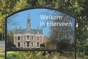
Ederveen
Village in Gelderland, Netherlands
Distance: Approx. 5098 meters
Latitude and longitude: 52.06666667,5.58333333
Ederveen is a village in the municipality of Ede in the province of Gelderland, the Netherlands.
Weather in this IP's area
clear sky
7 Celsius
7 Celsius
6 Celsius
9 Celsius
1030 hPa
95 %
1030 hPa
1029 hPa
10000 meters
0.88 m/s
0.98 m/s
222 degree
5 %
07:42:13
17:00:37


