Country:
 Greece
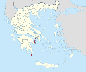
Region:
City:
Latitude and Longitude:
Time Zone:
Postal Code:
IP information under different IP Channel
ip-api
Country
Region
City
ASN
Time Zone
ISP
Blacklist
Proxy
Latitude
Longitude
Postal
Route
IPinfo
Country
Region
City
ASN
Time Zone
ISP
Blacklist
Proxy
Latitude
Longitude
Postal
Route
MaxMind
Country
Region
City
ASN
Time Zone
ISP
Blacklist
Proxy
Latitude
Longitude
Postal
Route
Luminati
Country
GRRegion
i
City
athens
ASN
Time Zone
Europe/Athens
ISP
Space Hellas S.A.
Latitude
Longitude
Postal
db-ip
Country
Region
City
ASN
Time Zone
ISP
Blacklist
Proxy
Latitude
Longitude
Postal
Route
ipdata
Country
Region
City
ASN
Time Zone
ISP
Blacklist
Proxy
Latitude
Longitude
Postal
Route
Popular places and events near this IP address

Hydra (island)
One of the Saronic Islands of Greece
Distance: Approx. 2309 meters
Latitude and longitude: 37.335,23.4725
Hydra, or Ydra or Idra (EE-dra; Greek: Ύδρα, romanized: Ýdra, pronounced [ˈiðra] in Modern Greek, Arvanitika: Nύδρα/Nidhra), and in antiquity Hydrea, is one of the Saronic Islands of Greece, located in the Aegean Sea between the Myrtoan Sea and the Argolic Gulf. It is separated from the Peloponnese by a narrow strip of water. In ancient times, the island was known as Hydrea (Ὑδρέα, derived from the Greek word for "water"), a reference to the natural springs on the island.
Islands (regional unit)
Regional unit in Greece
Distance: Approx. 4384 meters
Latitude and longitude: 37.33333333,23.5
The Islands Regional Unit (Greek: Περιφερειακή ενότητα Νήσων, Periphereiaki enotita Nison) is one of the regional units of Greece. It is part of the region of Attica. The regional unit covers the Saronic Islands, a small part of the Peloponnese peninsula, and a few islands off the eastern Peloponnese coast.
Weather in this IP's area
overcast clouds
20 Celsius
19 Celsius
20 Celsius
20 Celsius
1022 hPa
58 %
1022 hPa
1022 hPa
10000 meters
10.02 m/s
9.94 m/s
37 degree
89 %
07:37:56
18:43:56