195.189.145.86 - IP Lookup: Free IP Address Lookup, Postal Code Lookup, IP Location Lookup, IP ASN, Public IP
Country:
Region:
City:
Location:
Time Zone:
Postal Code:
IP information under different IP Channel
ip-api
Country
Region
City
ASN
Time Zone
ISP
Blacklist
Proxy
Latitude
Longitude
Postal
Route
Luminati
Country
ASN
Time Zone
Europe/Bucharest
ISP
Institutul National de Cercetare Dezvoltare pentru Fizica Pamantului - INCDFP RA
Latitude
Longitude
Postal
IPinfo
Country
Region
City
ASN
Time Zone
ISP
Blacklist
Proxy
Latitude
Longitude
Postal
Route
IP2Location
195.189.145.86Country
Region
ilfov
City
magurele
Time Zone
Europe/Bucharest
ISP
Language
User-Agent
Latitude
Longitude
Postal
db-ip
Country
Region
City
ASN
Time Zone
ISP
Blacklist
Proxy
Latitude
Longitude
Postal
Route
ipdata
Country
Region
City
ASN
Time Zone
ISP
Blacklist
Proxy
Latitude
Longitude
Postal
Route
Popular places and events near this IP address
Jilava
Commune in Ilfov, Romania
Distance: Approx. 4046 meters
Latitude and longitude: 44.33277778,26.07805556
Jilava is a commune in Ilfov County, Muntenia, Romania, near Bucharest. It is composed of a single village, Jilava. The name derives from a Romanian word of Slavic origin (Bulgarian жилав žilav (tough), which passed into Romanian as jilav) meaning "humid place".

Ferentari
Neighborhood in Bucharest, Romania
Distance: Approx. 6072 meters
Latitude and longitude: 44.392564,26.081017
Ferentari [fe.renˈtarʲ] is a neighbourhood located in the 5th Sector of Bucharest, Romania.

Bragadiru
Town in Ilfov, Romania
Distance: Approx. 5187 meters
Latitude and longitude: 44.37083333,25.975
Bragadiru is a town in Ilfov County, Muntenia, Romania. The town is located in the southwestern vicinity of the city of Bucharest, at the exit towards Alexandria, being a part of the Bucharest metropolitan area. Bragadiru became a town on 29 December 2005.

Măgurele
Town in Ilfov, Romania
Distance: Approx. 291 meters
Latitude and longitude: 44.34944444,26.02972222
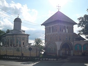
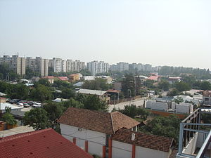
Măgurele is a town situated in the southwestern part of Ilfov County, Muntenia, Romania. It has a population of 14,414 as of 2021 and hosts several research institutes. In 2024, new buses were donated from the Voluntari district.

Dărăști-Ilfov
Commune in Ilfov, Romania
Distance: Approx. 3940 meters
Latitude and longitude: 44.31666667,26.01666667
Dărăști-Ilfov is a commune in the south of Ilfov County, Muntenia, Romania, 20 km (12 mi) from the national capital, Bucharest. It is composed of a single village, Dărăști-Ilfov. The commune, with a population of 2,865 people as of 2021, is mainly inhabited by low-income families, many of which commute to Bucharest for work but live in the locality due to cheaper housing.

Rahova
Distance: Approx. 5680 meters
Latitude and longitude: 44.39861111,26.055
Rahova is a neighbourhood of southwest Bucharest, Romania, situated in Sector 5, west of Dâmbovița River. It is named after the Bulgarian town Rahovo (today Oryahovo), site of a battle in the Romanian War of Independence. The neighborhood stretches from between Antiaeriană and Drumul Sării Avenues to Panduri Square (in the west), Panduri and 13 Septembrie Streets in the north, George Cosbuc Avenue, Viilor and Sălaj Streets in the east and Bucharest City Limits in the South.

Ciorogârla (river)
River in Ilfov, Romania
Distance: Approx. 2377 meters
Latitude and longitude: 44.3333,26.0519
The Ciorogârla is a left tributary of the river Sabar in Romania. It discharges into the Sabar in Jilava. Its length is 57 km (35 mi) and its basin size is 149 km2 (58 sq mi).

Jilava massacre
1940 massacre in Romania
Distance: Approx. 6139 meters
Latitude and longitude: 44.335,26.1075
The Jilava massacre took place during the night of November 26, 1940, at Jilava Prison, near Bucharest, Romania. Sixty-four political detainees were killed by the Iron Guard (Legion), with further high-profile assassinations in the immediate aftermath. It came about halfway through the fascist National Legionary State and led to the first open clash between the Guard and conducător Ion Antonescu, who ousted the Legion from power in January 1941.
Progresul
Distance: Approx. 5751 meters
Latitude and longitude: 44.373,26.098
Progresul is a district in southern Bucharest's Sectorul 4, Romania.

Ghencea
Distance: Approx. 6164 meters
Latitude and longitude: 44.4,26
Ghencea is a district of the Romanian capital city Bucharest, split between Sector 5 and Sector 6. It is home to the famous sports club CSA Steaua București. Nearby districts are Drumul Taberei and Rahova.
Odăi
District in Bucharest, Romania
Distance: Approx. 4769 meters
Latitude and longitude: 44.392733,26.037469
Odăi is a district in the Southwest side of Bucharest, Romania in Sector 5. In the north it is bounded by Alexandria Road, in the east it borders the Rahova neighborhood, and in the southwest it borders Ilfov County.

Jilava Prison
Prison in Jilava, Romania
Distance: Approx. 6139 meters
Latitude and longitude: 44.335,26.1075
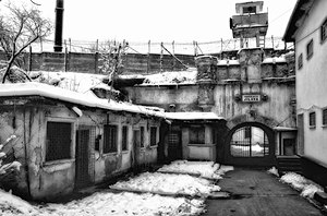
Jilava Prison (Romanian: Penitenciarul București–Jilava) is a prison located in Jilava, a village south of Bucharest, Romania.
Weather in this IP's area
light rain
2 Celsius
-3 Celsius
1 Celsius
2 Celsius
1035 hPa
59 %
1035 hPa
1024 hPa
10000 meters
5.66 m/s
70 degree
100 %

