Country:
 Hungary
Region:
City:
Latitude and Longitude:
Time Zone:
Postal Code:
IP information under different IP Channel
ip-api
Country
Region
City
ASN
Time Zone
ISP
Blacklist
Proxy
Latitude
Longitude
Postal
Route
IPinfo
Country
Region
City
ASN
Time Zone
ISP
Blacklist
Proxy
Latitude
Longitude
Postal
Route
MaxMind
Country
Region
City
ASN
Time Zone
ISP
Blacklist
Proxy
Latitude
Longitude
Postal
Route
Luminati
Country
HURegion
bz
City
putnok
ASN
Time Zone
Europe/Budapest
ISP
Invitech ICT Services Kft.
Latitude
Longitude
Postal
db-ip
Country
Region
City
ASN
Time Zone
ISP
Blacklist
Proxy
Latitude
Longitude
Postal
Route
ipdata
Country
Region
City
ASN
Time Zone
ISP
Blacklist
Proxy
Latitude
Longitude
Postal
Route
Popular places and events near this IP address

Putnok
Town in Borsod-Abaúj-Zemplén, Hungary
Distance: Approx. 1142 meters
Latitude and longitude: 48.29386,20.4368
Putnok (Slovak: Putnok/Putník) is a town in Borsod-Abaúj-Zemplén county, Northern Hungary. It lies 40 km (25 mi) from Miskolc, between the Bükk Mountains and the river Sajó.

Bánréve
Village in Northern Hungary, Hungary
Distance: Approx. 5588 meters
Latitude and longitude: 48.29843,20.35496
Bánréve is a village in Borsod-Abaúj-Zemplén county, Hungary. In the 19th and 20th centuries, a small Jewish community lived in the village, in 1920 36 Jews lived in the village, most of whom were murdered in the Holocaust. The community had a Jewish cemetery.
Dubicsány
Place in Northern Hungary, Hungary
Distance: Approx. 5027 meters
Latitude and longitude: 48.2847,20.49208056
Dubicsány is a village in Borsod-Abaúj-Zemplén County, in Hungary.

Hét
Village in Northern Hungary, Hungary
Distance: Approx. 4104 meters
Latitude and longitude: 48.28333333,20.38333333
Hét is a village in Borsod-Abaúj-Zemplén County in northeastern Hungary.

Kelemér
Village in Northern Hungary, Hungary
Distance: Approx. 5226 meters
Latitude and longitude: 48.35,20.43333333
Kelemér is a village in Borsod-Abaúj-Zemplén County in northeastern Hungary.

Királd
Village in Northern Hungary, Hungary
Distance: Approx. 6318 meters
Latitude and longitude: 48.25,20.4
Királd is a village in Borsod-Abaúj-Zemplén County in northeastern Hungary.

Serényfalva
Village in Northern Hungary, Hungary
Distance: Approx. 2692 meters
Latitude and longitude: 48.31666667,20.4
Serényfalva is a village in Borsod-Abaúj-Zemplén County in northeastern Hungary formerly known as Málé , Serényimál and Serényifalva. Serényfalva was first settled in the 13th century.

Sajópüspöki
Village in Northern Hungary, Hungary
Distance: Approx. 6327 meters
Latitude and longitude: 48.28333333,20.35
Sajópüspöki is a village in Borsod-Abaúj-Zemplén County in northeastern Hungary.

Sajómercse
Village in Northern Hungary, Hungary
Distance: Approx. 5994 meters
Latitude and longitude: 48.25,20.41666667
Sajómercse is a village in Borsod-Abaúj-Zemplén County in northeastern Hungary.

Sajónémeti
Village in Northern Hungary, Hungary
Distance: Approx. 5334 meters
Latitude and longitude: 48.26666667,20.38333333
Sajónémeti is a village in Borsod-Abaúj-Zemplén County in northeastern Hungary.

Sajóvelezd
Village in Northern Hungary, Hungary
Distance: Approx. 4215 meters
Latitude and longitude: 48.27189,20.46232
Sajóvelezd is a village in Borsod-Abaúj-Zemplén County in northeastern Hungary.
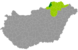
Putnok District
Districts of Hungary in Borsod-Abaúj-Zemplén
Distance: Approx. 1093 meters
Latitude and longitude: 48.29411042,20.43603935
Putnok (Hungarian: Putnoki járás) is a district in north-western part of Borsod-Abaúj-Zemplén County. Putnok is also the name of the town where the district seat is found. The district is located in the Northern Hungary Statistical Region.
Weather in this IP's area
clear sky
11 Celsius
10 Celsius
11 Celsius
11 Celsius
1024 hPa
55 %
1024 hPa
1001 hPa
10000 meters
1.43 m/s
1.4 m/s
88 degree
07:02:33
17:43:53