195.183.128.152 - IP Lookup: Free IP Address Lookup, Postal Code Lookup, IP Location Lookup, IP ASN, Public IP
Country:
Region:
City:
Location:
Time Zone:
Postal Code:
IP information under different IP Channel
ip-api
Country
Region
City
ASN
Time Zone
ISP
Blacklist
Proxy
Latitude
Longitude
Postal
Route
Luminati
Country
ASN
Time Zone
Europe/Amsterdam
ISP
ATGS-MMD-AS
Latitude
Longitude
Postal
IPinfo
Country
Region
City
ASN
Time Zone
ISP
Blacklist
Proxy
Latitude
Longitude
Postal
Route
IP2Location
195.183.128.152Country
Region
gauteng
City
alberton
Time Zone
Africa/Johannesburg
ISP
Language
User-Agent
Latitude
Longitude
Postal
db-ip
Country
Region
City
ASN
Time Zone
ISP
Blacklist
Proxy
Latitude
Longitude
Postal
Route
ipdata
Country
Region
City
ASN
Time Zone
ISP
Blacklist
Proxy
Latitude
Longitude
Postal
Route
Popular places and events near this IP address
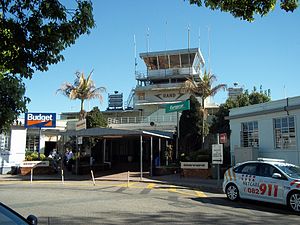
Alberton, South Africa
Place in Gauteng, South Africa
Distance: Approx. 5 meters
Latitude and longitude: -26.26722222,28.12194444
Alberton is a town situated on the southern part of the East Rand of the Gauteng Province in South Africa and is situated very close to the major urban centre of Johannesburg. Alberton is described as a typical suburban community, one which is primarily residential in character, with most of its workers commuting to work in nearby suburbs or cities such as Johannesburg and Germiston.
Elandspark
Place in Gauteng, South Africa
Distance: Approx. 2944 meters
Latitude and longitude: -26.243,28.11
Elandspark is a suburb of Johannesburg, South Africa. It is located in Region 9.
Electron, Gauteng
Place in Gauteng, South Africa
Distance: Approx. 3881 meters
Latitude and longitude: -26.24111111,28.09611111
Electron is a suburb of Johannesburg, South Africa. It is located in Region F of the City of Johannesburg Metropolitan Municipality.
Elladoone
Place in Gauteng, South Africa
Distance: Approx. 4459 meters
Latitude and longitude: -26.23916667,28.09
Elladoone is a suburb of Johannesburg, South Africa. It is located in Region F of the City of Johannesburg Metropolitan Municipality.
Klipriviersberg Estate
Place in Gauteng, South Africa
Distance: Approx. 4178 meters
Latitude and longitude: -26.244,28.089
Klipriviersberg Estate is a suburb of Johannesburg, South Africa. It is located in Region 9.
Risana
Place in Gauteng, South Africa
Distance: Approx. 3664 meters
Latitude and longitude: -26.257,28.087
Risana is a suburb of Johannesburg, South Africa. It is located in Region F of the City of Johannesburg Metropolitan Municipality.
South Hills, Gauteng
Place in Gauteng, South Africa
Distance: Approx. 4738 meters
Latitude and longitude: -26.249,28.079
South Hills is a suburb of Johannesburg, South Africa. Also known as Suidheuwels in Afrikaans, it is about 20 minutes drive from Johannesburg Central. It is located in Region F of the City of Johannesburg Metropolitan Municipality.
Steeledale
Place in Gauteng, South Africa
Distance: Approx. 3501 meters
Latitude and longitude: -26.246,28.096
Steeledale is an industrial suburb of Johannesburg, South Africa. It is located in Region F of the City of Johannesburg Metropolitan Municipality.
Tulisa Park
Place in Gauteng, South Africa
Distance: Approx. 2981 meters
Latitude and longitude: -26.249,28.1
Tulisa Park is a suburb of Johannesburg, South Africa. It is located in Region F of the City of Johannesburg Metropolitan Municipality.
Rand Airport
General aviation airport of Johannesburg; in Germiston, Gauteng, South Africa
Distance: Approx. 4008 meters
Latitude and longitude: -26.2425,28.15111111
Rand Airport (IATA: QRA, ICAO: FAGM) is an airport in Germiston, South Africa. It was constructed in the 1920s as the main airport for Johannesburg, but the city outgrew it and replaced the airport with Palmietfontein Airport in 1948 (itself replaced by Jan Smuts International Airport in 1952).
Hoërskool Marais Viljoen
Public school in Gauteng, South Africa
Distance: Approx. 1590 meters
Latitude and longitude: -26.2701,28.1063
Hoërskool Marais Viljoen (English: Marais Viljoen High School) is a public Afrikaans medium co-educational high school situated in the city of Alberton in the Gauteng province of South Africa. It is one of the top and most academic schools in Gauteng province.
Hoërskool Alberton
High school in South Africa
Distance: Approx. 904 meters
Latitude and longitude: -26.266141,28.130874
Hoërskool Alberton is an Afrikaans high school in Florentia, Alberton, South Africa. On Tuesday, Oct. 12, 1948, the books, furniture, and other supplies in use in the middle section of the Kruger School were transferred to the new junior high school in Alberton.
Weather in this IP's area
broken clouds
19 Celsius
19 Celsius
17 Celsius
20 Celsius
1011 hPa
96 %
1011 hPa
844 hPa
10000 meters
1.03 m/s
30 degree
77 %

