Country:
Region:
City:
Latitude and Longitude:
Time Zone:
Postal Code:
IP information under different IP Channel
ip-api
Country
Region
City
ASN
Time Zone
ISP
Blacklist
Proxy
Latitude
Longitude
Postal
Route
Luminati
Country
ASN
Time Zone
Europe/Rome
ISP
Mynet S.r.l.
Latitude
Longitude
Postal
IPinfo
Country
Region
City
ASN
Time Zone
ISP
Blacklist
Proxy
Latitude
Longitude
Postal
Route
db-ip
Country
Region
City
ASN
Time Zone
ISP
Blacklist
Proxy
Latitude
Longitude
Postal
Route
ipdata
Country
Region
City
ASN
Time Zone
ISP
Blacklist
Proxy
Latitude
Longitude
Postal
Route
Popular places and events near this IP address

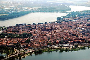
Mantua
City in Lombardy, Italy
Distance: Approx. 1732 meters
Latitude and longitude: 45.15638889,10.79166667
Mantua ( MAN-tew-ə; Italian: Mantova [ˈmantova] ; Lombard and Latin: Mantua) is a comune (municipality) in the Italian region of Lombardy, and capital of the province of the same name. In 2016, Mantua was designated as the "Italian Capital of Culture". In 2017, it was named as the "European Capital of Gastronomy", included in the Eastern Lombardy District (together with the cities of Bergamo, Brescia, and Cremona).

Palazzo del Te
Distance: Approx. 1574 meters
Latitude and longitude: 45.14737,10.78728
Palazzo del Te, or simply Palazzo Te, is a palace in the suburbs of Mantua, Italy. It is an example of the mannerist style of architecture, and the acknowledged masterpiece of Giulio Romano.

San Sebastiano, Mantua
Distance: Approx. 933 meters
Latitude and longitude: 45.15,10.78
San Sebastiano is an Early Renaissance church in Mantua, northern Italy. Begun in 1460 according to the designs of Leon Battista Alberti, it was left partially completed in the mid-1470s, by which time construction had slowed and was no longer being directed by Alberti. As a consequence, little remains of Alberti’s work apart from the plan, which is considered one of the earliest and most significant examples of Renassiances centrally-planned churches.

Belfiore martyrs
Group of pro-independence fighters during the Italian Risorgimento
Distance: Approx. 313 meters
Latitude and longitude: 45.15666667,10.77194444
The Belfiore martyrs were a group of pro-independence fighters condemned to death by hanging between 1852 and 1853 during the Italian Risorgimento. They included Tito Speri and the priest Enrico Tazzoli and are named after the site where the sentence was carried out, in the valley of Belfiore at the south entrance to Mantua. The hanging was the first in a long series of death sentences imposed by Josef Radetzky, governor general of Lombardy–Venetia.
Mantova railway station
Railway station in Italy
Distance: Approx. 1198 meters
Latitude and longitude: 45.15888889,10.78361111
Mantua Railway Station (Italian: Stazione di Mantova) is the main station of Comune of Mantua in the Region of Lombardy, northern Italy. The station, situated at Piazza Don Leone and northwest of the city centre, was opened in 1873. It is a junction of three railway lines: Verona-Modena Railway, Milan-Mantua Railway and Mantua-Monselice Railway (which connects to Padua).

Church of Sant'Orsola (Mantua)
Distance: Approx. 1357 meters
Latitude and longitude: 45.1577,10.7864
The Church of Sant'Orsola (St Ursula) in Mantua, Italy, was designed and built in 1608 by Antonio Maria Viani, the architect of the ducal court of the House of Gonzaga. The church was commissioned by Margherita Gonzaga d'Este, the widow of Alfonso II d'Este. Margherita, while not a nun herself, as a widow came to live in an apartment in the Clarissan monastery that was once adjacent (destroyed in 1930).

Ognissanti, Mantua
Distance: Approx. 1069 meters
Latitude and longitude: 45.15722222,10.78277778
The Ognissanti is a Baroque style, Roman Catholic church located on Corso Vittorio Emanuele in Mantua, Lombardy, Italy.

San Maurizio (Mantua)
Church in Mantua, Italy
Distance: Approx. 1487 meters
Latitude and longitude: 45.1559,10.7886
San Maurizio is a domed Baroque, Roman Catholic church designed by Antonio Maria Viani, and located on Via Chiassi, Mantua, Italy. It was once called ‘’Santi Maurizio e Margherita’’.

San Barnaba, Mantua
Church in Mantua, Italy
Distance: Approx. 1343 meters
Latitude and longitude: 45.154,10.7869
San Barnaba is a Roman Catholic church located at the intersection of Via Giovanni Chiassi and Via Carlo Poma in Mantua, Lombardy, Italy.

San Francesco, Mantua
Roman Catholic church in Mantua, Italy
Distance: Approx. 1543 meters
Latitude and longitude: 45.159766,10.787865
The Chiesa di San Francesco ( Italian, "Church of St. Francis" ) is a Roman Catholic church located in the historic center of Mantua, Italy, at Piazza San Francesco d'Assisi 5. The church was founded by the Franciscan Order in 1304 but it was not consecrated until 1459, when Pope Pius II performed the ceremony.
Palazzo D'Arco, Mantua
Distance: Approx. 1683 meters
Latitude and longitude: 45.1613,10.7888
The Palazzo D'Arco is a Neoclassical-style palace located on Piazza Carlo D'Arco #4 in Mantua, region of Lombardy, Italy. The palace houses the Museo di Palazzo d'Arco, which displays the furnishings and artwork collected by the Duke D'Arco.

Palazzo San Sebastiano
Distance: Approx. 1414 meters
Latitude and longitude: 45.15035,10.78692
The Palazzo San Sebastiano is a 16th-century palace in Mantua. Built by the Gonzaga family, since 19 March 2005 it has housed Mantua's city museum (Museo della Città di Palazzo San Sebastiano).
Weather in this IP's area
clear sky
1 Celsius
-1 Celsius
1 Celsius
2 Celsius
1023 hPa
81 %
1023 hPa
1020 hPa
10000 meters
2.31 m/s
2.28 m/s
260 degree
07:15:27
16:47:55

