Country:
Region:
City:
Latitude and Longitude:
Time Zone:
Postal Code:
IP information under different IP Channel
ip-api
Country
Region
City
ASN
Time Zone
ISP
Blacklist
Proxy
Latitude
Longitude
Postal
Route
Luminati
Country
Region
34
City
istanbul
ASN
Time Zone
Europe/Istanbul
ISP
Turk Telekom
Latitude
Longitude
Postal
IPinfo
Country
Region
City
ASN
Time Zone
ISP
Blacklist
Proxy
Latitude
Longitude
Postal
Route
db-ip
Country
Region
City
ASN
Time Zone
ISP
Blacklist
Proxy
Latitude
Longitude
Postal
Route
ipdata
Country
Region
City
ASN
Time Zone
ISP
Blacklist
Proxy
Latitude
Longitude
Postal
Route
Popular places and events near this IP address

Maalem Synagogue
Synagogue in Istanbul, Turkey
Distance: Approx. 932 meters
Latitude and longitude: 41.04055556,28.95361111
The Maalem Synagogue is a Jewish congregation and synagogue, located on Harap Çeşme Street, on the slopes overlooking the Golden Horn, near the Jewish old age home in the Hasköy district of Istanbul, Turkey. It is the only remaining open synagogue in an area that once had many Jewish residents. Completed in the early 20th century, the synagogue is open, yet only open for Shabbat services.

Mayor Synagogue, Istanbul
Former synagogue in Istanbul, Turkey
Distance: Approx. 1011 meters
Latitude and longitude: 41.03972222,28.95138889
The Mayor Synagogue, also known as the Majorka Synagogue, is a former Jewish congregation and synagogue, located on Hasköy Avenue, in the Hasköy district of Beyoğlu, Istanbul, in the Istanbul Province of Turkey. Completed in the 19th century, the building was used as a synagogue until 1923.

Karaite Synagogue (Istanbul)
Kenesa in Istanbul, Turkey
Distance: Approx. 983 meters
Latitude and longitude: 41.04,28.95266667
The Karaite Synagogue (Hebrew: בית הכנסת הקראי באיסטנבול, romanized: Bayṯ hak-Kənesseṯ haq-Qārāʾi bIsṭanbul; Turkish: Karahim Sinagogu, Karaim Sinagogu, Karayim Sinagogu) is a Karaite Jewish congregation and synagogue or kenesa, located on Dere Street, in Hasköy, in the Beyoğlu district of Istanbul, in the Istanbul Province of Turkey. Completed in 1842, the synagogue is open, yet only open for the Karaite Passover services, or by arrangement.

Hasköy, Beyoğlu
Quarter in Istanbul, Turkey
Distance: Approx. 1024 meters
Latitude and longitude: 41.03972222,28.94972222
Hasköy is a trading and residential district on the northern bank of the Golden Horn in Beyoğlu, Istanbul, Turkey. It includes the neighbourhoods of Keçeci Piri, Piri Paşa, and Halıcıoğlu, and parts of Camiikebir and Sütlüce. Immediately to the south lies Kasımpaşa.
Handan Agha Mosque
Mosque in Beyoğlu, Istanbul, Turkey
Distance: Approx. 1181 meters
Latitude and longitude: 41.0382,28.9511
Handan Agha Mosque is a mosque near the Golden Horn in the Hasköy neighborhood of Beyoğlu, Istanbul, Turkey. It is also known as the Kuşkonmaz or "Birds Don't Perch" Mosque. One of Sultan Mehmed II's aghas, Handan Agha, had it built in the 15th century.
Kırmızı Minare Mosque
Mosque in Beyoğlu, Istanbul, Turkey
Distance: Approx. 767 meters
Latitude and longitude: 41.04194444,28.95083333
The Kırmızı Minare Mosque (Turkish: Kırmızı Minare Camii; Red Minaret Mosque) is a mosque in the Hasköy neighborhood of Beyoğlu, Istanbul, Turkey. It was probably built in 1591 by Kiremitçi Ahmet Agha and so is also known as the Kiremitçi Ahmet Agha Mosque. It received the name "Red Minaret" because of its red brick minaret.

Sütlüce, Beyoğlu
Neighborhood in the Beyoğlu district of Istanbul, Turkey
Distance: Approx. 997 meters
Latitude and longitude: 41.05086,28.94014
Sütlüce is a neighbourhood in the municipality and district of Beyoğlu, Istanbul Province, Turkey. Its population is 12,736 (2022). It is on the eastern bank of the Golden Horn.

Haliç Bridge
Bridge in Istanbul, Turkey
Distance: Approx. 1039 meters
Latitude and longitude: 41.04333333,28.94166667
The Haliç Bridge (Turkish: Haliç Köprüsü), or the Golden Horn Bridge, is a road bridge across the Golden Horn in Istanbul, Turkey. It connects the neighbourhoods of Ayvansaray in the southwest and Halıcıoğlu in the northwest. The bridge carries the O-1 motorway, also known as the Istanbul Inner Beltway.

Piyalepaşa, Beyoğlu
Neighbourhood in Beyoğlu, Istanbul, Turkey
Distance: Approx. 1008 meters
Latitude and longitude: 41.049,28.9637
Piyalepaşa is a neighbourhood in the municipality and district of Beyoğlu, Istanbul Province, Turkey. Its population is 21,265 (2022). It is on the European Side of Istanbul.

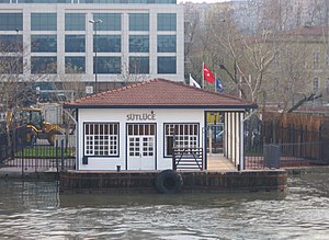
Sütlüce Pier
Distance: Approx. 955 meters
Latitude and longitude: 41.0466,28.9407
Sütlüce Pier (Turkish: Sütlüce İskelesi) is a ferry slip on the Golden Horn in Beyoğlu, Istanbul. The Municipal ferry operator, Şehir Hatları, operates hourly ferry service from Eyüp to Üsküdar, stopping at Sütlüce and six other piers on the Golden Horn. This route is known as the Golden Horn Line.

Haliç Congress Center
Cultural center in Istanbul, Turkey
Distance: Approx. 996 meters
Latitude and longitude: 41.0503,28.94
Haliç Congress Center (Turkish: Haliç Kongre Merkezi), formerly Karağaç Slaughterhouse (Karağaç Mezbahası) or Sütlüce Slaughterhouse (Sütlüce Mezbahası), is a building initially opened in 1923 in order to ensure hygienic slaughtering and supervision in Istanbul. Its architect is Vedat Tek. Since 2009, it has been used as a congress and cultural center, under the name of Haliç Congress Center.

Istanbul Health and Technology University
University in Istanbul, Turkey
Distance: Approx. 836 meters
Latitude and longitude: 41.0563,28.95115
Istanbul Health and Technology University, was established by Neutec, Bilgiç Foundation and took its place in higher education to start its activities in the 2020-2021 academic year as a foundation university that gained public legal personality with "Additional Article 196 (Additional: 9/5/2018-7141/7 md)", "Article 13 of the law dated 25/3/2020 and numbered 7226" with its publication in the Official Gazette. Istanbul Health and Technology University started its education life with Topkapı Campus in Zeytinburnu. In the second academic year, it opened Merter Campus and provided education in two campuses until the 2023-2024 academic year.
Weather in this IP's area
broken clouds
13 Celsius
13 Celsius
13 Celsius
13 Celsius
1017 hPa
94 %
1017 hPa
1008 hPa
6000 meters
4.63 m/s
360 degree
75 %
07:52:09
17:45:45