195.169.155.206 - IP Lookup: Free IP Address Lookup, Postal Code Lookup, IP Location Lookup, IP ASN, Public IP
Country:
Region:
City:
Location:
Time Zone:
Postal Code:
IP information under different IP Channel
ip-api
Country
Region
City
ASN
Time Zone
ISP
Blacklist
Proxy
Latitude
Longitude
Postal
Route
Luminati
Country
Region
ge
City
nijmegen
ASN
Time Zone
Europe/Amsterdam
ISP
SURF B.V.
Latitude
Longitude
Postal
IPinfo
Country
Region
City
ASN
Time Zone
ISP
Blacklist
Proxy
Latitude
Longitude
Postal
Route
IP2Location
195.169.155.206Country
Region
drenthe
City
dwingeloo
Time Zone
Europe/Amsterdam
ISP
Language
User-Agent
Latitude
Longitude
Postal
db-ip
Country
Region
City
ASN
Time Zone
ISP
Blacklist
Proxy
Latitude
Longitude
Postal
Route
ipdata
Country
Region
City
ASN
Time Zone
ISP
Blacklist
Proxy
Latitude
Longitude
Postal
Route
Popular places and events near this IP address

Dwingeloo
Village in Drenthe, Netherlands
Distance: Approx. 82 meters
Latitude and longitude: 52.83444444,6.37055556
Dwingeloo (Dutch: [ˈdʋɪŋəloː]) is a village halfway between Meppel and Assen in the Dutch province of Drenthe. It is a part of the municipality of Westerveld. The village is known internationally because of the radio telescope of the Dwingeloo Radio Observatory (which at the time of its completion in 1956 was the largest radio telescope in the world), located on the edge of the Dwingeloo Heath, 3 km south of the village.

Diever
Village in Drenthe, Netherlands
Distance: Approx. 4222 meters
Latitude and longitude: 52.85555556,6.3175
Diever is a village in the Dutch province of Drenthe. It is a part of the municipality of Westerveld, and lies about 18 km northwest of Hoogeveen. Diever is located near the Drentse Hoofdvaart, a major north–south route for pleasure boats in the province of Drenthe.

Dwingeloo Radio Observatory
Radio telescope in the Netherlands
Distance: Approx. 3064 meters
Latitude and longitude: 52.8119,6.3961
The Dwingeloo Radio Observatory is a single-dish radio telescope near the village of Dwingeloo (Dutch pronunciation: [ˈdʋɪŋəloː]) in the northeastern Netherlands. Construction started in 1954, and the telescope was completed in 1956. The radio telescope has a diameter of 25 m.

ASTRON
Distance: Approx. 2960 meters
Latitude and longitude: 52.81333,6.39667
ASTRON is the Netherlands Institute for Radio Astronomy. Its main office is in Dwingeloo in the Dwingelderveld National Park in the province of Drenthe. ASTRON is part of the institutes organization of the Dutch Research Council (NWO).

Westeinde, Drenthe
Hamlet in Drenthe, Netherlands
Distance: Approx. 1703 meters
Latitude and longitude: 52.825,6.34916667
Westeinde is a hamlet in the Dutch province of Drenthe. It is part of the town Dwingeloo and of the municipality of Westerveld. The name Westeinde means 'western end' and alludes to the fact that it lies west of Dwingeloo.

Lhee
Hamlet in Drenthe, Netherlands
Distance: Approx. 1754 meters
Latitude and longitude: 52.82833333,6.39361111
Lhee is a hamlet in the Dutch province of Drenthe. It is a part of the municipality of Westerveld, and lies about 13 kilometres (8.1 mi) north of Hoogeveen. The hamlet was first mentioned in 1181 as "In Lede".

Lheebroek
Hamlet in Drenthe, Netherlands
Distance: Approx. 4016 meters
Latitude and longitude: 52.84694444,6.42527778
Lheebroek is a hamlet in the Dutch province of Drenthe. It is a part of the municipality of Westerveld, and lies about 14 km (9 mi) north of Hoogeveen. The hamlet was first mentioned between 1381 and 1383 as to Lederbroke, and means "swampy land belonging to Lhee".

Eemster
Hamlet in Drenthe, Netherlands
Distance: Approx. 2489 meters
Latitude and longitude: 52.85388889,6.38694444
Eemster is a hamlet in the Dutch province of Drenthe. It is a part of the municipality of Westerveld, and lies about 16 km north of Hoogeveen. The hamlet was first mentioned in 1210 as Hemsere.

Leggeloo
Hamlet in Drenthe, Netherlands
Distance: Approx. 1973 meters
Latitude and longitude: 52.85166667,6.36444444
Leggeloo is a hamlet in the Dutch province of Drenthe. It is a part of the municipality of Westerveld, and lies about 17 km north of Hoogeveen. The hamlet was first mentioned in 1217 as in Legghelo.

Dieverbrug
Village in Drenthe, Netherlands
Distance: Approx. 2388 meters
Latitude and longitude: 52.84694444,6.34083333
Dieverbrug is a village in the Dutch province of Drenthe. It is a part of the municipality of Westerveld, and lies about 17 km northwest of Hoogeveen. The village was first mentioned in 1841 as "Dieverbrug of Dieverschebrug", and refers to the bridge which was built around 1770 over the Drentsche Hoofdvaart on the road from Diever to Dwingeloo.

De Vlijt, Diever
Dutch windmill
Distance: Approx. 4225 meters
Latitude and longitude: 52.85166667,6.31361111
De Vlijt (English: The Diligence) is a smock mill in Diever, Netherlands. It was built in 1882. The mill is listed as a Rijksmonument, number 12907.
Dwingelderveld National Park
National park in Drenthe, Netherlands
Distance: Approx. 4004 meters
Latitude and longitude: 52.803,6.399
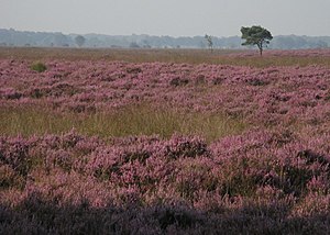
Dwingelderveld National Park is a national park of the Netherlands in the province of Drenthe, founded in 1991. The park covers about 37 km2 (14 sq mi) and is mainly managed by the State Forest Service (Staatsbosbeheer) and the most important Dutch private nature management organisation Natuurmonumenten. It is the largest wet heathland of Western-Europe.
Weather in this IP's area
overcast clouds
6 Celsius
3 Celsius
6 Celsius
7 Celsius
1027 hPa
96 %
1027 hPa
1025 hPa
10000 meters
4.2 m/s
8.2 m/s
204 degree
100 %
