195.167.138.222 - IP Lookup: Free IP Address Lookup, Postal Code Lookup, IP Location Lookup, IP ASN, Public IP
Country:
Region:
City:
Location:
Time Zone:
Postal Code:
IP information under different IP Channel
ip-api
Country
Region
City
ASN
Time Zone
ISP
Blacklist
Proxy
Latitude
Longitude
Postal
Route
Luminati
Country
Region
eng
City
hackney
ASN
Time Zone
Europe/London
ISP
Telcom Networks Limited
Latitude
Longitude
Postal
IPinfo
Country
Region
City
ASN
Time Zone
ISP
Blacklist
Proxy
Latitude
Longitude
Postal
Route
IP2Location
195.167.138.222Country
Region
england
City
haydon bridge
Time Zone
Europe/London
ISP
Language
User-Agent
Latitude
Longitude
Postal
db-ip
Country
Region
City
ASN
Time Zone
ISP
Blacklist
Proxy
Latitude
Longitude
Postal
Route
ipdata
Country
Region
City
ASN
Time Zone
ISP
Blacklist
Proxy
Latitude
Longitude
Postal
Route
Popular places and events near this IP address

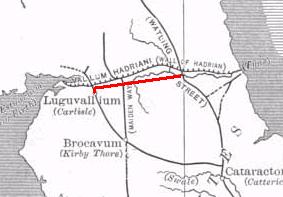
Stanegate
Roman road that ran from Carlisle to Corbridge, England
Distance: Approx. 4076 meters
Latitude and longitude: 55.00519,-2.28266
The Stanegate (meaning "stone road" in Northumbrian dialect) was an important Roman road and early frontier built in what is now northern England. It linked many forts including two that guarded important river crossings: Corstopitum (Corbridge) on the River Tyne in the east (situated on Dere Street) and Luguvalium (Carlisle) (on the River Eden) in the west. The Stanegate ran through the natural gap formed by the valleys of the River Tyne in Northumberland and the River Irthing in Cumbria.

Langley, Northumberland
Village in Northumberland, England
Distance: Approx. 3495 meters
Latitude and longitude: 54.948,-2.275
Langley or Langley-on-Tyne is a small village in Northumberland, England, located to the west of Hexham. The village is on the A686 about 3 miles (5 km) south of Haydon Bridge. The skyline of Langley on Tyne is still dominated by the lead smelting chimney with its underground flue leading to the old smelt works, now a sawmill, where the old tracks for the ore wagons can still be seen.

Haydon Bridge
Village in Northumberland, England
Distance: Approx. 212 meters
Latitude and longitude: 54.973,-2.247
Haydon Bridge is a village in Northumberland, England, which had a population of 2,184 in the 2011 census. Its most distinctive features are the two bridges crossing the River South Tyne: the picturesque original bridge after which the village was named (now restricted to pedestrian use) and a modern bridge which used to carry the A69 road. A bypass was completed in 2009 and the A69 now bypasses the village to the south.

Chesterwood
Hamlet in Northumberland, England
Distance: Approx. 1438 meters
Latitude and longitude: 54.9806,-2.267
Chesterwood is a hamlet in Northumberland, in England. It is situated a short distance to the north-west of Haydon Bridge on the South Tyne, west of Hexham. It includes a number of "Bastle Houses" from the 17th Century, originally built to protect against raids by the Border Reivers.

Haydon Bridge railway station
Railway station in Northumberland, England
Distance: Approx. 51 meters
Latitude and longitude: 54.9752903,-2.2472059
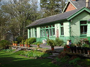
Haydon Bridge is a railway station on the Tyne Valley Line, which runs between Newcastle and Carlisle via Hexham. The station, situated 29 miles 68 chains (29.8 mi; 48.0 km) west of Newcastle, serves the village of Haydon Bridge in Northumberland, England. It is owned by Network Rail and managed by Northern Trains.

Langley Castle
Grade I listed castle in Langley, Northumberland, United Kingdom
Distance: Approx. 2244 meters
Latitude and longitude: 54.956,-2.259
Langley Castle is a restored medieval tower house, in the village of Langley in the valley of the River South Tyne. The castle is 3 miles (5 km) south of Haydon Bridge, in Northumberland, England. Langley Castle is a Grade I listed building.

River Allen, Northumberland
River in Northumberland, England
Distance: Approx. 4141 meters
Latitude and longitude: 54.9771,-2.3115
The River Allen is a river in the English county of Northumberland. The river has its sources in the hills of the Northern Pennines, and is formed by the confluence of the East and West Allen rivers. The Allen is itself, a tributary of the River Tyne.

Newbrough
Village in Northumberland, England
Distance: Approx. 4596 meters
Latitude and longitude: 55.0055,-2.1985
Newbrough (pronounced “Newbruff”) is a village in Northumberland, England, on the north bank of the River South Tyne about 5 miles (8 km) north-west of Hexham.
Elrington Halt railway station
Disused railway station in Northumberland, England
Distance: Approx. 2267 meters
Latitude and longitude: 54.9647,-2.2161
Elrington Halt station is a closed stone-built railway station situated on a single-track branch railway line in Northumberland, England, that runs from Allendale through the Border Counties Junction to Hexham.

Langley-on-Tyne railway station
Disused railway station in Northumberland, England
Distance: Approx. 3557 meters
Latitude and longitude: 54.9456,-2.269
Langley-on-Tyne is a closed stone built railway station situated on a single track branch railway line in Northumberland, England, that ran from Allendale through the Border Counties Junction to Hexham.
Haydon Bridge High School
Foundation school in Northumberland, England
Distance: Approx. 387 meters
Latitude and longitude: 54.97533,-2.25281
Haydon Bridge High School is a mixed secondary day school located in Haydon Bridge in the English county of Northumberland. The current headteacher is David Nisbet, who took over in September 2023. It is a foundation school administered by Northumberland County Council, It is claimed to have the largest catchment area of any school in England, reputedly covering an area larger than that encompassed by the M25, the orbital motorway around London.
Allerwash railway station
Short-lived railway station in Allerwash, Northumberland
Distance: Approx. 3363 meters
Latitude and longitude: 54.994,-2.206
Allerwash railway station served the hamlet of Allerwash, Northumberland, England from 1836 to 1837 on the Newcastle and Carlisle Railway.
Weather in this IP's area
overcast clouds
10 Celsius
8 Celsius
5 Celsius
10 Celsius
1026 hPa
96 %
1026 hPa
1018 hPa
10000 meters
2.5 m/s
8.46 m/s
236 degree
100 %