195.158.247.244 - IP Lookup: Free IP Address Lookup, Postal Code Lookup, IP Location Lookup, IP ASN, Public IP
Country:
Region:
City:
Location:
Time Zone:
Postal Code:
IP information under different IP Channel
ip-api
Country
Region
City
ASN
Time Zone
ISP
Blacklist
Proxy
Latitude
Longitude
Postal
Route
Luminati
Country
ASN
Time Zone
Europe/Warsaw
ISP
Marshal's Office of the Podkarpackie Province
Latitude
Longitude
Postal
IPinfo
Country
Region
City
ASN
Time Zone
ISP
Blacklist
Proxy
Latitude
Longitude
Postal
Route
IP2Location
195.158.247.244Country
Region
podkarpackie
City
nowe miasto
Time Zone
Europe/Warsaw
ISP
Language
User-Agent
Latitude
Longitude
Postal
db-ip
Country
Region
City
ASN
Time Zone
ISP
Blacklist
Proxy
Latitude
Longitude
Postal
Route
ipdata
Country
Region
City
ASN
Time Zone
ISP
Blacklist
Proxy
Latitude
Longitude
Postal
Route
Popular places and events near this IP address

Rzeszów
City in Podkarpackie Voivodeship, Poland
Distance: Approx. 1304 meters
Latitude and longitude: 50.03333333,22
Rzeszów (US: ZHESH-oof, -uuf, Polish: [ˈʐɛʂuf] ) is the largest city in southeastern Poland. It is located on both sides of the Wisłok River in the heartland of the Sandomierz Basin. Rzeszów is the capital of the Subcarpathian Voivodeship and the seat of Rzeszów County.

Rzeszów Voivodeship
Former administrative division of Poland
Distance: Approx. 2045 meters
Latitude and longitude: 50.038515,21.993477
Rzeszów Voivodeship (Polish: województwo rzeszowskie) can refer to one of two political entities in Poland: Rzeszów Voivodeship (1) was a unit of administrative division and local government from 1975 to 1998, superseded by Podkarpackie Voivodeship. Major cities and towns included (population in 1995 in brackets): Its capital city, Rzeszów (160,300) Mielec (64,400), Łańcut (18.000). Rzeszów Voivodeship (2) was a unit of administrative division and local government in Poland from 1945 to 1975, superseded by Rzeszów (1), Przemyśl, Krosno and parts of Tarnów and Tarnobrzeg voivodeships.

Rzeszów County
County in Subcarpathian Voivodeship, Poland
Distance: Approx. 1170 meters
Latitude and longitude: 50.03361111,22.00472222
Rzeszów County (Polish: powiat rzeszowski) is a unit of territorial administration and local government (powiat) in Subcarpathian Voivodeship, south-eastern Poland. It came into being on January 1, 1999, as a result of the Polish local government reforms passed in 1998. Its administrative seat is the city of Rzeszów, although the city is not part of the county (it constitutes a separate city county).

Konarski Secondary School in Rzeszów
High school in Rzeszów, Poland
Distance: Approx. 1502 meters
Latitude and longitude: 50.0359,22.0013
The Konarski Secondary School (1. Liceum Ogólnokształcące w Rzeszowie im. Księdza Stanisława Konarskiego) is a coeducational public secondary school in Rzeszów, Poland.

University of Rzeszów
University in Rzeszów, Poland
Distance: Approx. 776 meters
Latitude and longitude: 50.03,22.01555556
The University of Rzeszów is a university in Rzeszów, Poland. The patron of the university is Saint Queen Jadwiga of Poland. It was officially established in 2001 by combining several older institutions in the city.
Roman Catholic Diocese of Rzeszów
Roman Catholic diocese in Poland
Distance: Approx. 1359 meters
Latitude and longitude: 50.013057,22.019616
The Diocese of Rzeszów (Latin: Dioecesis Rzeszoviensis) is a Latin Church diocese of the Catholic Church located in the city of Rzeszów in the ecclesiastical province of Przemyśl in Poland.
Rzeszów Główny railway station
Railway station in Rzeszów, Poland
Distance: Approx. 2132 meters
Latitude and longitude: 50.0428,22.0069
Rzeszów Główny (Polish for Rzeszów Main station) is a railway station of the southeastern Polish city of Rzeszów, and the biggest of the Subcarpathian Voivodeship. According to the classification of passenger stations in Poland, it belongs to Class B. The first station in Rzeszów was built in 1858 on the newly constructed line of the Galician Railway of Archduke Charles Louis from Kraków which eventually reached Lwów in 1861. The station was initially supposed to be located further outside the town to the north in the village of Zaczernie, however ultimately it was placed just north of the town square, creating a u-shaped bend on the railway.

Strug (river)
River in Poland
Distance: Approx. 2491 meters
Latitude and longitude: 50.00416667,21.99388889
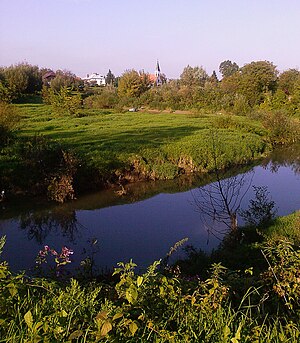
Strug is a river of Poland, a tributary of the Wisłok near Rzeszów.
Mikośka
River in Poland
Distance: Approx. 1841 meters
Latitude and longitude: 50.04,22.0158
Mikośka is a river of Poland, a tributary of the Wisłok in Rzeszów.

Rzeszów University of Technology
Distance: Approx. 1863 meters
Latitude and longitude: 50.027,21.98502778
Rzeszów University of Technology, also known as Rzeszów Polytechnic (Polish: Politechnika Rzeszowska im. Ignacego Łukasiewicza, PRz) or Ignacy Łukasiewicz University of Technology, is a state-run institution of higher education in Rzeszów, Poland. According to international ranking by the Webometrics Ranking of World Universities published by the Spanish institute Consejo Superior de Investigaciones Científicas, the university was ranked 14th among the technical universities in Poland and, internationally, at number 1,173 among all listed universities.

Rzeszów Castle
Historic site in in, Poland
Distance: Approx. 1181 meters
Latitude and longitude: 50.03222222,22.00055556
Rzeszów Castle is one of the main landmarks of Rzeszów. It was rebuilt between 1902 and 1906, and it is located on the former grounds of the castle of the House of Lubomirski. The castle is located between Aleja Pod Kasztanami and Aleja Lubomirski, Chopin Street, Śreniawitów Square, and Colonel Lis-Kula Street.

Hala Podpromie
Indoor arena in Poland
Distance: Approx. 1267 meters
Latitude and longitude: 50.0145,22.0004
Hala Podpromie im. Jana Strzelczyka is an indoor arena based in Rzeszów, Poland.
Weather in this IP's area
clear sky
2 Celsius
-2 Celsius
1 Celsius
4 Celsius
1010 hPa
93 %
1010 hPa
985 hPa
10000 meters
4.12 m/s
190 degree

