195.144.20.221 - IP Lookup: Free IP Address Lookup, Postal Code Lookup, IP Location Lookup, IP ASN, Public IP
Country:
Region:
City:
Location:
Time Zone:
Postal Code:
IP information under different IP Channel
ip-api
Country
Region
City
ASN
Time Zone
ISP
Blacklist
Proxy
Latitude
Longitude
Postal
Route
Luminati
Country
ASN
Time Zone
Europe/Budapest
ISP
Invitech ICT Services Kft.
Latitude
Longitude
Postal
IPinfo
Country
Region
City
ASN
Time Zone
ISP
Blacklist
Proxy
Latitude
Longitude
Postal
Route
IP2Location
195.144.20.221Country
Region
szabolcs-szatmar-bereg
City
zahony
Time Zone
Europe/Budapest
ISP
Language
User-Agent
Latitude
Longitude
Postal
db-ip
Country
Region
City
ASN
Time Zone
ISP
Blacklist
Proxy
Latitude
Longitude
Postal
Route
ipdata
Country
Region
City
ASN
Time Zone
ISP
Blacklist
Proxy
Latitude
Longitude
Postal
Route
Popular places and events near this IP address

Chop, Ukraine
City in Zakarpattia Oblast, Ukraine
Distance: Approx. 3224 meters
Latitude and longitude: 48.43333333,22.2
Chop (Ukrainian: Чоп, IPA: [tʃɔp] ; Hungarian: Csap; Slovak: Čop; Rusyn: Чоп; Yiddish: טשאָפּ) is a city located in Zakarpattia Oblast (province) of western Ukraine, near the borders of Slovakia and Hungary. It is separated from the Hungarian town of Záhony by the river Tisza, being situated on its right bank. It is located within Uzhhorod Raion.

Malé Trakany
Municipality of Slovakia
Distance: Approx. 4508 meters
Latitude and longitude: 48.4,22.11666667
Malé Trakany (Hungarian: Kistárkány) is a village and municipality in the Trebišov District in the Košice Region of south-eastern Slovakia.

Záhony
Place in Szabolcs-Szatmár-Bereg, Hungary
Distance: Approx. 998 meters
Latitude and longitude: 48.41666667,22.18333333
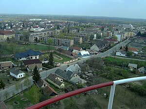
Záhony (Ukrainian: Загонь) is a town in Szabolcs-Szatmár-Bereg county, Northern Great Plain, eastern Hungary. It covers an area of 6.97 km2 (3 sq mi) and has a population of 4675 people (2005). It is near the Ukrainian border (at Chop and Solomonovo) and was part of Ung county before the Treaty of Trianon.
Zsurk
Place in Northern Great Plain, Hungary
Distance: Approx. 3008 meters
Latitude and longitude: 48.4111,22.2167
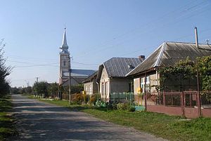
Zsurk is a village in Szabolcs-Szatmár-Bereg county, in the Northern Great Plain region of eastern Hungary. Zsurk is essentially a one-street, strip-filled settlement in the northern tip of Nyírség, on the left bank of the Tisa. It has only two neighbors on the Hungarian side of the border: Záhony on the west and Tiszaszentmárton on the south.
Tiszaszentmárton
Place in Northern Great Plain, Hungary
Distance: Approx. 5135 meters
Latitude and longitude: 48.38,22.23
Tiszaszentmárton is a village in Szabolcs-Szatmár-Bereg county, in the Northern Great Plain region of eastern Hungary. The settlement can be reached by road: on road 4 to Tuzsér, then to the left to Tiszabezdéd, from Záhony.

Tiszabezdéd
Place in Szabolcs-Szatmár-Bereg, Hungary
Distance: Approx. 5103 meters
Latitude and longitude: 48.36666667,22.15
Tiszabezdéd is a village in Szabolcs-Szatmár-Bereg county, in the Northern Great Plain region of eastern Hungary.
Győröcske
Place in Northern Great Plain, Hungary
Distance: Approx. 3205 meters
Latitude and longitude: 48.3853608,22.1515533
Győröcske is a small village in Szabolcs-Szatmár-Bereg county, in the Northern Great Plain region of eastern Hungary. It is next to the Slovak border (at Malé Trakany) and near the Ukrainian border (at Chop and Solomonovo) and was part of Ung county before the Treaty of Trianon.
Solomonovo
Village in Zakarpattia Oblast, Ukraine
Distance: Approx. 2553 meters
Latitude and longitude: 48.43055556,22.16388889
Solomonovo (Ukrainian: Соломоново; Hungarian: Tiszasalamon, Salamon) is a village in Uzhhorod Raion (district) of Zakarpattia Oblast (province) in western Ukraine. It is located 2 km (1.2 mi) west of the Chop railway station. It had a population of 1,342, according to the 2001 census.
Tysaashvan
Village in Zakarpattia Oblast, Ukraine
Distance: Approx. 5438 meters
Latitude and longitude: 48.42166667,22.24722222
Tysaashvan (Ukrainian: Тисаашвань; Hungarian: Tiszaásvány, Ásvány) is a village located in the Uzhhorod Raion (district) in the Zakarpattia Oblast (province) in western Ukraine. It was known as "Minieralnoye" between 1945–1995. It had a population of 852 according to the 2001 census.

Chop railway station
Railway station in Ukraine
Distance: Approx. 3509 meters
Latitude and longitude: 48.43280556,22.20741667
Chop (Ukrainian: Чоп, Hungarian: Csap) is a railway station that is located in a small city of Chop, Zakarpattia Oblast in Ukraine. It is part of the Uzhhorod administration (Lviv Railways).

Chop–Tysa
Distance: Approx. 1126 meters
Latitude and longitude: 48.418431,22.170222
For the city, see Chop, Ukraine. Chop–Tysa is a land border crossing between Ukraine and Hungary on the Ukrainian side, near the village of Solomonovo, Uzhhorod Raion, Zakarpattia Oblast. The crossing is situated on Highway M06.

Záhony District
Districts of Hungary in Szabolcs-Szatmár-Bereg
Distance: Approx. 484 meters
Latitude and longitude: 48.40478454,22.17691832
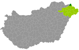
Záhony (Hungarian: Záhonyi járás) is a district in northern part of Szabolcs-Szatmár-Bereg County. Záhony is also the name of the town where the district seat is found. The district is located in the Northern Great Plain Statistical Region.
Weather in this IP's area
overcast clouds
2 Celsius
-3 Celsius
2 Celsius
2 Celsius
1023 hPa
75 %
1023 hPa
1010 hPa
10000 meters
5.72 m/s
10.54 m/s
349 degree
98 %
