Country:
Region:
City:
Latitude and Longitude:
Time Zone:
Postal Code:
IP information under different IP Channel
ip-api
Country
Region
City
ASN
Time Zone
ISP
Blacklist
Proxy
Latitude
Longitude
Postal
Route
Luminati
Country
Region
md
City
madrid
ASN
Time Zone
Europe/Madrid
ISP
SEWAN SAS
Latitude
Longitude
Postal
IPinfo
Country
Region
City
ASN
Time Zone
ISP
Blacklist
Proxy
Latitude
Longitude
Postal
Route
db-ip
Country
Region
City
ASN
Time Zone
ISP
Blacklist
Proxy
Latitude
Longitude
Postal
Route
ipdata
Country
Region
City
ASN
Time Zone
ISP
Blacklist
Proxy
Latitude
Longitude
Postal
Route
Popular places and events near this IP address

Cajal Institute
Research center in Spain
Distance: Approx. 473 meters
Latitude and longitude: 40.44833333,-3.68027778
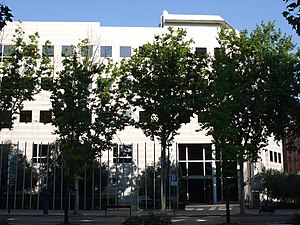
The Cajal Institute (IC) is a research center in neurobiology which belongs to the Spanish National Research Council (CSIC). The IC originates from the Laboratorio de Investigaciones Biológicas, founded in 1900 by order of King Alfonso XIII on the occasion of the Moscow Prize to Santiago Ramón y Cajal (1852–1934). Following Cajal's award of the Nobel Prize in Physiology and Medicine in 1906 and the 1907 creation of the Junta de Ampliación de Estudios, Cajal was appointed President of the Junta.

National Auditorium of Music
Distance: Approx. 539 meters
Latitude and longitude: 40.44583333,-3.6775
The Auditorio Nacional de Música (National Auditorium of Music) is a complex of concert venues located in Madrid, Spain and the main concert hall in the Madrid metropolitan area. It comprises two main concert rooms: a symphonic hall and a chamber music hall.
International Olive Council
Intergovernmental organization
Distance: Approx. 330 meters
Latitude and longitude: 40.44805556,-3.67777778
The International Olive Council (IOC) (formerly the International Olive Oil Council (IOOC)) is an intergovernmental organization of states that produce olives or products derived from olives, such as olive oil. The organization's members account for more than 98% of global olive production. The IOC's headquarters are in Madrid, Spain.

Prosperidad (Madrid Metro)
Madrid Metro station
Distance: Approx. 693 meters
Latitude and longitude: 40.4441899,-3.6748168
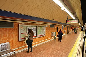
Prosperidad [pɾospeɾiˈðað] is a station on Line 4 of the Madrid Metro, located under the Plaza Prosperidad ("Prosperity Square").
Alfonso XIII (Madrid Metro)
Madrid Metro station
Distance: Approx. 678 meters
Latitude and longitude: 40.4482482,-3.6679119
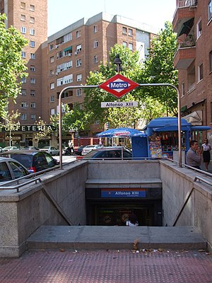
Alfonso XIII [alˈfonso ˈtɾeθe] is a station on Line 4 of the Madrid Metro, located near the Avenida de Alfonso XIII ("Alfonso XIII Avenue", called the same as the one that inaugurated the Metro in 1919 (1919)).

Colombia (Madrid Metro)
Madrid Metro station
Distance: Approx. 672 meters
Latitude and longitude: 40.4563406,-3.6768255
Colombia [koˈlombja] is a station on Line 8 and Line 9 of the Madrid Metro, located under the calle de Colombia.

Concha Espina (Madrid Metro)
Madrid Metro station
Distance: Approx. 188 meters
Latitude and longitude: 40.4505065,-3.6776132
Concha Espina [ˈkontʃa esˈpina] is a station on Line 9 of the Madrid Metro. It is located in fare Zone A. It is named after the Spanish writer Concha Espina (1870s–1955).

Cruz del Rayo (Madrid Metro)
Madrid Metro station
Distance: Approx. 723 meters
Latitude and longitude: 40.4442694,-3.6782139
Cruz del Rayo [ˈkɾuθ ðel ˈraʝo] is a station on Line 9 of the Madrid Metro, named for the Colonia Cruz del Rayo, a planned suburb.

Deutsche Schule Madrid
School
Distance: Approx. 411 meters
Latitude and longitude: 40.4513,-3.6801
Deutsche Schule Madrid (DSM: Spanish: Colegio Alemán Madrid) is a German international school in Madrid, Spain. It includes both the primary and secondary levels, ending with the Abitur. The German international school in Madrid used to be located at Avenida Concha Espina 32 in 28016 Madrid.

Prosperidad (Madrid)
City neighborhood in Madrid, Community of Madrid, Spain
Distance: Approx. 755 meters
Latitude and longitude: 40.445,-3.67
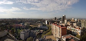
Prosperidad is an administrative neighborhood of Madrid belonging to the district of Chamartín. Its boundaries are: to the west the street Príncipe de Vergara, south: the Calle de María de Molina and Avenida de América, east: the M-30 and north: the street Lopez de Hoyos (one of the longest streets city noted for its great commercial activity.) Padre Claret street and avenue Ramon y Cajal.1 It has an area of 1.043284 km2 (0.402814 sq mi). As of 1 March 2020, it has a population of 37,018.

Ciudad Jardín (Madrid)
Ward of Madrid in Madrid, Spain
Distance: Approx. 498 meters
Latitude and longitude: 40.44694444,-3.67166667
Ciudad Jardín (Garden City) is an administrative neighborhood (barrio) of Madrid belonging to the district of Chamartín. It is located between Calle Príncipe de Vergara, Avenida Ramón y Cajal and Calle López de Hoyos, the latter being one of the longest streets in the city and well known for its great commercial activity. It has an area of 0.762371 km2 (0.294353 sq mi).

Hispanoamérica
City neighborhood in Madrid, Community of Madrid, Spain
Distance: Approx. 584 meters
Latitude and longitude: 40.45555556,-3.67666667
Hispanoamérica is an administrative neighborhood (barrio) of Madrid belonging to the district of Chamartín. It has an area of 1.707406 km2 (0.659233 sq mi). As of 1 March 2020, it has a population of 32,181.
Weather in this IP's area
broken clouds
13 Celsius
12 Celsius
12 Celsius
14 Celsius
1020 hPa
80 %
1020 hPa
937 hPa
10000 meters
3.6 m/s
100 degree
75 %
08:01:21
17:57:36

