Country:
Region:
City:
Latitude and Longitude:
Time Zone:
Postal Code:
IP information under different IP Channel
ip-api
Country
Region
City
ASN
Time Zone
ISP
Blacklist
Proxy
Latitude
Longitude
Postal
Route
Luminati
Country
ASN
Time Zone
Europe/Zurich
ISP
Init7 (Switzerland) Ltd.
Latitude
Longitude
Postal
IPinfo
Country
Region
City
ASN
Time Zone
ISP
Blacklist
Proxy
Latitude
Longitude
Postal
Route
db-ip
Country
Region
City
ASN
Time Zone
ISP
Blacklist
Proxy
Latitude
Longitude
Postal
Route
ipdata
Country
Region
City
ASN
Time Zone
ISP
Blacklist
Proxy
Latitude
Longitude
Postal
Route
Popular places and events near this IP address

Dübendorf
Municipality in Zürich, Switzerland
Distance: Approx. 1012 meters
Latitude and longitude: 47.41666667,8.61666667
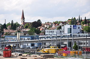
Dübendorf is a municipality in the district of Uster in the canton of Zürich in Switzerland. It is a suburb of Zürich in Switzerland with a population of about 30,000 (2021). It is the fourth largest city in the canton, after Zürich, Winterthur, and Uster.

Wallisellen
Municipality in Zürich, Switzerland
Distance: Approx. 2231 meters
Latitude and longitude: 47.41666667,8.6
Wallisellen is a municipality in the district of Bülach in the canton of Zürich in Switzerland, and belongs to the Glatt Valley (German: Glattal).

Dietlikon
Municipality in Zurich, Switzerland
Distance: Approx. 1012 meters
Latitude and longitude: 47.41666667,8.61666667
Dietlikon is a municipality in the district of Bülach in the canton of Zürich in Switzerland, and belongs to the Glatt Valley (German: Glattal).

Nürensdorf
Municipality in Zurich, Switzerland
Distance: Approx. 1527 meters
Latitude and longitude: 47.43333333,8.63333333
Nürensdorf is a municipality in the district of Bülach in the canton of Zürich in Switzerland.

Wangen-Brüttisellen
Municipality in Zurich, Switzerland
Distance: Approx. 1605 meters
Latitude and longitude: 47.41666667,8.65
Wangen-Brüttisellen is a municipality in the district of Uster in the canton of Zürich in Switzerland, located in the Glatt Valley (German: Glattal).
Swiss Federal Laboratories for Materials Science and Technology
Swiss federal research institute
Distance: Approx. 2389 meters
Latitude and longitude: 47.4022,8.6113
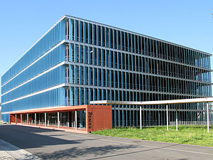
The Swiss Federal Laboratories for Materials Science and Technology (Empa; German: Eidgenössische Materialprüfungs- und Forschungsanstalt, French: Laboratoire fédéral d’essai des matériaux et de recherche, Italian: Laboratorio federale di prova dei materiali e di ricerca, Romansh: Institut federal da controlla da material e da perscrutaziun,) is a Swiss research institution for application-oriented materials science and technology. It has three locations – Dübendorf, St. Gallen and Thun.

Swiss Federal Institute of Aquatic Science and Technology
Swiss federal research institute
Distance: Approx. 2327 meters
Latitude and longitude: 47.403781,8.609558
The Swiss Federal Institute of Aquatic Science and Technology (Eawag, German acronym for Eidgenössische Anstalt für Wasserversorgung, Abwasserreinigung und Gewässerschutz) is a Swiss water research institute and an internationally networked institution. As part of the Swiss Federal Institutes of Technology Domain, it is an institution of the Federal Department of Home Affairs of the Swiss Confederation. The Eawag is based in Dübendorf near Zurich and Kastanienbaum near Lucerne.

Dübendorf railway station
Railway station in Canton of Zürich, Switzerland
Distance: Approx. 2268 meters
Latitude and longitude: 47.39998,8.622943
Dübendorf is a railway station in the Swiss canton of Zurich. It is situated in the municipality of Dübendorf on the Wallisellen–Uster–Rapperswil line.

Dietlikon railway station
Railway station in Switzerland
Distance: Approx. 728 meters
Latitude and longitude: 47.4205,8.61961111
Dietlikon railway station (German: Bahnhof Dietlikon) is a railway station in the Swiss canton of Zürich and municipality of Dietlikon (Glatt Valley). The station is located on the Zürich to Winterthur railway line. The station has a side platform and a central platform, providing three platform faces and serving all three tracks passing through the station.
Bassersdorf railway station
Railway station in the canton of Zürich, Switzerland
Distance: Approx. 2062 meters
Latitude and longitude: 47.438335,8.626564
Bassersdorf is a railway station in the Swiss canton of Zurich and the municipality of Bassersdorf. The station is located on the Zurich to Winterthur main line, to the east of where the Zürich Airport and Kloten lines diverge. It is an intermediate stop on the Zurich S-Bahn services S7 and S24.

Richti Wallisellen
Mixed-use development in Wallisellen, Switzerland
Distance: Approx. 2848 meters
Latitude and longitude: 47.408901,8.59509
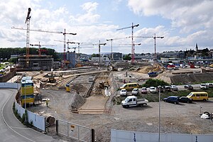
Richti Wallisellen is a mixed-use development (residential, commercial, offices) on former industrial land situated between Wallisellen railway station and the 1970s-era Glattzentrum indoor shopping mall. The master plan of the new complex was designed by architect Vittorio Magnago Lampugnani on a model of an Italian city center. Richti Wallisellen is made of six five-storey high buildings and one 72-meter-high glass high-rise.

Dübendorf Air Base
Military airfield in Switzerland
Distance: Approx. 2762 meters
Latitude and longitude: 47.39861111,8.64805556
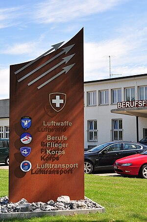
Dübendorf Military Airport (German: Militärflugplatz Dübendorf) (ICAO: LSMD) was a military airfield of the Swiss Air Force northeast of Dübendorf in Switzerland, located east of Zürich.
Weather in this IP's area
overcast clouds
10 Celsius
9 Celsius
10 Celsius
12 Celsius
1027 hPa
80 %
1027 hPa
974 hPa
10000 meters
1.03 m/s
100 %
07:12:26
17:05:35
