Country:
 Bosnia & Herzegovina
Region:
City:
Latitude and Longitude:
Time Zone:
Postal Code:
IP information under different IP Channel
ip-api
Country
Region
City
ASN
Time Zone
ISP
Blacklist
Proxy
Latitude
Longitude
Postal
Route
IPinfo
Country
Region
City
ASN
Time Zone
ISP
Blacklist
Proxy
Latitude
Longitude
Postal
Route
MaxMind
Country
Region
City
ASN
Time Zone
ISP
Blacklist
Proxy
Latitude
Longitude
Postal
Route
Luminati
Country
BARegion
bih
City
sarajevo
ASN
Time Zone
Europe/Sarajevo
ISP
University of Sarajevo
Latitude
Longitude
Postal
db-ip
Country
Region
City
ASN
Time Zone
ISP
Blacklist
Proxy
Latitude
Longitude
Postal
Route
ipdata
Country
Region
City
ASN
Time Zone
ISP
Blacklist
Proxy
Latitude
Longitude
Postal
Route
Popular places and events near this IP address

Siege of Sarajevo
Battle of the Bosnian War (1992–1996)
Distance: Approx. 341 meters
Latitude and longitude: 43.8476,18.3564
The Siege of Sarajevo (Serbo-Croatian: Opsada Sarajeva) was a prolonged blockade of Sarajevo, the capital of Bosnia and Herzegovina, during the Bosnian War. After it was initially besieged by the forces of the Yugoslav People's Army, the city was then besieged by the Army of Republika Srpska. Lasting from 5 April 1992 to 29 February 1996 (1,425 days), it was three times longer than the Battle of Stalingrad, more than a year longer than the siege of Leningrad, and was the longest siege of a capital city in the history of modern warfare.

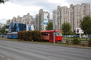
Novi Grad, Sarajevo
Municipality in Federation of Bosnia and Herzegovina, Bosnia and Herzegovina
Distance: Approx. 1036 meters
Latitude and longitude: 43.84888889,18.37111111
Novi Grad (Serbian Cyrillic: Нови Град, pronounced [nôʋiː grâːd]; lit. "New Town") is a municipality of the city of Sarajevo, Bosnia and Herzegovina. It is the westernmost of the four municipalities that make up the city of Sarajevo.

Bosmal City Center
Skyscraper in Sarajevo, Bosnia and Herzegovina
Distance: Approx. 1237 meters
Latitude and longitude: 43.8466,18.3745
The Bosmal City Center (BCC) (Bosnian, Croatian and Serbian: Bosmalov gradski centar / Босмалов градски центар) is a business and residential tower located in Sarajevo, Bosnia and Herzegovina. Standing 118 m (387 ft) high, it is the second tallest residential building in the Balkans. In addition to apartment units, the complex houses several amenities, including restaurants, salons, and shops.
High Judicial and Prosecutorial Council of Bosnia and Herzegovina
National council of the judiciary of Bosnia and Herzegovina
Distance: Approx. 563 meters
Latitude and longitude: 43.84475,18.36617
The High Judicial and Prosecutorial Council of Bosnia and Herzegovina (HJPC BiH) (Bosnian: Visoko sudsko i tužilačko vijeće BiH, VSTV BiH) is the national council of the judiciary of Bosnia and Herzegovina. It is the self-regulatory body of the judiciary in the country, tasked with guaranteeing its independence, with countrywide competences over the administration and career management of judicial office holders. It is based on the continental tradition of self-management of the judiciary.
Alipašino polje
Neighbourhood in Federation of Bosnia and Herzegovina, Bosnia and Herzegovina
Distance: Approx. 925 meters
Latitude and longitude: 43.842975,18.34813333
Alipašino polje (Serbian Cyrillic: Алипашино поље, lit. "Ali Pasha's Field") is a neighbourhood in Sarajevo, Bosnia and Herzegovina, located in the Sarajevo municipality of Novi Grad. It consists of three sub-neighborhoods: Faza A, Faza B, and Faza C, which include six local communities.

Court of Bosnia and Herzegovina
Distance: Approx. 614 meters
Latitude and longitude: 43.8447,18.3668
The Court of Bosnia and Herzegovina (Serbo-Croatian: Sud Bosne i Hercegovine, Cyrillic: Суд Босне и Херцеговине; abbreviated as the Court of BiH in English) is the highest ordinary court of Bosnia and Herzegovina. It was established on 3 July 2002 by the Parliament of Bosnia and Herzegovina with the Law on the Court of BiH, promulgated on 12 November 2000 by the High Representative for Bosnia and Herzegovina. The Court of Bosnia and Herzegovina, which is based in Sarajevo (88 Kraljice Jelene street) was necessary to provide for judicial protection in the matters that under the Constitution of Bosnia and Herzegovina fall under the jurisdiction of the Court of BiH, such as fight against terrorism, war crimes, human trafficking, organized and economic crimes.
Baitus Salam Mosque, Sarajevo
Mosque in Sarajevo, Bosnia and Herzegovina
Distance: Approx. 1002 meters
Latitude and longitude: 43.85369444,18.36369444
The Baitus Salam (House of Peace) is a mosque in Sarajevo run by the Ahmadiyya Muslim Community (AMJ) in Bosnia and Herzegovina.
Otoka, Sarajevo
Neighbourhood in Federation of Bosnia and Herzegovina, Bosnia and Herzegovina
Distance: Approx. 141 meters
Latitude and longitude: 43.845,18.3575
Otoka (Cyrillic: Отока) is a part of Novi Grad, Sarajevo, Bosnia and Herzegovina, located within the Federation of Bosnia and Herzegovina. It shares borders with the following neighborhoods: Čengić vila (East side), Aneks (South-East side), Švrakino Selo (South side). Its residential core represents a chain of high-rise buildings (Streets: Žrtava Fašizma, Brčanska, Aleja Lipa).

Olimpijski Bazen Otoka
Indoor water arena
Distance: Approx. 237 meters
Latitude and longitude: 43.84741667,18.35955556
Olimpijski Bazen Otoka is an indoor water arena in Sarajevo, Bosnia and Herzegovina. It is located in the Novi Grad district. Construction was finished in 2008, making it the first olympic sized swimming pool in Sarajevo.

Istiklal Mosque, Sarajevo
Mosque in Sarajevo, Bosnia and Herzegovina
Distance: Approx. 176 meters
Latitude and longitude: 43.84635,18.360833
Istiklal Mosque (Bosnian: Istiklal Džamija) is one of the largest mosques in Sarajevo, Bosnia and Herzegovina. It was named after Istiqlal Mosque, Jakarta, the national mosque of Indonesia, since the mosque was a gift from the Indonesian people and government for Bosnia and Herzegovina as a token of solidarity and friendship between the two nations. The name "istiqlal" is Arabic word for "independence", thus it is also meant to commemorate the independence of Bosnia and Herzegovina.

Čengić Vila
Neighbourhood in Sarajevo, Bosnia and Herzegovina
Distance: Approx. 925 meters
Latitude and longitude: 43.842975,18.34813333
Čengić vila (Cyrillic: Ченгић вила) is a neighbourhood in Sarajevo, Bosnia and Herzegovina. The neighborhood is a part of the Novo Sarajevo municipality. It is divided into the Čengić vila I and Čengić vila II units.
Timeline of Sarajevo
Distance: Approx. 341 meters
Latitude and longitude: 43.8476,18.3564
The following is a timeline of the history of the city of Sarajevo, Bosnia and Herzegovina.
Weather in this IP's area
broken clouds
12 Celsius
11 Celsius
12 Celsius
12 Celsius
1012 hPa
93 %
1012 hPa
952 hPa
10000 meters
1.54 m/s
290 degree
75 %
06:27:13
18:55:39