195.124.18.187 - IP Lookup: Free IP Address Lookup, Postal Code Lookup, IP Location Lookup, IP ASN, Public IP
Country:
Region:
City:
Location:
Time Zone:
Postal Code:
IP information under different IP Channel
ip-api
Country
Region
City
ASN
Time Zone
ISP
Blacklist
Proxy
Latitude
Longitude
Postal
Route
Luminati
Country
Region
nw
City
bochum
ASN
Time Zone
Europe/Berlin
ISP
UUNET
Latitude
Longitude
Postal
IPinfo
Country
Region
City
ASN
Time Zone
ISP
Blacklist
Proxy
Latitude
Longitude
Postal
Route
IP2Location
195.124.18.187Country
Region
nordrhein-westfalen
City
bochum
Time Zone
Europe/Berlin
ISP
Language
User-Agent
Latitude
Longitude
Postal
db-ip
Country
Region
City
ASN
Time Zone
ISP
Blacklist
Proxy
Latitude
Longitude
Postal
Route
ipdata
Country
Region
City
ASN
Time Zone
ISP
Blacklist
Proxy
Latitude
Longitude
Postal
Route
Popular places and events near this IP address

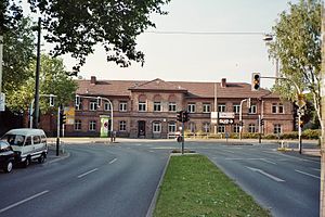
Bochum
City in Germany
Distance: Approx. 30 meters
Latitude and longitude: 51.48194444,7.21583333
Bochum (, BOHKH-uum; US: -əm; German: [ˈboːxʊm] ; Westphalian: Baukem) is a city in North Rhine-Westphalia. With a population of 372,348 (April 2023), it is the sixth-largest city (after Cologne, Düsseldorf, Dortmund, Essen and Duisburg) in North Rhine-Westphalia, one of the most populous German federal states, and the 16th-largest city in Germany. On the Ruhr Heights (Ruhrhöhen) hill chain, between the rivers Ruhr to the south and Emscher to the north (tributaries of the Rhine), it is the second largest city of Westphalia after Dortmund, and the fourth largest city of the Ruhr after Dortmund, Essen and Duisburg.

Bochum-Innenstadt
Distance: Approx. 18 meters
Latitude and longitude: 51.4818,7.2162
Innenstadt is a part of the city of Bochum in North Rhine-Westphalia, Germany including Gleisdreieck. It is located in the Ruhr area, the most populous German agglomeration. It includes the central business district of Bochum.

Hildegardis-Schule Bochum
Gymnasium school in Bochum, Germany
Distance: Approx. 986 meters
Latitude and longitude: 51.48611111,7.22833333
The Hildegardis-Schule is a secondary school in the city of Bochum, Germany.
Bochum Hauptbahnhof
Railway station for the city of Bochum in western Germany
Distance: Approx. 579 meters
Latitude and longitude: 51.478709,7.222827
Bochum Hauptbahnhof is a railway station for the city of Bochum in western Germany. In its current incarnation, it was built from 1955 to 1957 and is one of the most notable 1950s railway stations in Germany. The station underwent extensive remodeling and modernisation from 2004 to 2006 and was officially reopened on 29 May 2006.

Gymnasium am Ostring
School in Bochum, Germany
Distance: Approx. 659 meters
Latitude and longitude: 51.4815,7.2255
The Gymnasium am Ostring was the oldest gymnasium in Bochum. It was founded in 1860 and closed after the 2009-2010 school year. The school was located in downtown Bochum, near the main train station.
Rottstraße 5 Theater
Distance: Approx. 374 meters
Latitude and longitude: 51.47888889,7.21305556
Rottstraße 5 Theater is a theatre in Bochum, North Rhine-Westphalia, Germany.

German Mining Museum
Museum in Germany
Distance: Approx. 835 meters
Latitude and longitude: 51.48916667,7.21722222
The German Mining Museum in Bochum (German: Deutsches Bergbau-Museum Bochum) or DBM is one of the most visited museums in Germany with around 365,700 visitors per year (2012). It is the largest mining museum in the world, and a renowned research establishment for mining history. Above-ground exhibitions, and a faithfully reconstructed show mine below the museum terrain give visitors insights into the world of mining.

Bochum-Nord station
Railway station in Bochum, Germany
Distance: Approx. 654 meters
Latitude and longitude: 51.48277778,7.22527778
Bochum Nord station was a station on the Ostring (east ring) in the city of Bochum in the German state of North Rhine-Westphalia. It was built by the Rhenish Railway Company between 1871 and 1874 and opened on 15 October 1874. The station, which was originally called Bochum Rheinisch ("Rhenish") station, for a long time served passenger and freight traffic on the Osterath–Dortmund Süd railway.

Anneliese Brost Musikforum Ruhr
Distance: Approx. 474 meters
Latitude and longitude: 51.4775,7.21486
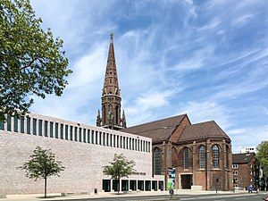
The Anneliese Brost Musikforum Ruhr is a music hall for classical music. It is located in Bochum, Germany. It was opened on 28 October 2016.

Technische Hochschule Georg Agricola
Distance: Approx. 672 meters
Latitude and longitude: 51.4875,7.21333333
The Technische Hochschule Georg Agricola (THGA, formerly also known as FH Bergbau and TFH Bochum) is a state-accredited, private university of applied sciences based in Bochum, Germany. It was founded in 1816 as a Bergschule (mining school) to train mining officials and mining foremen (Steiger) and, in the 20th century, grew into an engineering college and later a university. It has borne the name of the polymath and mining pioneer Georgius Agricola since 1995.

Im Winkel
Street in Bochum, Germany
Distance: Approx. 487 meters
Latitude and longitude: 51.482248,7.209024
Im Winkel, together with Gußstahlstraße, has been the red-light district of Bochum, Germany, since the early part of the 20th century. The local names for the street are "Eierberg", "Gurke" (cucumber, due to its length), "Riemenschleifer" (belt-grinder) or "Riemenwalzwerk" (belt rolling mill).

Bochum-West station
Railway station in North Rhine-Westphalia, Germany
Distance: Approx. 313 meters
Latitude and longitude: 51.481247,7.211543
Bochum-West station (German: Haltepunkt Bochum-West) is a railway station in the municipality of Bochum, North Rhine-Westphalia, Germany. The station has a single side platform, and is situated on the Glückauf-Bahn line between Bochum and Gelsenkirchen.
Weather in this IP's area
light rain
8 Celsius
7 Celsius
7 Celsius
8 Celsius
1000 hPa
89 %
1000 hPa
987 hPa
10000 meters
1.34 m/s
5.36 m/s
247 degree
100 %
