Country:
 Czech Republic
Region:
City:
Latitude and Longitude:
Time Zone:
Postal Code:
IP information under different IP Channel
ip-api
Country
Region
City
ASN
Time Zone
ISP
Blacklist
Proxy
Latitude
Longitude
Postal
Route
IPinfo
Country
Region
City
ASN
Time Zone
ISP
Blacklist
Proxy
Latitude
Longitude
Postal
Route
MaxMind
Country
Region
City
ASN
Time Zone
ISP
Blacklist
Proxy
Latitude
Longitude
Postal
Route
Luminati
Country
CZRegion
31
City
strakonice
ASN
Time Zone
Europe/Prague
ISP
Arelion Sweden AB
Latitude
Longitude
Postal
db-ip
Country
Region
City
ASN
Time Zone
ISP
Blacklist
Proxy
Latitude
Longitude
Postal
Route
ipdata
Country
Region
City
ASN
Time Zone
ISP
Blacklist
Proxy
Latitude
Longitude
Postal
Route
Popular places and events near this IP address

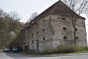
Strakonice
Town in Czech Republic
Distance: Approx. 682 meters
Latitude and longitude: 49.26138889,13.9025
Strakonice (Czech pronunciation: [ˈstrakoɲɪtsɛ]; German: Strakonitz) is a town in the South Bohemian Region of the Czech Republic. It has about 23,000 inhabitants.
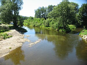
Volyňka
River in South Bohemian, Czech Republic
Distance: Approx. 731 meters
Latitude and longitude: 49.25861111,13.90444444
The Volyňka is a river in the Czech Republic, a right tributary of the Otava River. It flows through the South Bohemian Region. It is 46.1 km (28.6 mi) long.

Strakonice District
District in South Bohemian, Czech Republic
Distance: Approx. 1016 meters
Latitude and longitude: 49.26666667,13.9
Strakonice District (Czech: okres Strakonice) is a district in the South Bohemian Region of the Czech Republic. Its capital is the town of Strakonice.

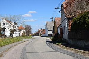
Droužetice
Municipality in South Bohemian, Czech Republic
Distance: Approx. 3446 meters
Latitude and longitude: 49.28916667,13.89805556
Droužetice is a municipality and village in Strakonice District in the South Bohemian Region of the Czech Republic. It has about 100 inhabitants. Droužetice lies approximately 4 kilometres (2 mi) north of Strakonice, 55 km (34 mi) north-west of České Budějovice, and 97 km (60 mi) south-west of Prague.
Mutěnice (Strakonice District)
Municipality in South Bohemian, Czech Republic
Distance: Approx. 2075 meters
Latitude and longitude: 49.23972222,13.89666667
Mutěnice is a municipality and village in Strakonice District in the South Bohemian Region of the Czech Republic. It has about 300 inhabitants. Mutěnice lies approximately 3 kilometres (2 mi) south-west of Strakonice, 52 km (32 mi) north-west of České Budějovice, and 102 km (63 mi) south of Prague.

Pracejovice
Municipality in South Bohemian, Czech Republic
Distance: Approx. 3289 meters
Latitude and longitude: 49.25722222,13.84916667
Pracejovice (German: Pratzowitz) is a municipality and village in Strakonice District in the South Bohemian Region of the Czech Republic. It has about 300 inhabitants. Pracejovice lies approximately 4 kilometres (2 mi) west of Strakonice, 55 km (34 mi) north-west of České Budějovice, and 102 km (63 mi) south-west of Prague.

Radošovice (Strakonice District)
Municipality in South Bohemian, Czech Republic
Distance: Approx. 2796 meters
Latitude and longitude: 49.23333333,13.89861111
Radošovice is a municipality and village in Strakonice District in the South Bohemian Region of the Czech Republic. It has about 600 inhabitants. Radošovice lies approximately 4 kilometres (2 mi) south of Strakonice, 51 km (32 mi) north-west of České Budějovice, and 103 km (64 mi) south of Prague.

Řepice
Municipality in South Bohemian, Czech Republic
Distance: Approx. 3760 meters
Latitude and longitude: 49.28055556,13.93333333
Řepice (German: Repitz) is a municipality and village in Strakonice District in the South Bohemian Region of the Czech Republic. It has about 500 inhabitants. Řepice lies approximately 4 kilometres (2 mi) north-east of Strakonice, 53 km (33 mi) north-west of České Budějovice, and 97 km (60 mi) south of Prague.
Sousedovice
Municipality in South Bohemian, Czech Republic
Distance: Approx. 3455 meters
Latitude and longitude: 49.23222222,13.86861111
Sousedovice is a municipality and village in Strakonice District in the South Bohemian Region of the Czech Republic. It has about 400 inhabitants. Sousedovice lies approximately 5 kilometres (3 mi) south-west of Strakonice, 53 km (33 mi) north-west of České Budějovice, and 104 km (65 mi) south-west of Prague.

Bažantnice u Pracejovic
Distance: Approx. 2015 meters
Latitude and longitude: 49.26027778,13.86683333
Bažantnice u Pracejovic is a nature reserve near Strakonice in the South Bohemian Region of the Czech Republic.

Tůně u Hajské
Distance: Approx. 3659 meters
Latitude and longitude: 49.25972222,13.94472222
Tůně u Hajské is natural monument close to the town Strakonice in Strakonice District, Czech Republic. The area is protected due to large amount of small pools in Otava River floodplain which were formed as a result of gold mining in the Middle Ages. These ponds are containing habitat of critically endangered aquatic plant Hottonia palustris and many representatives of amphibian species as Bufo bufo, Bufo viridis, Bombina bombina, Hyla arborea, Pelophylax esculentus and Rana ridibunda.
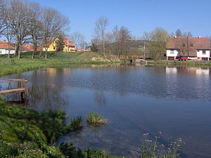
Střela (Strakonice)
Village
Distance: Approx. 3260 meters
Latitude and longitude: 49.26777778,13.85194444
Střela is a village, a local part of the town Strakonice in the district of Strakonice, the Czech Republic. It is located less than 4 km west of Strakonice; the Kolčavka stream flows through it, which feeds Střelský pond in the village and a few hundred meters further flows into the Otava river on the left. In the eastern extremity of the cadastral territory of Střela, there is also the old settlement of Virt, which is a separate registered part of the city and divides the local part of Střela into two parts.
Weather in this IP's area
clear sky
23 Celsius
23 Celsius
23 Celsius
24 Celsius
1012 hPa
63 %
1012 hPa
966 hPa
10000 meters
0.61 m/s
0.73 m/s
81 degree
7 %
06:31:10
19:33:14