194.98.51.121 - IP Lookup: Free IP Address Lookup, Postal Code Lookup, IP Location Lookup, IP ASN, Public IP
Country:
 France
Region:
City:
Location:
Time Zone:
Postal Code:
ISP:
ASN:
language:
User-Agent:
Proxy IP:
Blacklist:
IP information under different IP Channel
ip-api
Country
Region
City
ASN
Time Zone
ISP
Blacklist
Proxy
Latitude
Longitude
Postal
Route
db-ip
Country
Region
City
ASN
Time Zone
ISP
Blacklist
Proxy
Latitude
Longitude
Postal
Route
IPinfo
Country
Region
City
ASN
Time Zone
ISP
Blacklist
Proxy
Latitude
Longitude
Postal
Route
IP2Location
194.98.51.121Country
frRegion
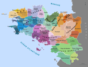
pays-de-la-loire
City
chateaubriant
Time Zone
Europe/Paris
ISP
Language
User-Agent
Latitude
Longitude
Postal
ipdata
Country
Region
City
ASN
Time Zone
ISP
Blacklist
Proxy
Latitude
Longitude
Postal
Route
Popular places and events near this IP address

Châteaubriant
Subprefecture and commune in Pays de la Loire, France
Distance: Approx. 634 meters
Latitude and longitude: 47.7178,-1.375
Châteaubriant (French: [ʃɑtobʁijɑ̃] ; Breton: Kastell-Briant; Gallo: Châtiaoberiant) is a town in western France, about 350 km (220 mi) southwest of Paris, and one of the three sous-préfectures of the Loire-Atlantique department. Châteaubriant is also situated in the historical and cultural region of Brittany, and it is the capital of the Pays de la Mée. A part of the traditional province of Brittany, Châteaubriant also lies on the threshold of Anjou, and it was an important stronghold in northwestern France during the Middle Ages.

Arrondissement of Châteaubriant
Former arrondissement in Pays de la Loire, France
Distance: Approx. 443 meters
Latitude and longitude: 47.72,-1.38
The arrondissement of Châteaubriant is a former arrondissement of France in the Loire-Atlantique department in the Pays de la Loire region. In January 2017 it was merged into the new arrondissement of Châteaubriant-Ancenis. It had 53 communes, and its population was 126,603 (2012).

Noyal-sur-Brutz
Commune in Pays de la Loire, France
Distance: Approx. 7271 meters
Latitude and longitude: 47.7769,-1.3456
Noyal-sur-Brutz (French pronunciation: [nwajal syʁ bʁy] ; Breton: Noal-ar-Bruz) is a commune in the Loire-Atlantique department in western France.

Saint-Aubin-des-Châteaux
Commune in Pays de la Loire, France
Distance: Approx. 7630 meters
Latitude and longitude: 47.7208,-1.485
Saint-Aubin-des-Châteaux (French pronunciation: [sɛ̃.t‿obɛ̃ de ʃato] ; Breton: Sant-Albin-ar-C'hestell) is a commune in the Loire-Atlantique department in western France.

Erbray
Commune in Pays de la Loire, France
Distance: Approx. 8351 meters
Latitude and longitude: 47.6567,-1.3164
Erbray (French pronunciation: [ɛʁbʁɛ] ; Gallo: Aèrbraéy, Breton: Ervoreg) is a commune in the Loire-Atlantique department in western France.

Louisfert
Commune in Pays de la Loire, France
Distance: Approx. 5821 meters
Latitude and longitude: 47.6758,-1.4317
Louisfert (French pronunciation: [lwifɛʁ] ; Gallo: Lóifèrr, Breton: Lufer) is a commune in the Loire-Atlantique department in western France.

Soudan, Loire-Atlantique
Commune in Pays de la Loire, France
Distance: Approx. 6434 meters
Latitude and longitude: 47.7383,-1.3036
Soudan (French pronunciation: [sudɑ̃] ; Breton: Saoudan) is a commune in the Loire-Atlantique department in western France. The river Verzée rises in the north-western part of the commune, then flows eastward through its northern part; the river Chère rises in the southern part of the commune, then flows northwestward through its western part.
Pays de la Mée
Distance: Approx. 2241 meters
Latitude and longitude: 47.7,-1.4
The Pays de la Mée (French pronunciation: [pɛ.i də la me]; Breton: Bro-Vez; Gallo: Paeyi de la Mée) is a historical region of Brittany (now France) which was part of the Duchy of Brittany before the French Revolution. It was then split between Loire-Atlantique and Ille-et-Vilaine department. Its capital is Châteaubriant.

Château de Châteaubriant
Distance: Approx. 854 meters
Latitude and longitude: 47.72,-1.373
The Château de Châteaubriant is a medieval castle strongly modified during the Renaissance, located in the commune of Châteaubriant in the Loire-Atlantique département of France. The original castle was founded in the 11th century on the eastern border of Brittany and, such as the fortresses in Vitré, Fougères, Ancenis and Clisson, it was defending the duchy against Anjou and the Kingdom of France. The castle was renovated several times during the Middle Ages and the town of Châteaubriant developed at its side.

Canton of Châteaubriant
Distance: Approx. 443 meters
Latitude and longitude: 47.72,-1.38
The canton of Châteaubriant is an administrative division of the Loire-Atlantique department, western France. Its borders were modified at the French canton reorganisation which came into effect in March 2015. Its seat is in Châteaubriant.

Arrondissement of Châteaubriant-Ancenis
Arrondissement in Pays de la Loire, France
Distance: Approx. 2241 meters
Latitude and longitude: 47.7,-1.4
The arrondissement of Châteaubriant-Ancenis is an arrondissement of France in the Loire-Atlantique department in the Pays de la Loire region. It has 76 communes. Its population is 231,576 (2021), and its area is 3,157.4 km2 (1,219.1 sq mi).
1984 Châteaubriant shooting
Mass shooting in Châteaubriant, France
Distance: Approx. 634 meters
Latitude and longitude: 47.7178,-1.375
On 11 November 1984, a mass shooting occurred in Châteaubriant, France. 23-year-old far-right extremist Frédéric Boulay opened fire on Turkish migrant workers, killing two people and wounding five others before being apprehended. He was sentenced to life imprisonment in 1985.
Weather in this IP's area
overcast clouds
4 Celsius
3 Celsius
4 Celsius
4 Celsius
1020 hPa
89 %
1020 hPa
1011 hPa
10000 meters
1.46 m/s
1.91 m/s
48 degree
100 %