194.93.47.153 - IP Lookup: Free IP Address Lookup, Postal Code Lookup, IP Location Lookup, IP ASN, Public IP
Country:
Region:
City:
Location:
Time Zone:
Postal Code:
ISP:
ASN:
language:
User-Agent:
Proxy IP:
Blacklist:
IP information under different IP Channel
ip-api
Country
Region
City
ASN
Time Zone
ISP
Blacklist
Proxy
Latitude
Longitude
Postal
Route
db-ip
Country
Region
City
ASN
Time Zone
ISP
Blacklist
Proxy
Latitude
Longitude
Postal
Route
IPinfo
Country
Region
City
ASN
Time Zone
ISP
Blacklist
Proxy
Latitude
Longitude
Postal
Route
IP2Location
194.93.47.153Country
Region
andalucia
City
torrox
Time Zone
Europe/Madrid
ISP
Language
User-Agent
Latitude
Longitude
Postal
ipdata
Country
Region
City
ASN
Time Zone
ISP
Blacklist
Proxy
Latitude
Longitude
Postal
Route
Popular places and events near this IP address

Nerja
Municipality and town in Andalusia, Spain
Distance: Approx. 6660 meters
Latitude and longitude: 36.74694444,-3.87888889
Nerja (pronounced [ˈneɾxa]) is a municipality on the Costa del Sol in the province of Málaga in the autonomous community of Andalusia in southern Spain. It is part of the comarca of La Axarquía. It is on the country's southern Mediterranean coast, about 50 kilometres (31 mi) east of Málaga.

Torrox
Municipality in Andalusia, Spain
Distance: Approx. 903 meters
Latitude and longitude: 36.75,-3.95
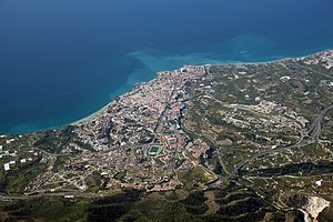
Torrox is a municipality in the province of Málaga in the autonomous community of Andalusia, southern Spain. It belongs to the comarca of Axarquía. It is located in the Costa del Sol (specifically the Costa del Sol Oriental), on the shores of the Mediterranean Sea and the foothills of the Sierra de Almijara.

Algarrobo, Spain
Municipality and town in Andalucía, Spain
Distance: Approx. 7292 meters
Latitude and longitude: 36.76666667,-4.03333333
Algarrobo is a town and municipality in the province of Málaga, part of the autonomous community of Andalusia in southern Spain. The municipality is situated in the coastal area of La Axarquía, 32 kilometers from the city of Málaga. It is bordered on the north by the municipality of Arenas and Sayalonga, to the east and west by Vélez-Málaga and to the south by the Mediterranean Sea.

Árchez
Municipality in Andalusia, Spain
Distance: Approx. 9639 meters
Latitude and longitude: 36.83888889,-3.99055556
Árchez is a small village in the province of Málaga, in southern Spain. The village is situated approximately 21 kilometres from Vélez Málaga. It has a population of approximately 408 residents, who are known as Archeros.

Cómpeta
Municipality in Andalucía, Spain
Distance: Approx. 8841 meters
Latitude and longitude: 36.83333333,-3.98333333
Cómpeta is a town and municipality in the comarca of Axarquía, and province of Málaga, part of the autonomous community of Andalusia in southern Spain. The municipality is situated approximately 18 kilometres from the coast (Costa del Sol), and 52 kilometres from Málaga, the provincial capital. It is situated at 638 metres above sea level in the foothills of La Maroma (the highest peak of the Sierra de Tejeda).
Frigiliana
Municipality in Andalucía, Spain
Distance: Approx. 5456 meters
Latitude and longitude: 36.78333333,-3.9
Frigiliana is a town and municipality in the province of Málaga, part of the autonomous community of Andalusia in southern Spain. The municipality is situated approximately 71 kilometers east of Málaga, the provincial capital, and approximately 6 kilometers north of Nerja. It is located in the comarca of La Axarquía, the easternmost region of the province, and integrated into the judicial district of Torrox.

Sayalonga
Place in Andalusia, Spain
Distance: Approx. 7409 meters
Latitude and longitude: 36.8,-4.01666667
Sayalonga is a town and municipality in the province of Málaga, part of the autonomous community of Andalusia in southern Spain. It belongs to the comarca of La Axarquía. The municipality is situated approximately 38 kilometres from the capital of Málaga and 12 kilometres from Vélez Málaga.

Caves of Nerja
Cave and archaeological site in Spain
Distance: Approx. 9504 meters
Latitude and longitude: 36.76166667,-3.84583333
The Caves of Nerja (Spanish: Cueva de Nerja) are a series of caverns close to the town of Nerja in the Province of Málaga, Spain. Stretching for almost 5 kilometres (3.1 mi), the caverns are one of Spain's major tourist attractions. Concerts are regularly held in one of the chambers, which forms a natural amphitheatre.

Bentomiz Castle
Distance: Approx. 9651 meters
Latitude and longitude: 36.804028,-4.043956
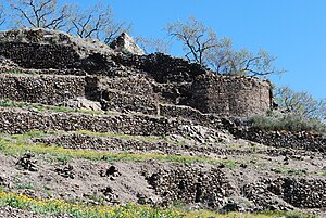
Bentomiz Castle is an ancient Moorish fortress built on a hill near the village of Arenas in the province of Málaga. It sits at a height of 711 metres (2,333 ft), and lies to the northeast of Vélez-Málaga. The castle site is thought to have been occupied by the Phoenicians, Greeks and Romans, although it is not clear which parts of the ruins date to which period.

Caleta de Velez
Place in Málaga, Spain
Distance: Approx. 9135 meters
Latitude and longitude: 36.7333,-4.05
Caleta de Vélez is a village in the Spanish province of Málaga, Andalusia. It belongs to Vélez-Málaga and it is in Axarquía. It is 35 kilometers away from Málaga.
Corumbela
Village in Andalusia, Spain
Distance: Approx. 8475 meters
Latitude and longitude: 36.821111,-4.005278
Corumbela is a village in the province of Málaga, Andalusia, Spain. The date of foundation is unknown, although it is believed that it was populated by Iberians. The name is Roman and means "dove".
Chíllar River
River in Andalusia, Spain
Distance: Approx. 6048 meters
Latitude and longitude: 36.741948,-3.887488
The Chíllar River is a river in the east of the Province of Málaga, Spain. It originates in the Sierra de Almijara and enters Mediterranean Sea just west of the town of Nerja.
Weather in this IP's area
clear sky
18 Celsius
17 Celsius
18 Celsius
18 Celsius
1015 hPa
51 %
1015 hPa
988 hPa
10000 meters
4.29 m/s
3.82 m/s
349 degree
8 %
