Country:
 France
Region:
City:
Latitude and Longitude:
Time Zone:
Postal Code:
IP information under different IP Channel
ip-api
Country
Region
City
ASN
Time Zone
ISP
Blacklist
Proxy
Latitude
Longitude
Postal
Route
IPinfo
Country
Region
City
ASN
Time Zone
ISP
Blacklist
Proxy
Latitude
Longitude
Postal
Route
MaxMind
Country
Region
City
ASN
Time Zone
ISP
Blacklist
Proxy
Latitude
Longitude
Postal
Route
Luminati
Country
FRRegion
ges
City
mirecourt
ASN
Time Zone
Europe/Paris
ISP
Ingecap Sarl
Latitude
Longitude
Postal
db-ip
Country
Region
City
ASN
Time Zone
ISP
Blacklist
Proxy
Latitude
Longitude
Postal
Route
ipdata
Country
Region
City
ASN
Time Zone
ISP
Blacklist
Proxy
Latitude
Longitude
Postal
Route
Popular places and events near this IP address

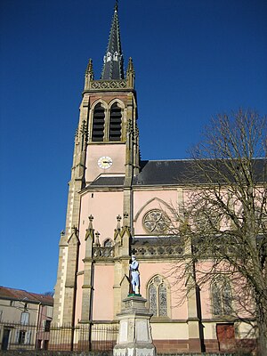
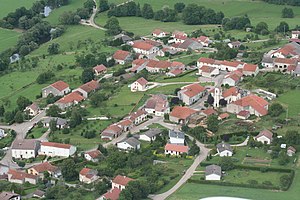
Mirecourt
Commune in Grand Est, France
Distance: Approx. 229 meters
Latitude and longitude: 48.302,6.1341
Mirecourt (French: [miʁkuʁ] ) is a commune in the Vosges department in Grand Est in northeastern France. Mirecourt is known for lace-making and the manufacture of musical instruments, particularly those of the violin family.
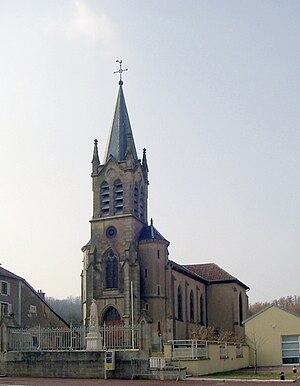
Mattaincourt
Commune in Grand Est, France
Distance: Approx. 2383 meters
Latitude and longitude: 48.2797,6.1336
Mattaincourt (French pronunciation: [matɛ̃kuʁ] ) is a commune in the Vosges department in Grand Est in northeastern France. Inhabitants are called Mattaincurtiens.
Mazirot
Commune in Grand Est, France
Distance: Approx. 2606 meters
Latitude and longitude: 48.3233,6.1475
Mazirot (French pronunciation: [maziʁo] ) is a commune in the Vosges department in Grand Est in northeastern France. Inhabitants are called Mazuriens.

Vroville
Commune in Grand Est, France
Distance: Approx. 3061 meters
Latitude and longitude: 48.2875,6.1728
Vroville (French pronunciation: [vʁɔvil] ) is a commune in the Vosges department in Grand Est in northeastern France.

Chauffecourt
Commune in Grand Est, France
Distance: Approx. 3751 meters
Latitude and longitude: 48.3331,6.1522
Chauffecourt (French pronunciation: [ʃofkuʁ] ) is a commune in the Vosges department in Grand Est in northeastern France.

Poussay
Commune in Grand Est, France
Distance: Approx. 2449 meters
Latitude and longitude: 48.3214,6.1244
Poussay (French pronunciation: [pusɛ] ) is a commune in the Vosges department in Grand Est in northeastern France. Inhabitants are called Porsuavitains (from the Latin version of Poussay, Portus Suavis).

Ramecourt, Vosges
Commune in Grand Est, France
Distance: Approx. 2906 meters
Latitude and longitude: 48.3114,6.1008
Ramecourt (French pronunciation: [ʁamkuʁ] ) is a commune in the Vosges department in Grand Est in northeastern France. Inhabitants are called Ramecurtiens.
Hymont
Commune in Grand Est, France
Distance: Approx. 3930 meters
Latitude and longitude: 48.2659,6.1425
Hymont (French pronunciation: [imɔ̃] ) is a commune in the Vosges department in Grand Est in northeastern France.
Villers, Vosges
Commune in Grand Est, France
Distance: Approx. 2752 meters
Latitude and longitude: 48.3025,6.1739
Villers is a commune in the Vosges department in Grand Est in northeastern France.
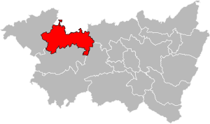
Canton of Mirecourt
Canton in Grand Est, France
Distance: Approx. 225 meters
Latitude and longitude: 48.3,6.13416667
The Canton of Mirecourt is a French administrative grouping of communes in the Vosges département of eastern France and in the region of Grand Est.

Musée de la Lutherie et de l'Archèterie françaises
Distance: Approx. 105 meters
Latitude and longitude: 48.3015,6.1356
Musée de la Lutherie et de l'Archèterie françaises is a museum in Mirecourt, Vosges, France. It is dedicated to the history of violin making.
Communauté de communes de Mirecourt Dompaire
Federation of municipalities in France
Distance: Approx. 3968 meters
Latitude and longitude: 48.28333333,6.18333333
The Communauté de communes de Mirecourt Dompaire is an administrative association of rural communes in the Vosges department of eastern France. It was created on 1 January 2017 by the merger of the former Communauté de communes du Pays de Mirecourt (which had absorbed the former Communauté de communes du Xaintois in January 2014), Communauté de communes du Secteur de Dompaire and 16 other communes. On 1 January 2018 it lost 2 communes to the Communauté d'agglomération d'Épinal.
Weather in this IP's area
light rain
14 Celsius
14 Celsius
14 Celsius
15 Celsius
1013 hPa
82 %
1013 hPa
982 hPa
10000 meters
4.12 m/s
220 degree
100 %
07:34:59
19:14:54