194.88.105.41 - IP Lookup: Free IP Address Lookup, Postal Code Lookup, IP Location Lookup, IP ASN, Public IP
Country:
Region:
City:
Location:
Time Zone:
Postal Code:
IP information under different IP Channel
ip-api
Country
Region
City
ASN
Time Zone
ISP
Blacklist
Proxy
Latitude
Longitude
Postal
Route
Luminati
Country
ASN
Time Zone
Europe/Amsterdam
ISP
WorldStream B.V.
Latitude
Longitude
Postal
IPinfo
Country
Region
City
ASN
Time Zone
ISP
Blacklist
Proxy
Latitude
Longitude
Postal
Route
IP2Location
194.88.105.41Country
Region
zuid-holland
City
naaldwijk
Time Zone
Europe/Amsterdam
ISP
Language
User-Agent
Latitude
Longitude
Postal
db-ip
Country
Region
City
ASN
Time Zone
ISP
Blacklist
Proxy
Latitude
Longitude
Postal
Route
ipdata
Country
Region
City
ASN
Time Zone
ISP
Blacklist
Proxy
Latitude
Longitude
Postal
Route
Popular places and events near this IP address

's-Gravenzande
Town in South Holland, Netherlands
Distance: Approx. 3035 meters
Latitude and longitude: 52,4.16666667
's-Gravenzande is a town in the province of South Holland, in the Netherlands. It is a part of the municipality of Westland, and lies about 12 kilometres (7.5 mi) southwest of The Hague. Until 2004 it was a separate municipality and covered an area of 20.77 km2 (of which 3.38 km2 water).

Naaldwijk
Town in South Holland, Netherlands
Distance: Approx. 355 meters
Latitude and longitude: 51.99305556,4.205
Naaldwijk (Dutch pronunciation: [ˈnaːltʋɛik]) is a town in the Dutch province of South Holland. It is a part of the municipality of Westland, and lies about 10 km (6 miles) southwest of The Hague. Naaldwijk lies in the heart of Westland.

Westland (municipality), Netherlands
Municipality in South Holland, Netherlands
Distance: Approx. 804 meters
Latitude and longitude: 52,4.21666667
Westland (Dutch pronunciation: [ˈʋɛstlɑnt] ) is a municipality in the western Netherlands, in the province of South Holland. It covers an area of 90.74 km2 (35.03 sq mi) of which 9.47 km2 (3.66 sq mi) is covered by water and had a population of 111,382 in 2021. Towns and other settlements: De Lier, 's-Gravenzande, Monster, Naaldwijk, Wateringen, Heenweg, Honselersdijk, Kwintsheul, Maasdijk, Poeldijk, and Ter Heijde.

Honselersdijk
Town in South Holland, Netherlands
Distance: Approx. 1735 meters
Latitude and longitude: 52,4.23333333
Honselersdijk is a town in the Dutch province of South Holland. It is home to the historic Huis Honselaarsdijk, former palatial estate of the Dutch Princes of Orange. Huis Honselaarsdijk was one of the finest examples of Baroque architecture and grounds in the history of The Netherlands.

Mariëndijk
Hamlet in South Holland, Netherlands
Distance: Approx. 2823 meters
Latitude and longitude: 52.01194444,4.23916667
Mariëndijk is a hamlet in the Dutch province of South Holland which lies on the border of Honselersdijk and the grounds of the former Paleis Honselersdijk Huis Honselaarsdijk. Today, the hamlet is a part of the municipality of the Westland. It is situated 1.6 km (0.99 mi) north of Naaldwijk, 6 km (3.7 mi) east of the beaches at Monster and Ter Heide, 2 km (1.2 mi) southwest of The Hague, 8 km (5.0 mi) west of Delft and 10 km (6.2 mi) northeast of Hook of Holland.

Rolpaal
Hamlet in South Holland, Netherlands
Distance: Approx. 2555 meters
Latitude and longitude: 52.01666667,4.21666667
Rolpaal is a hamlet in the Dutch province of South Holland. It is a part of the municipality of Westland, and lies about 9 km southwest of The Hague. The statistical area "Rolpaal", which also can include the surrounding countryside, has a population of around 40.

Heenweg
Village in South Holland, Netherlands
Distance: Approx. 2180 meters
Latitude and longitude: 51.98333333,4.18333333
Heenweg is a village in the Dutch province of South Holland. It is a part of the municipality of Westland, and lies about 7 km northwest of Maassluis. In 2001, the village of Heenweg had 601 inhabitants.

Nieuwe Tuinen
Hamlet in South Holland, Netherlands
Distance: Approx. 1838 meters
Latitude and longitude: 51.97861111,4.21916667
Nieuwe Tuinen is a hamlet in the Dutch province of South Holland. It is a part of the municipality of Westland, and lies about 5 km north of Maassluis.
Westerlee, South Holland
Hamlet in South Holland, Netherlands
Distance: Approx. 2466 meters
Latitude and longitude: 51.97305556,4.22111111
Westerlee is a hamlet in the Dutch province of South Holland. It is a part of the municipality of Westland, and lies about 5 km north of Maassluis. The statistical area "Westerlee", which also can include the surrounding countryside, has a population of around 70.
Naaldwijk, Sliedrecht
Distance: Approx. 294 meters
Latitude and longitude: 51.993,4.206
Naaldwijk is a former municipality in the Dutch province of South Holland. The municipality only existed from April 1, 1817, to August 23, 1818. Before and after that time, the area was part of Sliedrecht.
Westland (region), Netherlands
Distance: Approx. 1717 meters
Latitude and longitude: 52.00805556,4.22055556
Westland is a region of the Netherlands and lies in the western part of the Province of South Holland. It consists of the municipalities of Westland and Midden-Delfland, and also of the town of Hook of Holland (which is a part of the municipality of Rotterdam). Westland is well known for its horticulture in glasshouses, hence its nickname the glass city.

Maassluis Steendijkpolder metro station
Metro station in South Holland
Distance: Approx. 2042 meters
Latitude and longitude: 51.97905556,4.22694444
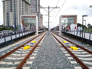
Steendijkpolder is a metro station on Line B of the Rotterdam Metro located in Maassluis, South Holland. The station entered regular service on 30 September 2019. Whereas located on the former Hoekse Lijn, converted from a railway, this is the only station of the line which never was a railway station and was constructed in 2019, when the railway was converted into rapid transit.
Weather in this IP's area
few clouds
4 Celsius
3 Celsius
2 Celsius
4 Celsius
1024 hPa
88 %
1024 hPa
1023 hPa
10000 meters
1.54 m/s
200 degree
20 %

