Country:
Region:
City:
Latitude and Longitude:
Time Zone:
Postal Code:
IP information under different IP Channel
ip-api
Country
Region
City
ASN
Time Zone
ISP
Blacklist
Proxy
Latitude
Longitude
Postal
Route
Luminati
Country
Region
13
City
vilanovadegaia
ASN
Time Zone
Europe/Lisbon
ISP
Nos Comunicacoes, S.A.
Latitude
Longitude
Postal
IPinfo
Country
Region
City
ASN
Time Zone
ISP
Blacklist
Proxy
Latitude
Longitude
Postal
Route
db-ip
Country
Region
City
ASN
Time Zone
ISP
Blacklist
Proxy
Latitude
Longitude
Postal
Route
ipdata
Country
Region
City
ASN
Time Zone
ISP
Blacklist
Proxy
Latitude
Longitude
Postal
Route
Popular places and events near this IP address

Military Academy (Portugal)
Distance: Approx. 105 meters
Latitude and longitude: 38.72305556,-9.13861111
The Military Academy (AM; Academia Militar in Portuguese) is a Portuguese military establishment, which has the ability to confer educational qualifications equivalent to a university. It develops activities of teaching, research and support for the communities with the purpose of training and forming officers for the Portuguese Army and the Republican National Guard.

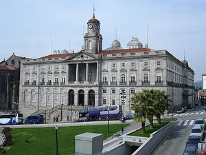
Euronext Lisbon
Stock exchange in Lisbon, Portugal
Distance: Approx. 564 meters
Latitude and longitude: 38.7210105,-9.1456241
Euronext Lisbon is a stock exchange in Lisbon, Portugal. It is part of Euronext pan-European exchange. The most famous index is PSI-20.
Taifa of Lisbon
Medieval emirate in Portugal
Distance: Approx. 3 meters
Latitude and longitude: 38.7223,-9.1393
The Taifa of Lisbon (from Andalusian Arabic: طائفة الأشبونة, romanized: Ṭāʾifa al-Ušbūna) was a medieval Islamic Arab Taifa kingdom of the Gharb al-Andalus or Western al-Andalus. It was located in Lower March, the northwestern section of al-Andalus. The Taifa was ruled by the Banu Khazraj.

Pena, Lisbon
Civil Parish in Lisbon, Portugal
Distance: Approx. 115 meters
Latitude and longitude: 38.72136389,-9.13988889
Pena is a former parish (freguesia) in the municipality of Lisbon, Portugal. At the administrative reorganization of Lisbon on 8 December 2012 it became part of the parish Arroios. In 2001, the population of the district included 6038 residents, in an area of 0.5 km2, representing a highly compact population.

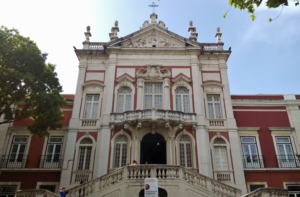
Bemposta Palace
Palace in Lisbon
Distance: Approx. 167 meters
Latitude and longitude: 38.72349444,-9.13818333
The Bemposta Palace (Palácio da Bemposta), also known as the Paço da Rainha (Queen's Palace), is a neoclassical palace in the area of Bemposta, now the civil parish of Pena, in Lisbon. It was originally built for Queen Dowager Catherine of Braganza on her return from London to Lisbon and served for many years as her residence. It was then transferred to the Casa do Infantado (the property of the younger son of the King of Portugal), before becoming the residence of John VI of Portugal until his death.
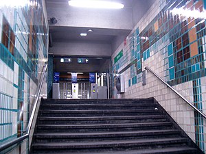
Anjos Station
Metro station in Lisbon, Portugal
Distance: Approx. 592 meters
Latitude and longitude: 38.7264,-9.135
Anjos is a station on the Green Line of the Lisbon Metro. The station is located on the Almirante Reis Avenue, close to Monte Agudo. It takes its name from the historic Anjos parish.
Intendente Station
Metro station in Lisbon, Portugal
Distance: Approx. 360 meters
Latitude and longitude: 38.7221,-9.1352
Intendente is a station on the Green Line of the Lisbon Metro. The station is located in the Almirante Reis Avenue and takes its name from the nearby Largo do Intendente Pina Manique.

Igreja dos Anjos
Distance: Approx. 485 meters
Latitude and longitude: 38.72450278,-9.13451944
The Church of Our Lady of the Angels (Portuguese: Igreja de Nossa Senhora dos Anjos), more commonly known simply as Igreja dos Anjos [iˈɣɾɐʒɐ ðuz ˈɐ̃ʒuʃ], is a Roman Catholic parish church located in Lisbon, Portugal.

List of ambassadors of Italy to Portugal
Distance: Approx. 273 meters
Latitude and longitude: 38.723926,-9.136987
The Italian ambassador in Lisbon is the official representative of the Government in Rome to the Government of Portugal. Since 1860 the governments in Rome and Lisbon maintain diplomatic relations.

List of ambassadors of Italy to Cyprus
Distance: Approx. 273 meters
Latitude and longitude: 38.723926,-9.136987
The Italian ambassador in Nicosia is the official representative of the Government in Rome to the Government of Cyprus.

Hospital de Santa Marta
Hospital in Lisbon, Portugal
Distance: Approx. 560 meters
Latitude and longitude: 38.7235,-9.1456
Hospital de Santa Marta (European Portuguese pronunciation: [ɔʃpiˈtal dɨ ˈsɐ̃tɐ ˈmaɾtɐ]; "Saint Martha's Hospital") is a public Central Hospital serving the Greater Lisbon area as part of the Central Lisbon University Hospital Centre (CHULC), a state-owned enterprise. Originally a Poor Clares nunnery, it became one of the country's main schools of Internal Medicine during most of the 20th century; more recently, it became especially differentiated in Cardiology and Cardiothoracic Surgery: it is one of the main reference centres on the diagnosis and treatment of cardiovascular disease in Portugal.

Hospital de Santo António dos Capuchos
Hospital in Lisbon, Portugal
Distance: Approx. 241 meters
Latitude and longitude: 38.7225,-9.1421
Hospital de Santo António dos Capuchos (European Portuguese pronunciation: [ɔʃpiˈtal dɨ ˈsɐ̃tu ɐ̃ˈtɔnju ðuʃ kɐˈpuʃuʃ, - ˈsɐ̃tw ɐ̃ˈt-]; "Hospital of Saint Anthony of the Capuchins"), more commonly referred to simply as Hospital dos Capuchos, is a public Central Hospital serving the Greater Lisbon area as part of the Central Lisbon University Hospital Centre (CHULC), a state-owned enterprise. The complex results from several modifications of the former Convent of Saint Anthony of the Capuchins, established in 1579 and partially destroyed in the 1755 Lisbon earthquake. In 1836, Queen Maria II converted the former convent into an Asylum for the Poor.
Weather in this IP's area
clear sky
17 Celsius
16 Celsius
15 Celsius
18 Celsius
1019 hPa
79 %
1019 hPa
1013 hPa
10000 meters
3.09 m/s
320 degree
07:22:36
17:21:18

