Country:
 Portugal
Region:
City:
Latitude and Longitude:
Time Zone:
Postal Code:
IP information under different IP Channel
ip-api
Country
Region
City
ASN
Time Zone
ISP
Blacklist
Proxy
Latitude
Longitude
Postal
Route
IPinfo
Country
Region
City
ASN
Time Zone
ISP
Blacklist
Proxy
Latitude
Longitude
Postal
Route
MaxMind
Country
Region
City
ASN
Time Zone
ISP
Blacklist
Proxy
Latitude
Longitude
Postal
Route
Luminati
Country
PTRegion
11
City
ramada
ASN
Time Zone
Europe/Lisbon
ISP
Nos Comunicacoes, S.A.
Latitude
Longitude
Postal
db-ip
Country
Region
City
ASN
Time Zone
ISP
Blacklist
Proxy
Latitude
Longitude
Postal
Route
ipdata
Country
Region
City
ASN
Time Zone
ISP
Blacklist
Proxy
Latitude
Longitude
Postal
Route
Popular places and events near this IP address

Vizela
Municipality in Norte, Portugal
Distance: Approx. 5289 meters
Latitude and longitude: 41.36666667,-8.26666667
Vizela (Portuguese pronunciation: [viˈzɛlɐ] ) is a municipality in the Braga District in Portugal. The population in 2011 was 23,736, in an area of 24.70 km². The present mayor is Vitor Hugo Salgado, elected as an independent.

Monastery of Santa Maria de Pombeiro
Church in Norte, Portugal
Distance: Approx. 2520 meters
Latitude and longitude: 41.38254444,-8.22546944
The Monastery of Santa Maria de Pombeiro (Portuguese: Mosteiro de Santa Maria de Pombeiro), shortened to Monastery of Pombeiro, is a monastery in the civil parish of Pombeiro de Ribavizela, in the municipality of Felgueiras (district in Porto), in the northern region of Portugal.

Felgueiras
Municipality in Norte, Portugal
Distance: Approx. 4917 meters
Latitude and longitude: 41.36666667,-8.2
Felgueiras (European Portuguese pronunciation: [fɛlˈɣɐjɾɐʃ] ) is a municipality in Porto District, Portugal. The current mayor is Nuno Fonseca. There are two cities located in the municipality: Felgueiras (city status received on 13 July 1990) and Lixa.

Igreja de São Romão de Arões
Distance: Approx. 5778 meters
Latitude and longitude: 41.45611111,-8.21722222
Igreja de São Romão de Arões is a church in Portugal. It is classified as a National monuments of Portugal.

Tagilde e Vizela (São Paio)
Civil parish in Norte, Portugal
Distance: Approx. 5451 meters
Latitude and longitude: 41.37666667,-8.2825
Tagilde e Vizela (São Paio) (officially União das Freguesias de Tagilde e Vizela (São Paio)) is a parish in the municipality of Vizela, in the district of Braga, Portugal, with an area of 5.25 km2 and 3 364 inhabitants (2011). The parish was created during an administrative reorganization of 2012–2013, and resulted from the joining of the former parishes of Tagilde and São Paio de Vizela. Both had been moved from the municipality of Guimarães in 1998, when the municipality of Vizela was created.

Serzedo e Calvos
Civil parish in Norte, Portugal
Distance: Approx. 821 meters
Latitude and longitude: 41.404,-8.239
Serzedo e Calvos (officially: União das Freguesias de Serzedo e Calvos) is a civil parish in the municipality of Guimarães, Portugal. It was formed in 2013 by the merger of the former parishes Serzedo and Calvos. The population in 2021 was 2,265, in an area of 4.50 km2.

Urgezes
Parish in Portugal
Distance: Approx. 6108 meters
Latitude and longitude: 41.42583333,-8.29694444
Urgezes, previously known as Santo Estêvão de Urgezes, is a civil parish in the municipality of Guimarães, Portugal. The population in 2021 was 5259 on an area of 3.31 km2 (1.28 sq mi). The civil parish makes up part of the surroundings of the city center of Guimarães.

Guimarães railway station
Railway station in Guimarães, Portugal
Distance: Approx. 6445 meters
Latitude and longitude: 41.43529167,-8.29505833
Guimarães railway station is the terminus of the Linha de Guimarães, a 1,668 mm (5 ft 5+21⁄32 in) gauge railway line that runs from Porto to the municipality of Guimarães, in the Braga District of Portugal. It was officially opened on 14 April 1884.

Vila Flor Palace
Palace in Guimarães, Portugal
Distance: Approx. 6557 meters
Latitude and longitude: 41.43725556,-8.29498056
The Vila Flor Palace is an 18th-century palace and an important cultural hotspot of the city of Guimarães, Portugal.

Vila Flor Cultural Centre
Main cultural centre of Guimarães, Portugal
Distance: Approx. 6516 meters
Latitude and longitude: 41.43699778,-8.29462361
The Vila Flor Cultural Centre (Portuguese: Centro Cultural Vila Flor), also known as CCVF (English: VFCC), is the most important cultural facility of Guimarães, located on the D. Afonso Henriques Avenue. It is Guimarães' main cultural centre. Completed in September 2005, it was born out of the restoration of the Vila Flor Palace and surrounding spaces, a project by the Pitagoras Group.
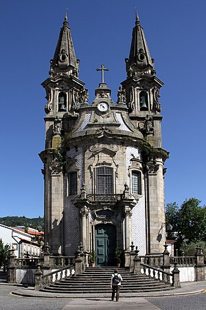
Santos Passos Church
Church in Guimarães, Portugal
Distance: Approx. 6433 meters
Latitude and longitude: 41.44083333,-8.28972222
The Santos Passos Church (Portuguese: Igreja dos Santos Passos), officially called Igreja de Nossa Senhora da Consolação e dos Santos Passos and sometimes referred to as Igreja de São Gualter, is an 18th-century Portuguese baroque Catholic church located at the Campo da Feira in Guimarães, Portugal. Constructed to replace the dilapidated chapel which had previously occupied the same site, the Santos Passos Church and its five oratories, which depict the Passion of Jesus, were designated a protected landmark by the Portuguese government in 1993. It also falls within the Historic Centre of Guimarães, a UNESCO World Heritage Site since 2001.

Campo da Feira
Square in Guimarães, Portugal
Distance: Approx. 6547 meters
Latitude and longitude: 41.44157,-8.29068
The Largo da República do Brasil, popularly known as Campo da Feira, is the largest and one of the most important squares in Guimarães, Portugal. It has many of the city's landmarks such as the Santos Passos Church, the S. Francisco Comercial Center and the old Colégio de Nossa Senhora da Conceição.
Weather in this IP's area
light rain
18 Celsius
18 Celsius
18 Celsius
18 Celsius
1019 hPa
91 %
1019 hPa
999 hPa
10000 meters
1.34 m/s
3.58 m/s
150 degree
100 %
07:29:49
19:14:57