Country:
Region:
City:
Latitude and Longitude:
Time Zone:
Postal Code:
IP information under different IP Channel
ip-api
Country
Region
City
ASN
Time Zone
ISP
Blacklist
Proxy
Latitude
Longitude
Postal
Route
Luminati
Country
Region
13
City
vilanovadegaia
ASN
Time Zone
Europe/Lisbon
ISP
Nos Comunicacoes, S.A.
Latitude
Longitude
Postal
IPinfo
Country
Region
City
ASN
Time Zone
ISP
Blacklist
Proxy
Latitude
Longitude
Postal
Route
db-ip
Country
Region
City
ASN
Time Zone
ISP
Blacklist
Proxy
Latitude
Longitude
Postal
Route
ipdata
Country
Region
City
ASN
Time Zone
ISP
Blacklist
Proxy
Latitude
Longitude
Postal
Route
Popular places and events near this IP address

Campo Pequeno Bullring
Building in Lisbon, Lisbon District, Portugal
Distance: Approx. 108 meters
Latitude and longitude: 38.7425,-9.14527778
The Campo Pequeno Bullring (Portuguese: Praça de Touros do Campo Pequeno) is the current Praça de Touros of the city of Lisbon, in Portugal. It is located in Avenida da República, in Lisbon. It is an enclosure for bull races, musical concerts, fairs, exhibitions and other events, with a capacity of around 10.000 people bearing 6.848 seats.
Praça de Entrecampos
Distance: Approx. 693 meters
Latitude and longitude: 38.74833333,-9.14833333
Praça de Entrecampos is a plaza in Lisbon, Portugal. "Entrecampos" means "between the fields" in Portuguese. Entrecampos is located between Campo Grande ("large field") and Campo Pequeno ("small field").
Nossa Senhora de Fátima, Lisbon
Distance: Approx. 716 meters
Latitude and longitude: 38.73916667,-9.15083333
Nossa Senhora de Fátima (English: Our Lady of Fátima) was a Portuguese parish (freguesia) in the municipality of Lisbon. It had a total area of 1.87 km2 and total population of 27.111 inhabitants (2001); density: 14,528.9 inhabitants/km2. It was created on February 7, 1959.

Teatro Maria Matos
Theatre in Lisbon, Portugal
Distance: Approx. 559 meters
Latitude and longitude: 38.74583333,-9.13888889
The Maria Matos Theatre (Portuguese: Teatro Maria Matos) is a theatre located in the civil parish of Alvalade, in the municipality and Portuguese capital of Lisbon.
Instituto de Plasmas e Fusão Nuclear
Distance: Approx. 686 meters
Latitude and longitude: 38.7373501,-9.1410516
Instituto de Plasmas e Fusão Nuclear (IPFN) (Institute for Plasmas and Nuclear Fusion) is a research unit of Instituto Superior Técnico (IST), Lisbon, and a leading Portuguese institution in physics research. IPFN has the status of Associate Laboratory in the thematic areas of controlled nuclear fusion, plasma technologies and intense lasers, granted by the Portuguese Foundation for Science and Technology. IPFN was formally created in January 2008, as a result of the merging between the former research units Center for Nuclear Fusion and Center for Plasma Physics.
Faculty of Social and Human Sciences
Distance: Approx. 645 meters
Latitude and longitude: 38.7404903,-9.150902
The Portuguese Faculdade de Ciências Sociais e Humanas (Faculty of Social and Human Sciences - FCSH) is an organic unit of the Universidade NOVA de Lisboa (NOVA). According to its statutes, “the Faculty of Social and Human Sciences of NOVA University of Lisbon is an institution dedicated to education, scientific research and cultural creation". The Faculty's own identity stems from the coexistence of social sciences with humanities, allowing an unusual interdisciplinarity in the Portuguese higher education panorama.

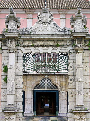
Galveias Palace
Historic site in Lisbon, Portugal
Distance: Approx. 179 meters
Latitude and longitude: 38.74144444,-9.14366667
Galveias Palace (Portuguese: Palácio das Galveias) is a Portuguese palace located in Lisbon, Portugal, in Avenidas Novas freguesia.

Avenidas Novas
Civil parish in Lisbon, Portugal
Distance: Approx. 472 meters
Latitude and longitude: 38.739,-9.146
Avenidas Novas (Portuguese pronunciation: [ɐvɨˈniðɐʒ ˈnɔvɐʃ]) is a freguesia (civil parish) and district of Lisbon, the capital of Portugal. Located in central Lisbon, Avenidas Novas is to the south of Alvalade, west of Areeiro, east of Campolide, and north of Santo António.

Roma Station (Lisbon Metro)
Metro station in Lisbon, Portugal
Distance: Approx. 692 meters
Latitude and longitude: 38.74888889,-9.14166667
Roma is a station on the Green Line of the Lisbon Metro. The station is located on Avenida de Roma, near the intersection with Av. dos Estados Unidos da América, enabling access to the Roma-Areeiro railway station nearby.
Campo Pequeno Station
Metro station in Lisbon, Portugal
Distance: Approx. 260 meters
Latitude and longitude: 38.74166667,-9.14666667
Campo Pequeno station is part of the Yellow Line of the Lisbon Metro.
Entre Campos Station
Lisbon metro station
Distance: Approx. 680 meters
Latitude and longitude: 38.74805556,-9.14861111
Entre Campos station is part of the Yellow Line of the Lisbon Metro.

Entrecampos railway station
Railway station in Lisbon, Portugal
Distance: Approx. 428 meters
Latitude and longitude: 38.74472222,-9.14861111
Entrecampos Station (Portuguese: Estação Ferroviária de Entrecampos) is a railway station located in the city of Lisbon, on the Cintura Line. It is served by Comboios de Portugal's Sintra, Azambuja and Western Lines, along with long-distance services to the Southern Line, as well as the private operator Fertagus. It is managed by Infraestruturas de Portugal.
Weather in this IP's area
few clouds
15 Celsius
15 Celsius
15 Celsius
16 Celsius
1019 hPa
82 %
1019 hPa
1009 hPa
10000 meters
3.09 m/s
320 degree
20 %
07:22:39
17:21:15


