Country:
Region:
City:
Latitude and Longitude:
Time Zone:
Postal Code:
IP information under different IP Channel
ip-api
Country
Region
City
ASN
Time Zone
ISP
Blacklist
Proxy
Latitude
Longitude
Postal
Route
Luminati
Country
Region
11
City
portosalvo
ASN
Time Zone
Europe/Lisbon
ISP
Nos Comunicacoes, S.A.
Latitude
Longitude
Postal
IPinfo
Country
Region
City
ASN
Time Zone
ISP
Blacklist
Proxy
Latitude
Longitude
Postal
Route
db-ip
Country
Region
City
ASN
Time Zone
ISP
Blacklist
Proxy
Latitude
Longitude
Postal
Route
ipdata
Country
Region
City
ASN
Time Zone
ISP
Blacklist
Proxy
Latitude
Longitude
Postal
Route
Popular places and events near this IP address
Argoncilhe
Civil parish in Norte, Portugal
Distance: Approx. 3207 meters
Latitude and longitude: 41.023,-8.542
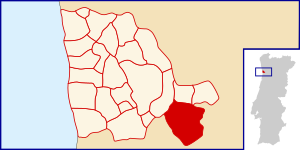
Argoncilhe (Portuguese pronunciation: [ɐɾɣõˈsiʎɨ]) is a Portuguese civil parish in the municipality (concelho) of Santa Maria da Feira. The population in 2011 was 8,420, in an area of 8.21 km2. It is located near the city of Porto.
Sanguedo
Civil parish in Norte, Portugal
Distance: Approx. 3557 meters
Latitude and longitude: 41.009,-8.518
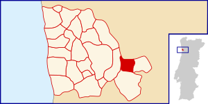
Sanguedo is a Portuguese parish, located in the municipality of Santa Maria da Feira. The population in 2011 was 3,600. The total land area is 4.57 km2.
Vila Maior (Santa Maria da Feira)
Civil parish in Norte, Portugal
Distance: Approx. 4364 meters
Latitude and longitude: 41.005,-8.49
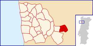
Vila Maior is a former civil parish in the municipality of Santa Maria da Feira, Portugal. In 2013, the parish merged into the new parish Canedo, Vale e Vila Maior. It has a population of 1,438 inhabitants and a total area of 2.71 km2.
CTFD PortoGaia
Distance: Approx. 2854 meters
Latitude and longitude: 41.065921,-8.51707
The CTFD PortoGaia (Centro de Treinos e Formação Desportiva PortoGaia; English: PortoGaia Sports Training Center) is a football training complex located in Vila Nova de Gaia, Portugal, that is used by the senior, reserve and youth teams of FC Porto. Designed by Portuguese architect Alcino Soutinho and inaugurated in the summer of 2002, the complex is property of the Vila Nova de Gaia municipality, with the official name CTFD Olival/Crestuma. It had a construction cost of €16 million but was leased to FC Porto for €500 a month for a period of 50 years.

Seixezelo
Distance: Approx. 3402 meters
Latitude and longitude: 41.033,-8.551
Seixezelo is a former civil parish in the municipality of Vila Nova de Gaia, Portugal. In 2013, the parish merged into the new parish Pedroso e Seixezelo. The population in 2011 was 1,712, in an area of 1.45 km².

Crestuma
Distance: Approx. 1439 meters
Latitude and longitude: 41.05,-8.5
Crestuma is a former civil parish in the municipality of Vila Nova de Gaia, Portugal. In 2013, the parish merged into the new parish Sandim, Olival, Lever e Crestuma. The population in 2011 was 2,621, in an area of 4.68 km².

Sandim
Distance: Approx. 443 meters
Latitude and longitude: 41.037,-8.514
Sandim is a former civil parish in the municipality of Vila Nova de Gaia, Portugal. In 2013, the parish merged into the new parish Sandim, Olival, Lever e Crestuma. The population in 2011 was 5,938, in an area of 13.56 km2.

Lever, Portugal
Distance: Approx. 3757 meters
Latitude and longitude: 41.06666667,-8.48333333
Lever is a former civil parish in the municipality of Vila Nova de Gaia, Portugal. In 2013, the parish merged into the new parish Sandim, Olival, Lever e Crestuma. The population in 2011 was 2,794, in an area of 7.84 km2.

Olival, Vila Nova de Gaia
Distance: Approx. 3618 meters
Latitude and longitude: 41.071,-8.527
Olival is a former civil parish in the municipality of Vila Nova de Gaia, Portugal. In 2013, the parish merged into the new parish Sandim, Olival, Lever e Crestuma. The population in 2011 was 5,812, in an area of 8.07 km².
Sandim, Olival, Lever e Crestuma
Civil parish in Norte, Portugal
Distance: Approx. 1057 meters
Latitude and longitude: 41.05,-8.51
Sandim, Olival, Lever e Crestuma is a civil parish in the municipality of Vila Nova de Gaia, Portugal. It was formed in 2013 by the merger of the former parishes Sandim, Olival, Lever and Crestuma. The population in 2011 was 17,168, in an area of 34.16 km².
Crestuma–Lever Dam
Dam in municipality Vila Nova de Gaia, Porto District
Distance: Approx. 4167 meters
Latitude and longitude: 41.07275,-8.48633333
Crestuma–Lever Dam (Portuguese: Barragem de Crestuma-Lever) is a concrete gravity dam on the Douro. It is located in the municipality Vila Nova de Gaia, in Porto District, Portugal. Construction of the dam began in 1976.
Estádio Municipal Jorge Sampaio
Distance: Approx. 4054 meters
Latitude and longitude: 41.067158,-8.544812
The Estádio Municipal Jorge Sampaio is an association football stadium located in Pedroso, Portugal, which is used by FC Porto B as their home ground.
Weather in this IP's area
overcast clouds
17 Celsius
17 Celsius
17 Celsius
17 Celsius
1021 hPa
86 %
1021 hPa
1001 hPa
10000 meters
1.9 m/s
4.12 m/s
124 degree
100 %
07:10:02
17:25:15

