Country:
 Portugal
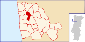
Region:
City:
Latitude and Longitude:
Time Zone:
Postal Code:
IP information under different IP Channel
ip-api
Country
Region
City
ASN
Time Zone
ISP
Blacklist
Proxy
Latitude
Longitude
Postal
Route
IPinfo
Country
Region
City
ASN
Time Zone
ISP
Blacklist
Proxy
Latitude
Longitude
Postal
Route
MaxMind
Country
Region
City
ASN
Time Zone
ISP
Blacklist
Proxy
Latitude
Longitude
Postal
Route
Luminati
Country
PTRegion
01
City
espinho
ASN
Time Zone
Europe/Lisbon
ISP
Nos Comunicacoes, S.A.
Latitude
Longitude
Postal
db-ip
Country
Region
City
ASN
Time Zone
ISP
Blacklist
Proxy
Latitude
Longitude
Postal
Route
ipdata
Country
Region
City
ASN
Time Zone
ISP
Blacklist
Proxy
Latitude
Longitude
Postal
Route
Popular places and events near this IP address

Vila Nova de Gaia
Municipality in Norte, Portugal
Distance: Approx. 1099 meters
Latitude and longitude: 41.13333333,-8.61666667
Vila Nova de Gaia (European Portuguese: [ˈvilɐ ˈnɔvɐ ðɨ ˈɣajɐ] ; Proto-Celtic: *Cale), or simply Gaia, is a city and a municipality in Porto District in Norte Region, Portugal. It is located south of the city of Porto on the other side of the Douro River. The city proper had a population of 178,255 in 2001.

Dom Luís I Bridge
Bridge in Porto, Portugal
Distance: Approx. 1785 meters
Latitude and longitude: 41.139863,-8.609336
The Dom Luís I Bridge (Portuguese: Ponte de Dom Luís I), or Luís I Bridge, is a double-deck metal arch bridge that spans the river Douro between the cities of Porto and Vila Nova de Gaia in Portugal. At its construction, its 172 metres (564 ft) span was the longest of its type in the world. It can be confused with the nearby Maria Pia Bridge, a railway bridge that was built 9 years earlier (and is located 1 kilometre (0.62 mi) to the east), which is similar in aspect to the Luís I bridge.
Portus Cale
Ancient town and port in current-day northern Portugal
Distance: Approx. 1099 meters
Latitude and longitude: 41.13333333,-8.61666667
Portus Cale was an ancient town and port in present-day northern Portugal, in the area of today's Porto and Vila Nova de Gaia. The name of the town eventually influenced the name of the subsequent country of Portugal, from the 9th century onwards.
Vilar do Paraíso
Distance: Approx. 1891 meters
Latitude and longitude: 41.108,-8.62
Vilar do Paraíso is a former civil parish in the municipality of Vila Nova de Gaia, Portugal. In 2013, the parish merged into the new parish Mafamude e Vilar do Paraíso. The population in 2011 was 13,878, in an area of 5.30 km2.

Mafamude
Distance: Approx. 1284 meters
Latitude and longitude: 41.135,-8.617
Mafamude is a former civil parish in the municipality of Vila Nova de Gaia, Portugal. In 2013, the parish merged into the new parish Mafamude e Vilar do Paraíso. The population in 2011 was 38,544, in an area of 5.28 km².

Casa do Infante
Residence in São Nicolau e Vitória, Portugal
Distance: Approx. 1879 meters
Latitude and longitude: 41.14080556,-8.6145
The Casa do Infante (House of the Prince), or alternately as the Alfândega Velha (Old Customshouse), is a historical house in the civil parish of Cedofeita, Santo Ildefonso, Sé, Miragaia, São Nicolau e Vitória, in the municipality of Porto, in northern Portugal. The house was originally built in the 14th century as customs and mint, although its present condition derives mostly from a remodelling carried out in the 17th century. Its name derived from an oral tradition that suggested the house was the birthplace of Prince Henry the Navigator in 1394.

Ribeira Square
Historical square in Porto, Portugal
Distance: Approx. 1860 meters
Latitude and longitude: 41.1407,-8.613
The Ribeira Square (Portuguese: Praça da Ribeira) is a historical square in Porto, Portugal.

Taylor, Fladgate, & Yeatman
Portuguese port wine company
Distance: Approx. 1114 meters
Latitude and longitude: 41.13388889,-8.61444444
Taylor, Fladgate & Yeatman (often simply Taylor Fladgate and trading under the name Taylor's) is one of the largest port wine houses. Founded in 1692 in Vila Nova de Gaia, Portugal by Job Bearsley, becoming Taylor, Fladgate & Yeatman when Joseph Taylor, John Alexander Fladgate and Morgan Yeatman formed a partnership in 1838, it is also one of the oldest. The house owns the brands of Fonseca, Fonseca-Guimaraens, Taylor, Krohn and Croft.
Mafamude e Vilar do Paraíso
Civil parish in Norte, Portugal
Distance: Approx. 1572 meters
Latitude and longitude: 41.11,-8.61
Mafamude e Vilar do Paraíso is a civil parish in the municipality of Vila Nova de Gaia, Portugal. It was formed in 2013 by the merger of the former parishes Mafamude and Vilar do Paraíso. The population in 2011 was 52,422, in an area of 10.58 km².
Santa Marinha e São Pedro da Afurada
Civil parish in Norte, Portugal
Distance: Approx. 923 meters
Latitude and longitude: 41.13,-8.62
Santa Marinha e São Pedro da Afurada is a civil parish in the municipality of Vila Nova de Gaia, Portugal. It was formed in 2013 by the merger of the former parishes Santa Marinha and São Pedro da Afurada. The population in 2011 was 33,714, in an area of 6.91 km².

2017 Red Bull Air Race of Porto
Distance: Approx. 1717 meters
Latitude and longitude: 41.13916667,-8.61611111
The 2017 Red Bull Air Race of Porto was the fifth round of the 2017 Red Bull Air Race World Championship season, the twelfth season of the Red Bull Air Race World Championship. The event was held on Douro River in Porto, Portugal.

Monastery of Serra do Pilar
Monastery in Vila Nova de Gaia, Portugal
Distance: Approx. 1648 meters
Latitude and longitude: 41.13833333,-8.6075
The Monastery of Serra do Pilar is a former monastery located in Vila Nova de Gaia, Portugal, on the opposite side of the Douro River from Porto. The monastery is situated on an outcrop overlooking the Dom Luís I Bridge and the historic centre of Porto. Together with these locations, the monastery was designated a UNESCO World Heritage Site in 1996.
Weather in this IP's area
broken clouds
18 Celsius
18 Celsius
17 Celsius
18 Celsius
1018 hPa
98 %
1018 hPa
1004 hPa
7000 meters
3.6 m/s
190 degree
75 %
07:31:16
19:16:35