Country:
Region:
City:
Latitude and Longitude:
Time Zone:
Postal Code:
IP information under different IP Channel
ip-api
Country
Region
City
ASN
Time Zone
ISP
Blacklist
Proxy
Latitude
Longitude
Postal
Route
Luminati
Country
Region
13
City
porto
ASN
Time Zone
Europe/Lisbon
ISP
Nos Comunicacoes, S.A.
Latitude
Longitude
Postal
IPinfo
Country
Region
City
ASN
Time Zone
ISP
Blacklist
Proxy
Latitude
Longitude
Postal
Route
db-ip
Country
Region
City
ASN
Time Zone
ISP
Blacklist
Proxy
Latitude
Longitude
Postal
Route
ipdata
Country
Region
City
ASN
Time Zone
ISP
Blacklist
Proxy
Latitude
Longitude
Postal
Route
Popular places and events near this IP address

Odivelas
Municipality in Lisbon, Portugal
Distance: Approx. 2038 meters
Latitude and longitude: 38.79027778,-9.17972222
Odivelas (European Portuguese pronunciation: [ɔðiˈvɛlɐʃ] ) is a city and a municipality in Lisbon metropolitan area, Portugal, in the Lisbon District and the historical and cultural Estremadura Province. The municipality is located 10 km northwest of Lisbon. The present mayor is Hugo Martins, elected by the Socialist Party.
Palace of Correio-Mor
Palace in Loures, Portugal
Distance: Approx. 2789 meters
Latitude and longitude: 38.82756111,-9.18434722
The Palace of the Correio-Mor, Loures (Portuguese: Palácio do Correio-Mor), is a palatial residence in the civil parish of Loures, in the municipality of the same name in the periphery of the Portuguese capital of Lisbon. The imposing Baroque-era residence, is a U-shaped layout, consisting of a courtyard leading to a staircase and a two-storey building decorated in azulejos, stucco artistic works, and paintings that were once home to the Counts and Marquesses of Penafiel. Appropriately translated into British English, the Estate is called Palace of the Postmaster General of Portugal.
Ramada (Odivelas)
Civil parish in Lisbon, Portugal
Distance: Approx. 371 meters
Latitude and longitude: 38.804,-9.191
Ramada (Portuguese pronunciation: [ʁɐˈmaðɐ]) is a former civil parish in the municipality of Odivelas, Portugal. In 2013, the parish merged into the new parish Ramada e Caneças. It covers an area of 3.86 km² and had a population of 15,770 as of 2001.

Monastery of São Dinis de Odivelas
Building in Lisbon District, Portugal
Distance: Approx. 1774 meters
Latitude and longitude: 38.7913451,-9.1828498
The Monastery of Saint Denis (Portuguese: Mosteiro de São Dinis) is located in the city of Odivelas, near Lisbon, in Portugal. The feminine Cistercian convent was founded by King Dinis I and was built during the 14th century in Gothic style. It is the burial place of the king.
Famões
Civil parish in Lisbon, Portugal
Distance: Approx. 2071 meters
Latitude and longitude: 38.79,-9.211
Famões is a former civil parish in the municipality of Odivelas, Portugal. In 2013, the parish merged into the new parish Pontinha e Famões. Administratively, the parish of Famões was de-annexed from the neighboring parish of Odivelas on 25 August 1989, and later elevated to the status of town, on 19 April 2001.
Odivelas (parish)
Civil parish in Lisbon, Portugal
Distance: Approx. 2046 meters
Latitude and longitude: 38.79,-9.18
Odivelas is a civil parish in the municipality of Odivelas, Portugal. The population in 2011 was 59,546, in an area of 5.04 km².
Santo António dos Cavaleiros e Frielas
Civil parish in Lisbon, Portugal
Distance: Approx. 2694 meters
Latitude and longitude: 38.814,-9.167
Santo António dos Cavaleiros e Frielas is a civil parish in the municipality of Loures, Portugal. It was formed in 2013 by the merger of the former parishes Santo António dos Cavaleiros and Frielas. The population in 2011 was 28,052, in an area of 9.20 km2.
Ramada e Caneças
Civil parish in Lisbon, Portugal
Distance: Approx. 371 meters
Latitude and longitude: 38.804,-9.191
Ramada e Caneças is a civil parish in the municipality of Odivelas, Portugal. It was formed in 2013 by the merger of the former parishes Ramada and Caneças. The population in 2011 was 32,581, in an area of 9.66 km2.
Instituto de Odivelas
Distance: Approx. 1719 meters
Latitude and longitude: 38.7912702,-9.184071
The Instituto de Odivelas (IO) was a Portuguese military school for young girls, located at Odivelas. It was founded in 1900 and closed in 2015. The last official full name of the school was Instituto de Odivelas (Infante Dom Afonso) (Portuguese for "Institute of Odivelas (Prince Alfonse)").

Senhor Roubado Station
Metro station in Lisbon, Portugal
Distance: Approx. 2935 meters
Latitude and longitude: 38.78555556,-9.17111111
Senhor Roubado station is part of the Yellow Line of the Lisbon Metro.
Odivelas Station
Metro station in Lisbon, Portugal
Distance: Approx. 2301 meters
Latitude and longitude: 38.79305556,-9.17277778
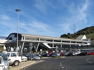
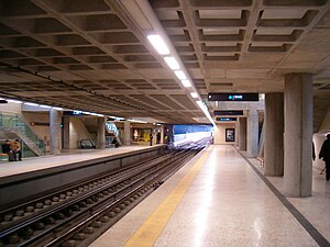
Odivelas station is the northern terminus on the Yellow Line of the Lisbon Metro in the Odivelas neighbourhood, north west of central Lisbon.

Anta das Pedras Grandes
Megalithic site near Odivelas, Portugal
Distance: Approx. 2046 meters
Latitude and longitude: 38.80666667,-9.21861111
Anta is the Portuguese name for about 5,000 megaliths built during the Neolithic period in the area of Portugal. The Anta das Pedras Grandes (Dolmen of large stones) is a late-Neolithic (between 4500 and 2000 BC) site located in Casal Nova in the parish of Caneças, in the Odivelas municipality, in the Lisbon District of Portugal. It was classified as a National Monument in 1944.
Weather in this IP's area
clear sky
16 Celsius
15 Celsius
14 Celsius
17 Celsius
1019 hPa
82 %
1019 hPa
1001 hPa
10000 meters
1.79 m/s
2.68 m/s
328 degree
07:23:01
17:21:20

