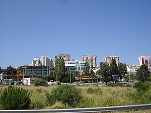
Country:
 Portugal
Region:
City:
Latitude and Longitude:
Time Zone:
Postal Code:
IP information under different IP Channel
ip-api
Country
Region
City
ASN
Time Zone
ISP
Blacklist
Proxy
Latitude
Longitude
Postal
Route
IPinfo
Country
Region
City
ASN
Time Zone
ISP
Blacklist
Proxy
Latitude
Longitude
Postal
Route
MaxMind
Country
Region
City
ASN
Time Zone
ISP
Blacklist
Proxy
Latitude
Longitude
Postal
Route
Luminati
Country
PTRegion
07
City
evora
ASN
Time Zone
Europe/Lisbon
ISP
Nos Comunicacoes, S.A.
Latitude
Longitude
Postal
db-ip
Country
Region
City
ASN
Time Zone
ISP
Blacklist
Proxy
Latitude
Longitude
Postal
Route
ipdata
Country
Region
City
ASN
Time Zone
ISP
Blacklist
Proxy
Latitude
Longitude
Postal
Route
Popular places and events near this IP address

Amadora
Municipality in Lisbon, Portugal
Distance: Approx. 1378 meters
Latitude and longitude: 38.73333333,-9.23333333
Amadora (European Portuguese pronunciation: [ɐmɐˈðoɾɐ] ) is a city and municipality in the northwest of the Lisbon metropolitan area and 10 km from central Lisbon. The population in 2011 was 175,136, in an area of 23.78 km2 (9.2 sq mi). It is the fourth biggest, and most densely populated, city in Portugal.
Carnaxide
Civil parish in Lisbon, Portugal
Distance: Approx. 1418 meters
Latitude and longitude: 38.71666667,-9.25
Carnaxide (European Portuguese pronunciation: [kɐɾnɐˈʃiðɨ]) is a former civil parish in the municipality of Oeiras, Portugal. In 2013, the parish merged into the new parish Carnaxide e Queijas. The population in 2011 was 25,911, in an area of 6.51 km2.
Portugal Open
Tennis tournament
Distance: Approx. 2117 meters
Latitude and longitude: 38.70805556,-9.2525
The Portugal Open (formerly named Estoril Open) was an ATP and WTA clay court tennis tournament in Portugal. The event took place at the sports complex of Jamor in Oeiras, of which Estoril Court Central is the most prominent show court. In 2015, the tournament was canceled due to lack of sponsorship.
Estoril Court Central
Main tennis court in Oeiras, Portugal
Distance: Approx. 2077 meters
Latitude and longitude: 38.70972222,-9.25370278
Estoril Court Central is the main tennis court in Oeiras, Portugal. Built in 2005, it currently holds 10,000 spectators. It used to host the Portugal Open in May.
São Francisco Xavier, Lisbon
Place in Lisbon, Portugal
Distance: Approx. 2155 meters
Latitude and longitude: 38.70722222,-9.21722222
São Francisco Xavier (English: Saint Francis Xavier) is a former civil parish (freguesia) in the city and municipality of Lisbon, Portugal. It was created on February 7, 1959. At the administrative reorganization of Lisbon on 8 December 2012 it merged with the former parish of Santa Maria de Belém, thus creating the new Belém parish.

Algés River
Distance: Approx. 1428 meters
Latitude and longitude: 38.71944444,-9.21833333
Algés River (Portuguese pronunciation: [alˈʒɛʃ]) flows into the Tagus River in Algés Parish, Portugal. Since Algés grew, some parts of the river were covered, and now it runs under the ground, including the final stretch to the sea.
Alfragide
Civil parish in Lisbon, Portugal
Distance: Approx. 2046 meters
Latitude and longitude: 38.734,-9.218
Alfragide (Portuguese pronunciation: [alfɾɐˈʒiðɨ]) is a parish in Amadora Municipality. The population in 2011 was 17,044, in an area of 2.51 km². Its patron saint is Our Lady of Fatima.
Carnaxide e Queijas
Civil parish in Lisbon, Portugal
Distance: Approx. 986 meters
Latitude and longitude: 38.727,-9.243
Carnaxide e Queijas is a civil parish in the municipality of Oeiras, Portugal. It was formed in 2013 by the merger of the former parishes Carnaxide and Queijas. The population in 2011 was 36,288, in an area of 8.81 km².

Alfragide Towers
Buildings in Alfragide, Portugal
Distance: Approx. 1978 meters
Latitude and longitude: 38.733103,-9.217975
The Alfragide Towers (Portuguese: Torres de Alfragide) are a set of residential buildings in Alfragide, Amadora, Portugal. The complex consists of three residential towers and a shopping centre at ground level, connecting the three buildings. It also contains an underground car park and a complex of swimming pools, currently unused.

Estoril Open (tennis)
Tennis tournament in Portugal
Distance: Approx. 2117 meters
Latitude and longitude: 38.70805556,-9.2525
The Estoril Open (also known as the Millennium Estoril Open for sponsorship purposes) is an ATP clay court tennis tournament held in the Portuguese Riviera. The event takes place at the sports complex of Clube de Ténis do Estoril in Cascais. The tournament was removed from the 2025 ATP calendar, and its future was left uncertain, until it was announced in September 2024 that it would be returning in 2025 as a Challenger 175 event.

Monsanto Tower
Distance: Approx. 1250 meters
Latitude and longitude: 38.7158,-9.2219
The Monsanto Tower (Portuguese: Torre de Monsanto) is a 394-foot (120 m) skyscraper in Oeiras, a town and municipality to the west of Lisbon which is part of the Portuguese capital's urban agglomeration. Finished in 2001, the 17-floor building is the second tallest in Portugal. Lisbon-based architectural firm Sua Kay Architects designed the 21,000-square-metre (230,000 sq ft) office building.

Mama Lighthouse
Lighthouse
Distance: Approx. 972 meters
Latitude and longitude: 38.72755556,-9.22725
The Mama lighthouse (Portuguese: Farol da Mama) is located in the Carnaxide Sierra (Portuguese: Serra de Carnaxide) of the municipality of Oeiras, in Lisbon District, Portugal. It is built on a round hill, known as the Mama Sul, next to a Geodesic landmark. The Mama Lighthouse is about 4 km inland, northwest of Belém, and combines with the Esteiro and Gibalta lighthouses to indicate the alignment of the southern entrance to the Port of Lisbon.
Weather in this IP's area
scattered clouds
19 Celsius
19 Celsius
17 Celsius
19 Celsius
1019 hPa
85 %
1019 hPa
1007 hPa
10000 meters
2.24 m/s
4.92 m/s
317 degree
40 %
07:32:56
19:19:53