Country:
Region:
City:
Latitude and Longitude:
Time Zone:
Postal Code:
IP information under different IP Channel
ip-api
Country
Region
City
ASN
Time Zone
ISP
Blacklist
Proxy
Latitude
Longitude
Postal
Route
Luminati
Country
Region
13
City
porto
ASN
Time Zone
Europe/Lisbon
ISP
Nos Comunicacoes, S.A.
Latitude
Longitude
Postal
IPinfo
Country
Region
City
ASN
Time Zone
ISP
Blacklist
Proxy
Latitude
Longitude
Postal
Route
db-ip
Country
Region
City
ASN
Time Zone
ISP
Blacklist
Proxy
Latitude
Longitude
Postal
Route
ipdata
Country
Region
City
ASN
Time Zone
ISP
Blacklist
Proxy
Latitude
Longitude
Postal
Route
Popular places and events near this IP address
Expo '98
1998 World's Fair in Lisbon, Portugal
Distance: Approx. 1023 meters
Latitude and longitude: 38.7677,-9.0958
Expo '98 (1998 Lisbon Specialised Expo) was an official specialised World's Fair held in Lisbon, Portugal from Friday, 22 May to Wednesday, 30 September 1998. The theme of the fair was "The Oceans, a Heritage for the Future", chosen in part to commemorate 500 years of Portuguese discoveries. The Expo received over 10 million visitors in 132 days, while 143 countries and many organizations were represented.

Gare do Oriente
Train station in Lisbon, Portugal
Distance: Approx. 790 meters
Latitude and longitude: 38.76777778,-9.09916667
Gare do Oriente (Portuguese pronunciation: [ˈɡaɾɨ ðu oɾiˈẽtɨ]), or alternately, the Lisbon Oriente Station is one of the main Portuguese intermodal transport hubs, and is situated in the civil parish of Parque das Nações, municipality of Lisbon.
Estádio Alfredo Marques Augusto
Distance: Approx. 262 meters
Latitude and longitude: 38.774,-9.103
Estádio Alfredo Marques Augusto is a stadium in Lisbon, Portugal. It is currently used mostly for football matches and it is the home stadium of CD Olivais e Moscavide. The stadium is able to hold 2,730 people.

Parque das Nações
Civil parish in Lisbon, Portugal
Distance: Approx. 1140 meters
Latitude and longitude: 38.768,-9.094
The Parque das Nações (Portuguese pronunciation: [ˈpaɾkɨ ðɐʒ nɐˈsõjʃ]; Park of the Nations), colloquially known as Expo (as the site of the 1998 Lisbon World Exposition), is a freguesia (civil parish) and typical quarter of Lisbon, the capital city of Portugal. Located in eastern Lisbon, Parque das Nações is to the east of Olivais, northeast of Marvila, and directly south of Lisbon's border with Loures. The population in 2021 was 22,382.

Olivais, Lisbon
Civil parish in Lisbon, Portugal
Distance: Approx. 1084 meters
Latitude and longitude: 38.774,-9.118
Olivais (Portuguese pronunciation: [oliˈvajʃ]) is a freguesia (civil parish) and typical quarter of Lisbon, the capital city of Portugal. Located in eastern Lisbon, Olivais is west of Parque das Nações, north of Marvila and Alvalade, and east of Lumiar and Santa Clara. The population in 2021 was 32,179.

Web Summit
Annual technology conference in Lisbon, Portugal
Distance: Approx. 1050 meters
Latitude and longitude: 38.76802778,-9.09516667
Web Summit is an annual technology conference held in Lisbon, Portugal. Founded in 2009 by Paddy Cosgrave, David Kelly, and Daire Hickey, Web Summit was held in Dublin, Ireland until 2016, when it moved to Lisbon. The conference's topics center on internet technology, emerging technologies, marketing and venture capitalism.
Cabo Ruivo Station
Metro station in Lisbon, Portugal
Distance: Approx. 1126 meters
Latitude and longitude: 38.76277778,-9.10388889
Cabo Ruivo is a station on the Red Line of the Lisbon Metro. The station is located on Av. Padua, near the intersection with Av.

Moscavide Station (Lisbon Metro)
Metro station in Lisbon, Portugal
Distance: Approx. 364 meters
Latitude and longitude: 38.775,-9.1025
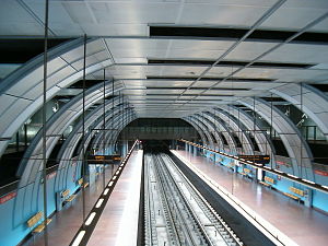
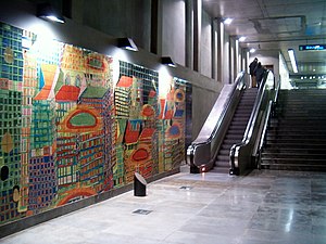
Moscavide is a station on the Red Line of the Lisbon Metro. The station is in the parish of Moscavide in the Municipality of Loures, bordering Lisbon, and is located in Rua João Pinto Ribeiro beside Estádio Alfredo Marques Augusto. The station, designed by the architect Manuel Bastos, opened in July 2012 in conjunction with the Encarnação and Aeroporto stations, as part of the expansion of the line to serve Lisbon Portela Airport.

Encarnação Station
Metro station in Lisbon, Portugal
Distance: Approx. 867 meters
Latitude and longitude: 38.77472222,-9.11527778
Encarnação is a station on the Red Line of the Lisbon Metro. The station is located under Rua General Silva Freire in the parish of Encarnação, a densely populated residential neighbourhood of northern Lisbon. The station, designed by the architect Alberto Barradas, opened on 17 July 2012 in conjunction with the Moscavide and Aeroporto stations, as part of the expansion of the line to serve Lisbon Portela Airport.
Army Geospatial Information Center
Military unit
Distance: Approx. 932 meters
Latitude and longitude: 38.7783,-9.1137
The Army Geospatial Information Center (Portuguese: Centro de Informação Geoespacial do Exército; CIGeoE) is the military geographical, cartographical and geospatial intelligence agency of the Portuguese Army. The main mission of the CIGeoE is to provide the Army and the other branches of the Armed Forces of Portugal, as well as the civil community, with geographic information, ensuring the implementation of activities related to the geographical science, cartographic technique and the promotion and development of scientific and technological research actions in the field of geographical support and geomatics. This mission includes the geospatial intelligence (GEOINT) and imagery intelligence (IMINT) activities in support of the Armed Forces.
Moscavide e Portela
Civil parish in Lisbon, Portugal
Distance: Approx. 726 meters
Latitude and longitude: 38.779,-9.103
Moscavide e Portela is a civil parish in the municipality of Loures, Portugal. It was formed in 2013 by the merger of the former parishes Moscavide and Portela. The population in 2011 was 21,891, in an area of 1.66 km².
Oriente Station (Lisbon Metro)
Metro station in Lisbon, Portugal
Distance: Approx. 790 meters
Latitude and longitude: 38.76777778,-9.09916667
Oriente is a station on the Red Line of the Lisbon Metro. The station is located in Lisbon, between the Cabo Ruivo and Moscavide stations. The station is a part of the Gare do Oriente, one of the main transport hubs of the city, serving the North, Sintra, and Azambuja Lines and also several bus lines.
Weather in this IP's area
clear sky
16 Celsius
16 Celsius
15 Celsius
17 Celsius
1019 hPa
87 %
1019 hPa
1015 hPa
10000 meters
3.6 m/s
310 degree
07:22:35
17:21:03


